Wednesday, June 20, 2018

Best Climbs and Rock Scrambles near NJ

Living in the so-called flat lands of the East Coast, it can be difficult to prepare for rugged mountain races. But if you look hard enough, you'll find plenty of steep and technical climbs within driving distance of the NY, NJ, PA area. Here are a few of my favorites, in no particular order, all within a 3 hour radius of northern/central NJ.


Rock Scrambles

These are not necessarily the steepest trails, but they'll show you the meaning of the word "technical."
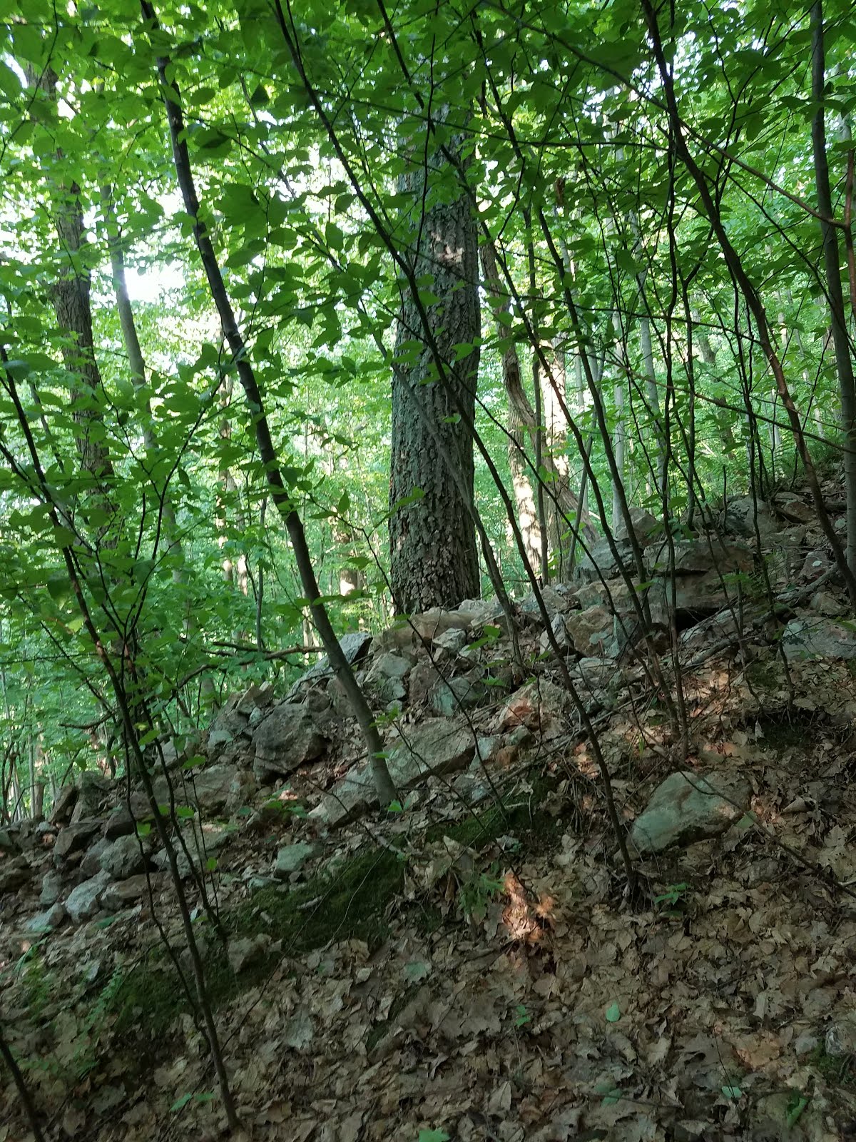
Giant Stairs


Location
: Palisades, NJ
Description: Boulder field at the base of the Palisades Cliffs on the Hudson River. Starts on a paved section of the Long Path, then descends down the Shore Trail. Once at the bottom of the cliffs, scramble over car sized boulders on a relatively flat trail. Then climbs a steep but well maintained trail to the parking lot.
Biggest climb: 504 ft. over 0.38 mi (25%)

Lehigh Gap


Location: Lehigh, PA
Description: Rocky section of the Appalachian Trail from the Lehigh River to the Kitatinny Ridge. Portions of the trail require the use of all four limbs. For extra fun, stick to the ridge line above the AT where the views are better, then follow a social trail to get back to the AT when the ridge levels off.
Biggest climb: 927 ft. over 0.97 mi (18%)

Bonticou Crag


Location: Mohonk Preserve, NY
Description: Short and sweet! Follow the well maintained Crag Trail to Bonticou Rd. The crag is a white cliff face which rises abruptly from the road. Scramble over a massive pile of giant rocks to reach the summit where you have spectacular views of the Catskills to the west. For more fun, follow the trail north to Table Rocks, to find giant crevices in the bedrock.
Biggest climb: 157 ft. over 0.09 mi (33%)

Lemon Squeeze


Location: Mohonk Preserve, NY
Description: Not for those with claustrophobia! From the Labyrinth Trail near Mohonk Lake, follow blazes through a boulder field climbing under several house sized boulders as you ascend the face of the rock. The trail is so narrow that you might be required to take off your pack and hold it in front of you.
Biggest climb: 219 ft. over 0.26 mi (16%)

Pyngyp Mountain


Location: Bear Mountain State Park, NY
Description: A short steep scramble up a series of rock faces from Palisades Interstate Parkway to the summit of Pyngyp Mountain. Unfortunately, there is no parking on the parkway, so you'll need to hike about 3 miles to get there.
Biggest climb: 623 ft. over 0.66 mi (18%)

Onoko Falls


Location: Jim Thorpe, PA
Description: A 1.3 mile loop following a waterfall up a steep rocky trail. In the winter, the waterfall can freeze and the trail will be covered in ice, so traction devices are a must. This trail is crowded in all seasons.
Biggest climb: 676 ft. over 0.62 mi (21%)

Breakneck Ridge


Location: Cold Spring, NY
Description: A series of rock slabs which climb from the Hudson River to the summit of Breakneck Ridge. The trail is always crowded on nice days, so expect to get stuck behind other hikers. Also note that the trail is scheduled to close for maintenance some time in 2019.
Biggest climb: 1,172 ft. over 1.05 mi (21%)
Trailhead parkinghttps://goo.gl/maps/Bu9tZEEo6Ek

Anthony's Nose


Location: Garrison, NY
Description: Basically a smaller, steeper version of Breakneck Ridge. The trail makes a staggeringly steep climb up a rock face overlooking the Hudson River before joining the Appalachian Trail. This is just across the river from Bear Mountain, so it's easy to link up with other climbs.
Biggest climb: 703 ft. over 0.30 mi (44%)
Trailhead parkinghttps://goo.gl/maps/Bu9tZEEo6Ek

The Beast


Location: Lock Haven, PA
Description: This is just over 3 hours from most parts of NJ, but it's worth the trip. The Beast is one of the largest and steepest boulder fields in the region, climbing well over 1,000 feet to the summit of Mt. Logan. Navigation is a little tricky, so it's best to follow a GPS track if possible.
Biggest climb: 1,126 ft. over 0.66 mi (32%)


Big and Steep Climbs

For those days when you want to get a ton of vertical change without moving horizontally too much.

Mount Tammany Red Dot Trail


Location: Columbia, NJ
Description: The Mecca for NJ area trail and ultra runners. The Red Dot trail is a steep, technical ascent of Mount Tammany from the Delaware River. Runners often opt to descend the Blue Trail which is slightly more runnable. On hot days, a quick dip in Dunnfield Creek is a nice way to cool off after a tough run.
Biggest climb: 1,039 ft. over 1.00 mi (20%)
Trailhead parkinghttps://goo.gl/maps/j7Vboofsgkp

Mount Tammany West Headwall


Location: Columbia, NJ
Description: A breathtakingly steep and faintly blazed social trail used by rock climbers to access the cliffs on the south face of Tammany. From the Dunnfield Creek parking area, follow a drainage ditch along Rt. 80. Look for faded green blazes on the trees leading up the steep embankment on your right. If you reach the boulder field on the south side of the mountain, you went too far.
Biggest climb: 1,115 ft. over 0.49 mi (43%)
Trailhead parkinghttps://goo.gl/maps/j7Vboofsgkp

Hunter Mountain via Becker Hollow Trail


Location: Elka Park, NY
Description: Really, I could have picked any climb in the Catskills, but this is one of the biggest. From the Becker Hollow parking lot, this trail climbs the east face of Hunter Mountain, eschewing switchbacks in favor of a more direct route. The trail is constantly wet and very rocky, making footing difficult. On the bright side, the view from the fire tower is amazing on sunny days. For extra fun, link up with the Devil's Path after summitting.
Biggest climb: 2,119 ft. over 2.03 mi (20%)
Trailhead parkinghttps://goo.gl/maps/2h2dgsRxENw

The Leg Destroyer


Location: Hamburg, PA
Description: They called it that for a reason! This is a gas pipeline cut that branches off from the Appalachian Trail at the Schuylkill Gap. The steepest section rises 339 ft. over 0.16 mi. (40%) and is covered in loose rock, which can make it difficult to stop if you descent this trail with a full head of steam. For more vertical, check out the AT on either side of the Schuylkill River. This area has a crazy amount of elevation gain per mile.
Biggest climb: 847 ft. over 0.61 mi (26%)
Trailhead parkinghttps://goo.gl/maps/yemEvZ5HYfr

Mount Beacon Trail


Location: Beacon, NY
Description: A rocky but runnable trail that climbs from the town of Beacon to the fire tower at the top of Mt. Beacon. To maximize elevation gain per mile during hill repeats, turn around at the overlook, where you'll have a 180 degree view of the Hudson Valley.
Biggest climb: 1,011 ft. over 0.98 mi (20%)
Trailhead parkinghttps://goo.gl/maps/PyYpMch87xm

Bear Mountain via Major Welch


Location: Tomkins Cove, NY
Description: Ascend Bear Mountain from the Hudson River by way of single track trail and steep rock slabs, then descend via the AT. Good views from the top, but these trails and the surrounding area are very crowded on nice days, making it difficult to descend quickly.
Biggest climb: 940 ft. over 0.90 mi (20%)

Camelback Mountain via Cliffhanger


Location: Tannersville, PA
Description: Climb Camelback Mountain on a double black diamond ski slope, then descend via the blue square Nile Mile, which is a gravel road in the summer months. Beautiful views from the top, but the slope is not maintained during the summer, so prepare to bushwhack a little, and check for ticks afterwards.
Biggest climb: 748 ft. over 0.55 mi (26%)

The Frozen Snot Course


Location: Lock Haven, PA
Description: Home of The Beast, this course was designed to pack the most elevation gain into the shortest distance possible. In the 11.4 miles of trail on this 14 mile course, runners climb and descend 5,650 feet, with multiple climbs and descents of 1,000+ feet. The steepest of these is Barb's Kiss My Ass, which rises 1,022 ft. over 0.47 mi (42%)!
Biggest climb: 1,126 ft. over 0.66 mi (32%)

Spring Road Races (are finally over!)

Spring is road racing season for me since the trails tend to be a muddy snowy mess, plus I think some fast flat running is a good way to gauge my fitness each year (#anysurfaceanydistance or whatever). The downside to this tradition is that - as I have come to learn - I don't really enjoy running on roads. No sir, I'm definitely a trail runner through and through. So here are some quick updates on how my road races went, and then we'll get back to the good stuff in a few weeks.

Lenape 50K: New Year, Same Navigation Issues

So here's the good news: I spent less than 10 seconds off course at the Lenape 50K this year, shattering my record low of 14 minutes set last year. The bad news is that my missed turn was literally the very first turn on the entire course, less than a tenth of a mile into the race. Early enough that the entire field of runners watched me make this mistake and then yelled at me to get back on course...

Thankfully this wasn't a sign of things to come

The point is that despite running this race four times now, I still apparently have no idea where I'm going. I've been informed that my previous race reports are terrifying for first time runners because they think the course is impossible to navigate, and they imagine themselves getting horribly lost and dying of exposure in downtown Newark. Well rest easy, fellow runners, because it turns out that I'm just a fucking idiot.

Anyway, here goes my account of 2018...

Lenape Course

The Lenape 50K is a point-to-point fatass, which follows a faint series of trail blazes through roads, greenways, and forests across northeastern NJ. The course gets progressively more difficult as the race progresses, with much of the final 10 miles on rocky single track.

Course map. The race runs from east to west.
Elevation profile

The Race

Having just run Mt. Mitchell the week before, I again promised myself that this would be a long run effort, rather than a full race effort. No last minute dashes for the finish, no seeing stars on the final uphill, none of that funny business. Just a nice moderate effort for 5-6 hours to work on my endurance before the NJ Marathon.

Runners in Newark train station before the start
Photo courtesy of Anthony Longano

After my initial navigation error (yes, I know I'm dumb), I was immediately passed by the dynamic duo of Jay Lemos and Jayson Kolb, who would run together and easily go on to tie for the win in 5:17. The first 13 miles were all on pavement or sidewalks, and I chugged along at a steady 8:30/mi effort, chatting with Chris McGovern and Joe Limone. The weather was a brisk 40 degrees and windy, but these early miles passed quickly as we discussed our racing plans for the summer. The days leading up to the race had seen snow and rain, and the patches of snow lining the road hinted at the wet trail conditions that we would face later in the day.

Early paved miles in Branch Brook Park
Photo courtesy of Anthony Longano

At mile 14, we made a steep snowy 200 foot climb up to Mills Reservation and I pushed ahead on the sloppy trail, now running alone. The next few miles were slow and wet, but otherwise uneventful. As the course went through Cedar Grove and Montclair, the course was a mix of bike paths, snowy trails, and roads, so it was tough to stay in a rhythm.

Another 200 foot climb at mile 22 brought us to Eagle Rock Reservation, where I made one of my many wrong turns last year. As I passed the trail that I mistakenly took that year, I flipped it off for good measure. That'll teach that trail to uh... let me run on it, I guess.

The trail spit us out onto Rt. 611 in West Orange, where a few tricky turns had us crossing under I-280 and then climbing a power line cut which gained 200 feet in a quarter mile of slushy, slippery, overgrown trail. This is the kind of masochism that keeps running interesting, and I made quick work of this section with a big dopey grin on my face.

A runner coming up the power line
Photo courtesy of Anthony Longano

From here, it was a short jaunt through a neighborhood (big thanks to a local woman who paused from shoveling her driveway to point me in the right direction), and then we were back on trails for the remainder of the race. Miles 27 and 28 passed through marshy areas, and I carefully crossed the icy wooden boards that were placed in particularly wet parts of the trail. A few near-falls into frigid water convinced me to slow my pace until the trail got better.

Entering South Mountain Reservation around mile 29 was a relief because I knew I was on the home stretch, but the last few miles would be the most difficult of the race. A series of hills on washed out rocky trails meant that these miles were my slowest of the day. Keeping my promise to myself, I trotted along at the same effort level that I had maintained for the previous 5 hours.

After a final rocky descent, I reached the parking lot and smacked the back of Jay's van, which acted as the finish line. My final time was 5:36:11, about five minutes slower than my previous best, but in worse conditions and a lower effort level. Not bad. As a bonus, my time was good enough for 3rd place, which meant that I got one of the coveted wooden trophies that Jay made.

Jay, Jayson, and myself showing off our hardware.
Note that they had enough time to change their clothes before I got there!
Picture courtesy of Jay Lemos

The part where I find out how much Jay likes my race reports

It's well known in the local running community that I write very lengthy - some would say tedious - reports for just about every event I participate in. Jay has noticed this over the years and tends to give me a hard time about it. But secretly, I know that he loves spending hours poring over my epic tales of heroism (and whatever the opposite of heroism is).

When I requested the above picture, Jay asked, "Is this conversation going to end up in your race report?"

A sparkle in his eye (or maybe it was the sun shining through his hair) told me that he was really asking "Can you make me the star of your report?"

Of course not, I replied with a wink, as I mentally filed away the conversation for later use.

"Good," he responded, "because that would be pointless."

Indeed, Jay.


New Jersey Marathon: New Year, Same Speed

I went into this year's NJ Marathon feeling like I did (almost) everything right. I didn't race too much in the spring and gave myself a full 8 weeks to recover from Lenape, train, and then taper. By comparison, last year I ran the brutally tough Breakneck Marathon two weeks before NJ and then Bear Mountain 50 miler two weeks after it. I also managed to avoid aggravating my right calf/Achilles tendon this year, which I have done both of the past two springs. So, pretty successful all around.

The Race

The weather on April 29 was absolutely perfect. Scattered showers in the early morning darkness gave way to a fifty degree day with partly cloudy skies and a slight breeze. Not exactly beach weather, but if you're a stocky runner who tends to overheat in the sun, this is an ideal scenario.

Getting dropped off and looking like a homeless person
Photo by my mom

I tucked in behind the 3:10 pace group, hoping to take a few minutes off my previous best of 3:15, which I set at last year's race. A 3:10 finish would mean 7:10-7:15 per mile, depending on how well I ran the tangents of the course.

Miles 1-6: 7:10, 7:04, 7:11, 7:07, 7:08, 7:12

I did my best to stay patient in the initial chaos of the start. I often find myself scrambling to pass slower runners in the first few miles in order to stay with the pace group, but this kind of early adrenaline rush can have disastrous consequences later in the race.

Around mile 6, I found myself getting a little ahead of the pacers. In retrospect, I should have backed off the pace and let them take the full force of the wind, but I was feeling good so I forged ahead.

Miles 7-13: 7:13, 7:10, 7:07, 7:06, 7:05, 7:06, 7:12

I was still going strong through here and I stayed about 10-20 seconds ahead of the pacers. It was nice to not be in a pack of runners, getting jostled and bumped or worrying about people abruptly stopping in front of me at water stations.

I passed Alex, my mom, and Julie at mile 9, and they were enthusiastic as usual. A little while later I hit the half marathon timing mat with 1:34:40 elapsed, setting a new personal record at that distance. That reminds me, I should really try racing a half marathon again. As Alex says, "It's such a lovely distance."

Feeling good for now
Photo by Alex

Miles 14-20: 7:12, 7:17, 7:18, 7:06, 7:19, 7:19, 7:22

Somewhere in here, the wind started to pick up, and the pace group caught back up to me. I was still feeling strong, but it became more of an effort to hold my pace. Finally around mile 19 or 20, they passed me for good, and I was on my own in the quietest part of the course.

Miles 21-26: 7:22, 7:40, 7:35, 7:41, 7:32, 7:25

Of all the "walls" that I have hit during a marathon, this was the mildest. I couldn't stick to my pace, but my drop off was much less significant than in previous years. I slowly lost sight of the pace group, but I found other runners to chase down. I saw Jun Bermudez, a fellow ultrarunner with whom I shared some miles at Grindstone in 2016, and I made it my goal to keep him in sight.

My hamstrings complained and threatened to quit, so I shortened up my stride and tried to keep my cadence as high as possible. I focused on my form, reminding myself to keep my elbows back, push forward with my hips, etc... With a mile to go, I caught up to Jun. I tried to say nice job, but instead I wheezed something incoherent as I passed by.

Two tenths to go and still not dead yet
Photo by Alex

At mile 26.0, I saw my little cheering squad again, now flanked by Harry and Eileen "The Half Marathon Queen" Uberti. I managed a smile and a feeble kick as I passed by, entering the boardwalk for the home stretch.

Harry with the greatest marathon sign ever
Photo by Alex

I crossed the finish line in 3:12:56, a two minute improvement over last years time.

Thoughts

I'm pleased to be a little closer to a Boston Marathon qualifying time, but it sucks that I only improved by two minutes after a year of training and more rest leading up to the race. I guess the takeaway from this is that I shouldn't bother avoiding fun races in the spring to save myself for my annual marathon attempt.

Next year I'm running whatever the hell I want to, and if that means I'm a few minutes slower in the marathon, I can live with that.


Next Up

Now that this road nonsense is out of the way, we can get down to serious business.

Manitou's Revenge 54 miler is on June 23, and then the big mama race of 2018 - Fat Dog 120 - is in August. Along the way, I'll probably have some other adventures in the mountains.

Stay tuned.