Friday, April 28, 2023

Silver Linings at TWOT 100

Since this is a semi-invitational, here are some guidelines to help you determine if you are "invited", or, more aptly, not invited:
  • If you are even the least bit worried or concerned about getting lost, don't come.
  • If you have questions, don't come.
  • If you need a crew, don't come.
  • If you need toilet paper, don't come.
  • If you expect to be pampered in any way shape or form, don't come.
  • If you're a whiner, don't come.
  • If you're a freeloader, don't come.
  • If you're seeking fame and/or fortune, don't come.
  • If you're thinking about writing a report about your experience at Wild Oak, don't come.*
  • If you crave abuse, if you yearn for abuse, if you are addicted to abuse in any way shape or form (be it physical, mental, sexual, verbal, mathematical, artistic or whatevah), please send an request for entry!
  • The above bullet point applies to abusees only. Abusers are not welcome. The only abuser allowed is the trail.
  • If you don't like getting rained on, sleeted on, snowed on, or getting muddy while you grind out 25, 100, or 200 miles, don't come.
*We're all going to pretend we didn't see this one, got it?

All smiles on loop 1 of TWOT

TWOT's that you say?

Built in 1979, The Wild Oak Trail is a 27 mile loop with 7,000 feet of ascent through the backcountry of George Washington National Forest in Virginia. In 1988, the legendary Dennis "Animal" Herr organized a 50 mile winter race on the TWOT. Since then, the race has grown to include 25+, 100+, and 200+ mile options, and has spawned a fall version known as "Hot TWOT" (the original one, naturally, is now colloquially known as "Cold TWOT"). On average, there are about two finishers of the Cold TWOT per year.

Like most races, I can't pinpoint when TWOT appeared on my radar. John Kelly's jaw dropping sub-24:00 performance in 2018 certainly brought it to national attention though. I had been thinking about running it for the past few years, when my buddy Nich Mamrak gave me the push I needed with a simple Instagram message:
@nchlsmmrk: Any interest in doing TWOT this February? I am applying and you were the first person that came to mind that might be interested, could car pool, etc. 112 miles, 28k climb
Folks, nothing gets me going quite like someone saying "I have a dumb idea and you're the first person that came to mind." I live for that shit.

TWOT 100 map and profile


TWOT in tarnation am I doing with my life?

Having just Everested in 24 hours in typically chilly January weather, I was feeling confident that I could survive the winter conditions. Since TWOT was about 50 miles longer than the Everesting challenge, I figured 36 hours would be a good time goal to shoot for.

That confidence began to wane as Nich and I drove down to Virginia through a light drizzle, then a steady rain, then an outright downpour. The 200 mile race had started two days prior, and we followed the race's Twitter feed as each runner dropped out one by one, none even reaching the 100 mile mark.

These were veterans of the TWOT 100 who had tons of experience running long distances. What the hell was waiting for us on that course?

We got our answer as we drove into camp on race morning. The North River was lapping up at the sides of the road, swollen from the inch-and-a-half of rain that had fallen. We knew we had to cross the river once per loop and wondered aloud what that was going to be like.

We got to the start with enough time to take the most awkward starting line photo ever, and after a brief pump up speech, RD Antoinette Landragin released us into the wilderness.

100 mile starters, left to right: Nich Mamrak, Pat Heine, Ryan Thorpe, Jeffrey Moore, Zachary Davis, Mike Zinn, and Barry Main

Alone and loving it

The other runners took off up the first climb, but homeboy ain't about that life. I casually walked behind them, watching them to quickly disappear from view. I have run enough races over the years that I don't worry about how far ahead the other runners get. If things go well, most of them come back to me eventually.

The first climb of TWOT is the infamous Chestnut Ridge climb that Grindstone 100 runners know and love. It cumulatively climbs 3,350' over seven miles to the summit of Little Bald Knob (lol). I've done this climb four times during Grindstone and once in a training run, and it always sucks. There's just no way around that fact. The climb is punctuated by short steep downhill sections, so it's very difficult to get into a rhythm. Despite being on a ridge, the views are mostly obscured by trees.
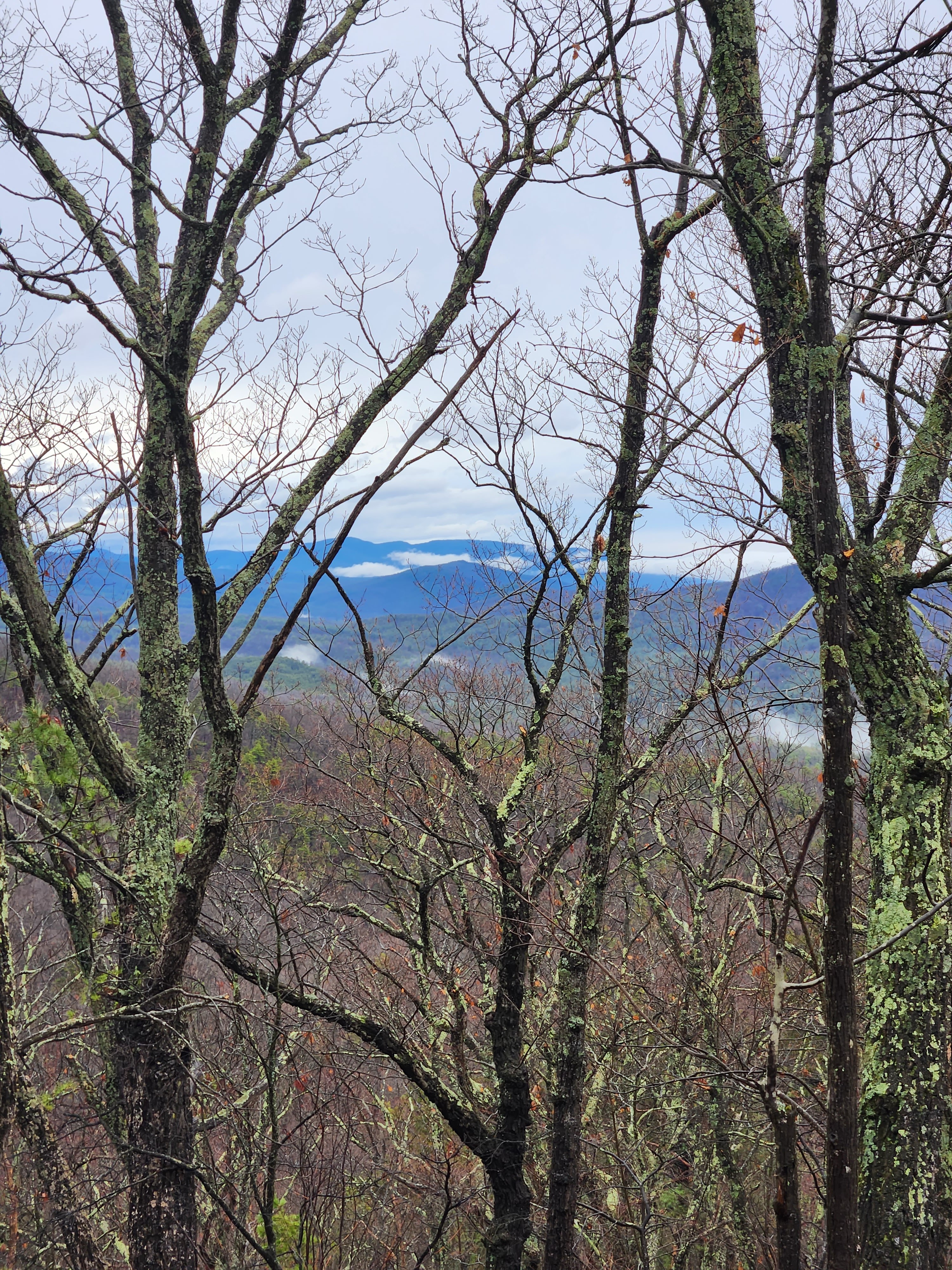
The mist made things a bit more photogenic though

Lately I've made a conscious effort to be more mindful of the positive aspects of my races, despite the fact that the word "mindful" makes me want to vomit. In that spirit, I tried to identify the silver linings of each obstacle that presented itself.

Silver lining #1: Every other climb in this loop is smaller.

I made it to the top of the climb without an issue, stopping myself once in a while to take some pictures while the conditions allowed. The summit ridge had some spots with impressive drop offs, and I made a mental note to not eat shit and fall off a cliff overnight.

The 2,000' descent to Camp Todd was on a steep but surprisingly smooth section of single track. Unfortunately, there were a dozen trees that had fallen across the trail over the winter.

Silver lining #2: Climbing over downed trees is kind of like stretching and is probably good for me... or something.

At the bottom, I found myself facing a very deep and fast moving North River. I was glad to have poles as I forded the freezing cold, thigh deep water.

Silver lining #3: I am now wide awake.

I made it through the water slowly but without an issue. Volunteer Eric was waiting for me at Camp Todd on the other side, and he greeted me with all the hospitality I've come to expect in semi-supported races: "What took you so long? We were starting to think you were dead!" Glad to see you too, friend.

I was carrying all the nutrition I needed for this loop, so I just refilled my water bottles and got back on the trail. Or rather, I sloshed uphill through an ankle deep river that had trail blazes on it. Yesterday's rain was apparently still making it's way off the mountains.

The climb up to Big Bald Knob (lol) was shorter but steeper than its predecessor. At 4,134', Big Bald Knob is - you guessed it - 200 feet shorter than Little Bald Knob. I relayed my confusion about this to the race organizers afterwards, and they explained that the words "big" and "little" refer to the size of the balds at the summit of each mountain and not to the height of the mountains themselves. I didn't see a bald on either of them, but I'll take their word for it.

One of the more easily negotiated downed trees on the course

The descent from Big Bald was unremarkable except for a short section with a 30% grade. I made it to the bottom without blowing up my quads and considered that a victory. I refilled my bottles again at the road crossing and started the last climb of the loop: Hankey Mountain.

On an elevation profile, Hankey Mountain looks like an afterthought. It's almost a thousand feet shorter than the previous peaks, but it contains the steepest section of the loop: Chinscraper. Aptly named, the Chinscraper climbs 517' in just 0.38 miles for an average grade of 25% and a peak grade over 40%. It's steep enough that you can stand upright and almost touch the ground in front of you in certain spots.

Suffice it to say I didn't set any course records on this climb, but I did happen to see another runner for the first time all day. Jeff Moore, a finisher of many other difficult 100 mile races, was just ahead of me in 6th. It was too early to think about racing, but after 5 hours alone in the woods I figured it would be nice to have some company. I spent a few miles chasing him down a rolling jeep road, appreciative of the fact that he was leading me through a few crucial turns. I finally caught up as we began the final descent into camp, and we got to talking about the weather.

At this point I should mention that the weather had been mild all day with clouds in the morning and some glorious sunshine and 50+ degree temperatures in the afternoon. We were on track to finish this loop under 8 hours (well under my goal of 9 hours per loop), but with limited daylight in mid-February, it was already time to start planning for the night. The forecasts were calling for 20 degree temperatures in the valley with winds gusting to 30 mph. That meant that the wind chill at the summits could approach zero. Looking at the beautiful blue sky above us, it was hard to believe that conditions would deteriorate that much, but we decided we needed to be prepared.

We arrived in camp with 7:40 elapsed, which I consider a pretty solid 100 mile pace, but tied for last place. I spent about 10 minutes in camp making sure I had enough clothing to get through the first night loop. I don't usually like to stop that long, but with limited aid on the course it was important to make sure I had everything I needed.

Night Moves

The big question for this loop was what to do at the river crossing. The RD had told us that we had the option to cross at another spot further upstream where there were stones to hop across, but this added almost a mile to the loop and there was no guarantee that we would even keep our feet dry.

Last view for a while

Ultimately, Jeff convinced me to take the longer route because at this time of day, falling in the freezing water would have almost certainly ended our races. We summited Little Bald together, and I got a bit ahead on the descent. I negotiated the downed trees without too much issue and made the hard right turn to the alternate river crossing. I was pleased to see that the stones were just above the waterline, and a few short jumps got me to the opposite bank in one piece.

Jeff caught back up as I was refilling my bottles at Camp Todd, but he needed to get some clothing out of his pack so I hit the trail ahead of him and unfortunately didn't see him again for the rest of the race. He would go on to finish in 40:25.

Silver lining #4: I'm no longer in last place.

As predicted, the cold weather rolled in, and I progressively added more warm layers. I've gotten pretty good at micromanaging my temperature in races, which, being that I'm a sweaty disgusting bastard, is highly important. First is a Buff around the neck, which always adds a surprising amount of warmth. Then one around the ears. Then gloves, then the waterproof mitten shells, and then finally my rain shell. I had a puffer jacket stowed in my pack in case of emergency but never felt the need to use it.

Armored against the increasingly hostile elements, I finished loop 2 in 8:25, which was fairly consistent with the previous loop considering the addition of an extra mile. I again kept this stop to just 10 minutes, getting some caffeine in my system and grabbing a few slices of bacon from Jose Cardenas, who was volunteering before running the midnight single loop: "Take some bacon. The meat sweats will keep you warm on the climb." I thanked him for the motivation, and he responded, "thank me by running fast!"

Race entry was food for the communal aid station and a bundle of firewood. The volunteers kept a fire burning at the start/finish all weekend!

It was now after midnight, and the cold front was in full swing. The wind howled through the trees on Chestnut Ridge and bits of snow pelted my face. I went to take a sip of water and realized that the mouthpieces of both bottles were freezing. This problem was solved by putting my jacket on over my pack, which then created a new problem: I now had to take off my mittens and unzip my jacket whenever I needed any food or water. Ah, the joys of running in freezing weather!

I once again made the "smart" decision to detour around the deep river crossing. This plan was thrown back in my face when I slipped on an icy rock and plunged my left leg into water up to my knee. I also managed to bang my shin on another rock in the process, which - writing this ten weeks later - appears to have left a permanent mark.

Silver lining #5: Cold feet are great motivation to move fast.

I hobbled into the heated tent at Camp Todd feeling sorry for myself, but I was greeted by Pat and Zack who had both dropped out and were waiting for a ride. I tried to convince them to join me for the rest of the loop, but it was hard enough to convince myself to go back out. So I left and hit the climb up Big Bald, which was still a river but now had sections of fresh ice to keep things interesting.

I won't describe every twist and turn of this third loop, but the bottom line is that it was very cold and I gradually worked myself into a calorie deficit because of my reluctance to take off my jacket to access my food. When the sun came up midway through the loop, the weather started to warm and I slowly worked my way back out of that deficit. I made it through the loop in 9:15, which given the conditions, I'm very pleased with. I had passed Mike Zinn on the descent from Big Bald, which put me in third place out of the five runners remaining. Mike was looking tired but determined and would go on to finish in 41:40.

On the hunt

I spent a few extra minutes at my car getting calories and caffeine in my system. With 26:15 elapsed I headed out for my final lap. That gave me 9:45 to hit my time goal. By all accounts, Nich had solidified his hold on first place and was many hours ahead of me. I was happy just to avoid being lapped. I asked how far ahead the 2nd place runner was.

"Oh you're not going to catch him. He left an hour ago and looked great!" came the response from the RD and volunteers.

"Like hell I'm not!" was what I thought to myself, but I think I responded, "Okie dokie, thanks!" as I left camp.

I'm not usually very competitive, but on the other hand...
  • I wanted to prove those volunteers wrong.
  • I thought it would be cool for the two Warren County, NJ runners to finish 1st and 2nd (ok, Nich technically lives in NY now, but he grew up just a few towns over from me).
  • I wanted to thank Jose and those same volunteers by running fast.
As I headed up Chestnut Ridge for the final time, a bald eagle took off from a tree and flew directly over my head. Patriotic AF. Now I had to chase down second place for America too.

Then something orange in the trail caught my attention. It was an orange peel. I figured the second place guy must have accidentally dropped it. Then a mile later I found another orange peel. Then another. Then another. Each one dropped in the middle of the trail. This was clearly deliberate.

That settles it. This litterbug fuck is going down!

If you're keeping track of my motivations to run fast, they were now: spite, camaraderie, gratitude, patriotism, and spite.

Silver lining #6: Spite is a great motivator.

I charged up Little Bald and ran the descent as quickly as possible. With the sun shining and the weather heating up, I made the decision to wade through the river one more time to save myself the extra mile. The cold water actually felt good on my tired legs. Plus now wading through the semi-frozen river on Big Bald wouldn't bother me.

Big Bald felt steeper than ever, but I hammered down the backside of it, running a pair of 13 and 12 minute miles for the first time in many hours. At the road crossing, I finally spotted him. Mister soon-to-be-third-place litterbug.

"Just how many oranges do you have with you?" I demanded.

"Um. I'm not carrying any oranges," he responded with some confusion.

After some discussion, it became clear that the orange peels were left by a single loop runner who had started with a backpack full of them. I don't want to name names, so we'll just call him Schmarty Schwinn. I politely asked Schmarty after the race not to litter in National Forests and he politely thanked me for informing him about proper race decorum. Just kidding, he threw a temper tantrum and made the world's laziest TWOT pun in retaliation. Eat a dick Schmarty. Eat all the dicks.

Regardless, I still had those four other reasons to run fast. I took off up the trail to Hankey Mountain with the other runner right on my heels. I stepped on the pedal harder and he stayed with me. We arrived at the base of Chin Scraper and it was time for me to make my move... except that he zipped right up the climb and left me in his dust. It became clear that I might have blown my wad too early in this loop, metaphorically speaking of course. My legs were not cooperating.

I arrived at the top panting and wheezing to find this runner waiting patiently.

"Hey man, do you want to run this in together?" he asked.

"Shit, yeah, I really do." I replied.

Silver lining #7: Running with other people is fun.

Mister soon-to-be-tied-for-second non-litterbug was actually named Barry. Barry is a remarkably cool dude. With no one close behind us and my sub-36 hour goal well in hand, we enjoyed a leisurely jog through the final ten miles of the course. We swapped stories and learned the sort of personal details about each other's lives that only come out after many hours of running on a trail. At one point, he also politely waited while I pooped behind a tree. Which was nice of him.

We arrived at the finish in 35:27:00, announcing "We are tied!" just so there was no confusion. I had suggested holding hands, but I guess our words were effective enough.

Me and Barry showing off our sweet 3D printed finisher trophies which are shaped like the course map

Nich had finished many hours earlier, taking the win and setting the fastest Cold TWOT time by anyone not named John Kelly. His reward was having to sleep in the car for seven hours while Barry and I had our bonding session.

With the sun setting for the second time and the weather cooling again, it was time to head back to civilization and indulge in Virginia's finest cuisine: Waffle House and Cracker Barrel.

Thank you to the race directors Antoinette and Guy; to Eric, Jose, and the other volunteers; and to everyone who came out to race (not you, Schmarty). TWOT represents the perfect intersection of wilderness, community, and sadomasochism that I seek out in races. One of these days, I'd like to try the midnight single loop, but I don't know if my soul will ever be ready for another four loop effort.

Distance: 115.05 miles
Elevation: 28.805 feet

Wednesday, January 11, 2023

Fat Dog 120: Don't Call It a Comeback

Or do call it a comeback. Whatever, I'm not your mom.

I originally registered for Fat Dog 120 on January 2, 2018. I was coming off the best racing season of my short ultrarunning career, having broken 14 hours at Manitou's Revenge, 20 hours at Vermont 100, and 24 hours at Grindstone, along with setting a new FKT on the NJ section of the Appalachian Trail. I was feeling invincible and was ready to take on a new level of mountain ultramarathon.

For reasons that I will elaborate on in way too much detail, that did not come to pass. If you would like to fast forward, skip to the race section below. For those of you who want to wallow in self pity with me, read on...

I waited a long time for this view

What followed was a string of bad luck for the race organizers, for myself personally, and - well - for the entire planet:

2018: Race canceled because of wildfires on course
2019: Race held on a modified course. I deferred to 2020.
2020: Race canceled because of Covid
2021: Race canceled because of Covid
2022: Race held on a modified course because of flooding

On August 5, 2022, four and a half years after registering, I finally stood on the starting line. Rather than using the intervening years to get stronger and faster, I had suffered a string of mild but nagging health issues that had slowed me down a quite a bit from my peak. I was now coming off my worst years of racing, having blown up at Manitou's Revenge, Grindstone, Hellbender, and Manitou's again.

If you've noticed a lack of activity on this blog, that's because for a long period of time, I simply didn't enjoy running any more. I kept going through the motions, hoping to reignite the flame, but my body would not cooperate. Even my easy runs were leaving me feeling drained and sore.

It wasn't until a blood test showed low levels of iron and vitamin D that things started to click. I started taking supplements and immediately noticed an uptick in my energy levels. I bought a gravel bike and a TheraBand and started doing what would have been unimaginable to a young Ryan: stretching and cross training.

My race results didn't immediately improve though. My body was recovering, but my fitness would take longer to return. Also, I was about 15 pounds over my ideal racing weight. Rather than focus on a time goal, I decided that my main goal was to enjoy this experience that I was finally going to have in the mountains. Rather than taper, I spent the week before the race exploring Banff with Alex.

Moraine Lake. Worth the bike ride.

Mt. Rundle. Worth the 8 hour hike on race week.

Okay, I did have one time goal. They give out colorful buckles for a 36 hour finish. I thought that would be fun, but it seemed optimistic given all of the above. That goal went out the window pretty early on.

Let's get to the race.

The Gang Races Fat Dog

Fat Dog is a 120+ mile race in the Canadian Cascades, running point to point from Cathedral Provincial Park to Manning Provincial Park. Despite being located just across the border from North Cascades National Park, these provincial parks are some of the best kept secrets in North America. The course passes through pristine wilderness, crossing alpine meadows and rugged ridgelines. In 2022 the course was rerouted, perhaps permanently, because of severe flood damage in the Skagit Valley. This added on 5-10 miles and a bit of elevation gain.

2022 Fat Dog elevation profile

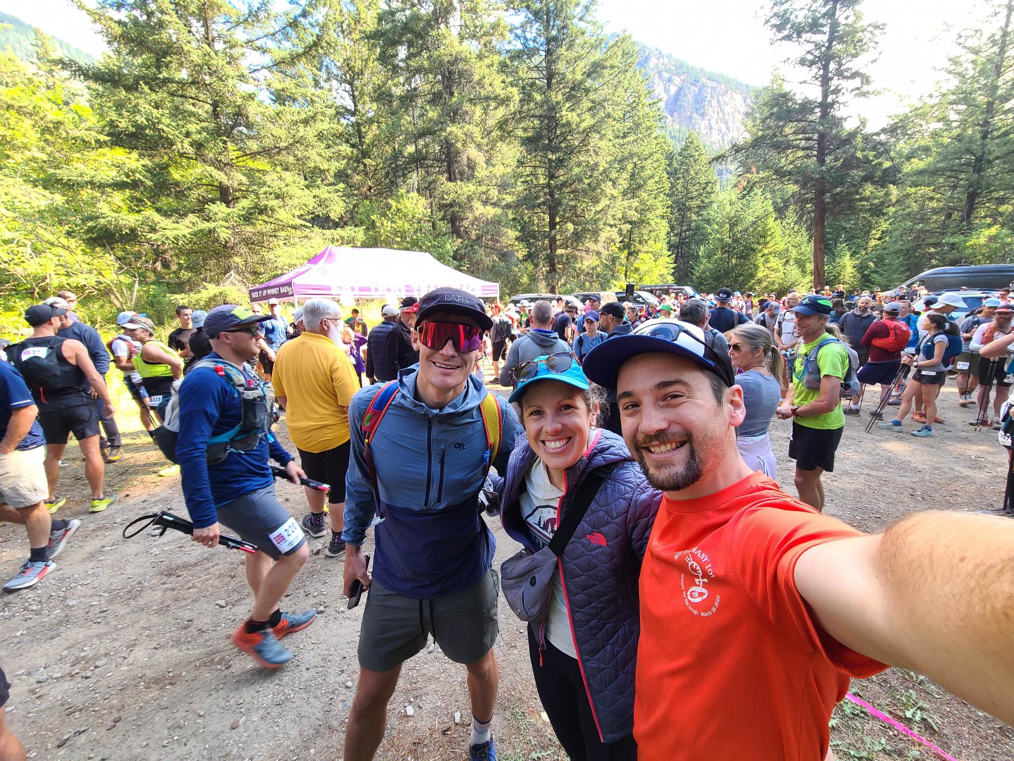
I was lucky enough to be joined by my two favorite Alexes for this race: Alex T. (my wife, aka Girl Alex) and Alex G. (my running friend, aka Boy Alex). Their experience in getting my dumb ass through difficult running events is unmatched. With a little bit of fanfare at the starting line, we set off on our 120+ mile journey.

Boy Alex, Girl Alex, Boy Ryan
The tent in the background says "Suck it up whiney baby" which is a pretty good race motto

The first section was a 4,800' climb over about 9 miles on the Lakeview Trail to the Cathedral Aid station. This was the biggest climb and the highest point of the race, so as usual I forced myself to take it extremely easy, letting the more enthusiastic runners race past me while I stopped to take pictures and enjoy the scenery.

All smiles on the first climb
Photo by Matt Cecil

The views on the ridge were spectacular. Race weekend happened to fall exactly at peak wildflower bloom and I finally got to see why people call this the most scenic race in North America.

Stupidly pretty

After a short traverse along the chilly ridgeline, we made a 3,700' descent to Ashnola Aid station at mile 18. The weather got hotter and the trail got dustier as we descended, so I reined in my effort level. I was excited to see my crew for the first time, but I was also eager to get out of the dusty mosquito-y valley and into cooler weather. I think I got a little impatient with them as they swapped out the dying batteries in my SPOT tracker, but in reality I was only there for 5-10 minutes.

The next section was almost the mirror opposite of the first section: a 3,400' climb to Flat Top mountain over 10 miles followed by a 4,000' descent to the Passayten River. I should mention here that on paper, these climbs all max out at around 800 ft/mi, which is not particularly steep for a mountain race. But I noticed pretty quickly that the trails were not evenly graded. Strava backs me up on this, showing that the ironically named Easygoing Creek trail maxes out around 30% grade in certain sections.

On the bright side, there was this to look at:

I mean, just...

Bruh.

I'm sure I lost 10 minutes in this section just spinning in circles taking pictures. But when am I going to be back to the Canadian Cascades? Worth it.

Wet Feet and the Search for Meat

Much to the relief of my race time, the sun went down and my view shrunk to just the 10 foot circle  in front of me that was illuminated by my headlamp. The descent was pretty straightforward, but what I found at the bottom was a surprise: a thigh deep crossing of the Passayten River aided by a fixed rope. I had read a half dozen race reports to prepare for the race, but apparently this didn't make enough of an impression on those runners to warrant its inclusion. Canadians are a different breed.

This was a definite highlight

At 39 miles into the race, I didn't expect to get stuck behind any groups of runners, but this was a major choke point since only one person could use the rope at a time. I considered charging ahead without the rope but didn't want to risk dousing myself in cold water as the temperature was dropping. Instead, I occupied myself by taking pictures and filtering water. After a 10 minute wait, it was finally my turn to cross. I wasted no time, charging ahead and presumably winning a Strava crown for that 100 foot segment (note to self: create the world's dumbest Strava segment).

Moody shot courtesy of Matt Cecil

In the original course, this crossing would have been followed by a 3 mile section of highway, which always sounded awful. Instead this year we followed a fire break that paralleled the road. For those of you who, like me, are unfamiliar with this term, a fire break is essentially a path bulldozed through the woods to prevent forest fires from spreading. This one was brand new, as evidenced by the fresh bulldozer tracks, and was basically a mud pit that climbed 1,000 feet from the highway. On fresh legs it might have been fun, but holy cow was this a slog!

Anyway, I finally made it to Bonnevier aid station, which I had been calling Bon Iver in my head for the last few hours. It was just after 11pm and I hadn't seen my crew in over 7 hours. I asked the Alexes to see if the aid station had any cheeseburgers. I had smelled them cooking back at the Trapper Aid station four hours earlier, but someone snagged the last one and I didn't want to wait for them to make more. I had been on a mission to find a burger since that moment, but I was shit out of luck because apparently those were the only burgers in the entire mountain range.

Boy Alex found me some bacon though, which is a fantastic consolation prize.
Get yourself a vegetarian friend who still brings you meat at aid stations.

With dry shoes on my feet and a handful of greasy animal products for the journey, I got back on the trail. This would be the crux of the race for me and the other runners: a nighttime traverse of the Heather Trail, 37 miles in the backcountry with no major aid stations.

I started the climb with another runner who had run the first edition of Fat Dog. I had previously heard that the inaugural race was advertised as a 100 miler, and it wasn't until runners got close to the finish that they realized it was more like 115-120 miles. Yeesh. I learned from him that the reality was even worse. The race was also marketed as "beginner friendly" and there were runners attempting their first 100 miler that year. As someone who came into this race having finished thirteen 100 mile races and was completely drained by the finish, the thought of doing this with no prior 100 mile experience was horrifying.

I hit the Bonnevier aid station around 3am, happy to see other people for the first time in a few hours. The weather was starting to get chilly, and I saw frost forming in the grass around me. The aid station was a sullen affair with just a couple of volunteers standing shivering in the dark. I filled a water bottle and grabbed a gel and got moving. To those poor volunteers, thank you for standing on a mountaintop in the dark to hand out gels and fill water bottles!

A few miles later I found myself stumbling. My mind was drifting and I suddenly had the irresistible urge to sleep. I've noticed that my ability to handle sleep deprivation has been getting worse as I get older, and for the first time in my racing career I had to lie down in the middle of the trail and take a nap. I left my headlamp on so no one would step on me, took a quick look at my watch, and immediately drifted off into the abyss. I woke up 5 minutes later, a bit chilly but feeling much more energetic.

Sunrise over Nicomen Lake

It was now almost 5am, and I knew that the sunrise would help me wake up. I crested Nicomen ridge just in time to see the first rays of sunlight peaking out over the mountains in the distance. A short but steep descent brought me to the Nicomen Lake aid station, where I once again grabbed a minimal amount of food and water and got back on the trail. I was around the half way point in the race with just under 20 hours elapsed. A 36 hour finish was certainly not going to happen, but 40 sounded like a nice round number too.

With the sun now shining down on me, I felt a renewed burst of energy and hammered the descent to Grainger Creek aid station. Just kidding! I immediately began to feel sleepy again, and I staggered down the trail, barely managing a 15min/mi pace on the buttery smooth single track. I zombie shuffled into the aid station, set a 5 minute timer on my phone, and immediately collapsed onto a yoga mat for my second nap of the race.

Once again, the short nap revived me (following it up with a cup of coffee didn't hurt either), and I was back on the trail. I now had a 10 mile climb on the Hope Pass Trail to get to my crew at the next major aid station. I was moving well, but this was a new section of the course, and it had clearly not seen much foot traffic. I could tell how much work had gone into clearing it ahead of race day, given all the fallen trees that had been cut. However, the trail was a muddy, mossy, brushy mess. Despite not having had rain in the last few days, I found myself constantly sidestepping puddles and creeks running across the trail.

I arrived at Hope Pass aid station at almost noon, having gone 12 hours since seeing my crew. I asked if they could find me that cheeseburger, but the hot options were tater tots and bacon. Once again, not bad as far as consolation prizes go. I was craving salt and I vaguely recall saying "Tell them to put a lot of ketchup on the tots. Like, a disgusting amount of ketchup. Fuck them up with ketchup."

Boy Alex sunscreening my calves and thighs. Not who I expected to deal with that task, but I'm not complaining.

The Part Where I Got to Run with People!

Now 80 miles into the race, we were firmly in pacer territory. Boy Alex had initially offered to pace more mileage, but with the lack of crew access in the backcountry, the only other option would have been for him to start at mile 40. And while 80 miles with a pacer sounds nice, I didn't want us to both be trashed by the end.

We were back in the high country, and with the sun shining on the wildflowers we felt like we were in the Sound of Music. We had a 24 mile traverse back along the Heather Trail to the next major aid station, and Boy Alex was determined to keep me focused and motivated. Although like me, he couldn't help but stop for pictures.

Flowers for DAYS, son!

We reached Nicomen Lake aid station at the same time as Lee Conner, a badass woman with whom I have shared miles at Grindstone and Hellbender. I always know I'm having a good day if I'm near her on the course, but unfortunately she was going through a serious rough patch. She seemed to be struggling to form words and her movement was uncharacteristically slow and cautious. I advised her to get some food in her system and take a nap, not that she needs my advice when it comes to finishing mountain ultras. I left her in the capable hands of the aid station volunteers and hoped for the best as I trudged onward.


The remainder of the Heather Trail was beautiful, if not particularly fast. I hit the 100 mile mark in 32 hours, which seemed respectable to me given the difficulty of the course. I noted out loud that it would have been so nice if this race was "only" 100 miles. But alas, my dumb ass decided that 120+ was a good idea.

At mile 103 we hit Blackwall Road, a winding dirt road that would take us down to the race headquarters at Manning Park Resort. From here we had a panoramic view south into North Cascades National Park.

View from Blackwell Road
Photo by Matt Cecil

It was nice to be on a graded road and not have to think about foot placements for a while, but the soles of my feet were a mess after running through so much mud earlier in the race. We got to Blackwell aid station, and the Alexes swapped pacing bibs while I did some surgery. I scrubbed the grit off my feet with a towel (a highly useful piece of race gear) and dried them off as best as possible. To add a bit of protection, I double layered my socks, which seemed to help somewhat. With Girl Alex now by my side, I got back on my feet and hobbled onward.

It hurts but it do be pretty though

We had a short detour onto a rocky trail that cut a switchback off the road descent, but after that it was six miles of pavement to descend 2,000 feet. I'm typically a strong downhill runner late in races, and I managed a respectable-but-not-aggressive 14 min/mi pace on this section. But let me tell you that my hips and knees were not happy about this sudden burst of what I will generously call "speed."

Pain cave, party of one

I felt bad that Girl Alex's section with me was such a low point. She tried to distract me by talking about some dinner plans with my family when we got back, but I informed her in no uncertain terms that I was in no state to check my mental calendar for openings. In fact, I was pretty sure that we were going to have to throw my corpse in a dumpster after the race, so future dinner plans seemed pretty fuckin' irrelevant. So yeah, that's the head space I was in. Sorry babe.

The Alexes swapped pacer bibs again, and now I was back to being Boy Alex's problem. He had chugged a cold brew coffee and was determined to get me to the finish line regardless of my deteriorating state. I spent the next few miles trying to keep up with him as he went into full drill sergeant mode, barking orders to run interspersed with words of encouragement. I racked my brain for a polite way to tell him to fuck off. I considered sitting down in the center of the trail and DNFing in protest of this outrageous treatment, but that seemed a tad too dramatic. Eventually I settled on a very frank, "Hey man, this is not working and I'm totally fine with finishing an hour later if it means not pushing this hard." That did the trick.

Pic unrelated to this point. I just like the way it looks. Can you tell how hard I'm trying to hold my shit together?

We passed by the finish line at mile 113 and still had another 14 miles left to go, which if you ask me is a pretty rotten thing to do to a runner. We trudged onwards, but for the third time in the race I was met with an overwhelming urge to lie down and sleep. Boy Alex, having been nudged out of drill sergeant mode, relented and I curled up for a few minutes until I felt a very large spider crawl up my inner thigh. Fine. Fuck. I guess I won't sleep.

Thus began a very slow and sullen ascent of the Skyline Trail. If you had stopped me at this point in the race and asked my opinion on the technicality of the Fat Dog trails, I would have said that it has some mildly rocky sections but nothing too strenuous. Skyline flipped this assessment on its head. Rocky ledges. Steep drop-offs, sometimes on both sides of the trail. If I had done this in the daylight on fresh legs it would have been my jam. In the dark with 120 miles on my legs, it was very much not my jam.

Cool, but also ouch.
Photo by Anne Christensen on AllTrails

Boy Alex did his best to distract me by practicing his Spanish. It had been freezing by the water at Lightning Lake ("Ryan esta frio!"), and as we climbed we hit a much warmer patch of air ("Ahora, Ryan esta muy caliente!") As my 20 mile miles turned to 30+ minute miles, I did the sort of mental math that every runner does at this point in the race. 40 hours had slipped away. 41 wasn't looking good either. Let's shoot for 42 then. The answer to life, the universe, and everything. It's a better number than 36 or 40 anyway.

We crested the last summit with just over 40 hours elapsed. I tried to run downhill but my feet were hamburger meat and I was losing coordination from the lack of sleep. At one point I stepped straight off the side of the trail and would have fallen 20 feet into some brush if not for a perfectly placed fallen tree that my foot landed on. Get your shit together Thorpe!

I noted with surprise that no runners had passed us since the last aid station, and with that a half dozen people flew by. One of them was Lee Conner, who was back from the dead and poised to finish with her trademark sprint. I gave chase for a few seconds but had to let her go.

At long last, we reached the bottom of the mountain. The finish line came into view across Lightning Lake and we heard cheering from the small group of spectators who were braving the cold in the middle of the night. I shambled across the finish line, gave Girl Alex a big kiss, collected my buckle, and gave that a big kiss too for good measure. Boy Alex got a hug.

All the feels

Just a boy and his Alexes

Only nine runners had broken 36 hours and twenty broke 40 hours, which made me feel a bit better about missing those goals by such a wide margin. Despite having almost perfect weather, the course changes certainly seem to have added some difficulty to an already difficult race. Nevertheless, I finished feeling healthy (my feet were fine once they dried out) and despite some late race struggles, I really thoroughly enjoyed the experience.


We couldn't hang out long because the temperature was just above freezing, but the next afternoon, after eating all the bacon and eggs they had in our small town, we returned to the scene of the crime and enjoyed soaking our tired feet in Nicomen Lake in 90 degree weather. What a difference a few hours makes!

I could have spent the whole day sitting here

Then we had a three hour drive back to Vancouver to catch our flights home. Or rather, the Alexes had a three hour drive. I took a three hour nap and magically found myself at YVR airport.

It ain't colorful but it's a keeper

I don't know if I'll come back to Fat Dog any time soon, but I'm glad I finally had the opportunity to run this amazing race. Huge thanks to the organizers, the volunteers, and of course, my two wonderful Alexes!

Thursday, July 28, 2022

Adventure Report: The Bob Marshall Picnic

There comes a time in every man's life when he finds himself frantically burying a bicycle in the woods in the middle of the night. For me, that time happened to be 11pm on Thursday July 14, 2022.

Allow me to explain.

Bob Marshall, the OG mountain ultrarunner


The Bob Marshall Traverse

Back in 1932, legendary ultra-hiker and wilderness advocate Bob Marshall summited 13 Adirondack High Peaks in a day, as well as the 2,876 foot Mount Jo for good measure. This broke the previous record of eleven peaks. He summarized the endeavor with the kind of self-effacing humor you would expect from a modern day ultrarunner:
Well said, Bob.

Marshall would pass away suddenly from heart failure at the age of 38, but his legacy would live on in the nine million acres of wilderness he helped to preserve.

Marshall spent the night before his hike at John's Brook Lodge, a backcountry bunkhouse five miles from Keene Valley. At 3:30am, he set off into the darkness, summiting Big Slide before returning to the Lodge for a quick breakfast. He then turned south, climbing each peak in the Great Range (Lower Wolfjaw, Upper Wolfjaw, Armstrong, Gothics, Saddleback, Basin, Haystack, and Marcy). He dropped down the south face of Marcy to Four Corners, where he made an out-and-back summit of Skylight before continuing west past Lake Colden and up to Iroquois, Algonquin, and Wright. He then made the 2,500' descent to the Adirondack Loj where he had dinner. Feeling reenergized, he made the short but steep hike to the summit of Mount Jo to take in the stars. His route totaled 30-35 miles and 15,000 feet of elevation gain and took 18 hours and 40 minutes.

Ted "Cave Dog" Kaiser repeated this route in 2005 as part of his 50K in 50 states project, finishing in around 24 hours. However, it wasn't until 2018, more than 86 years after Marshall's famous hike, that a local runner named Bethany Garretson bested Marshall's time, completing the traverse in 15:33. Within a few years the records had been lowered to 13:07 for women and 12:10 for men.

Elevation profile of the Bob Marshall Traverse
Water droplets indicate places where water can be filtered

Introducing the Bob Marshall Picnic

Since seeing the Bob Marshall Traverse on the FKT webpage, I've been trying to find a time to drive up to the Adirondacks and run it. My name is indelibly etched in the annals of Adirondacks history thanks to that time that Alex Galasso and I created its greatest running route. I felt compelled, therefore, to add to my legacy by smashing the existing FKT for the Bob Marshall Traverse.

The problem, however, was that the logistics of the traverse are complicated. It is point-to-point and starts 5 miles from the nearest town (1.5 mi on road + 3.5 mi on trail). That means that you either need to get a ride to the start, a ride back from the finish, or both if you are really trying to conserve energy. Additionally, the bunks at the Lodges are booked months in advance and it is impossible to predict mountain weather more than a few days ahead of time.

The solution, it seemed to me, was to turn this traverse into a loop. This would require hiking into JBL from Keene Valley, completing the traverse, and either running or biking the 20 miles from the ADK Loj back to the start. In the same vein as the Presidential Picnic, Grand Teton Picnic, and various other routes that combine biking and running, I named this new route the Bob Marshall Picnic.

The Bob Marshall Picnic. The original route is in red, the hike into JBL is pink, and the biking route from ADK Loj to Keene Valley is blue [click to see the route on Caltopo]. 

All that is a long way to say that at 11pm on a Thursday night in July, I found myself thrashing through the woods outside of the ADK Loj trying to decide how big a pile of branches and leaves was required to safely hide my $120 gravel bike from any would-be thieves. I had made the 5 hour drive up from NJ after work that day, eaten a nutritious dinner of pizza and diet Coke while driving, and I planned to get a few hours of sleep before starting the next morning. My body is a temple, but like, a shitty one that thrives on sarcasm and junk food.

Hiking in the dark

After an all-too-short night of sleep, my alarm went off at 3am. Go time! I had slept in my running clothes so all I had to do was hobble to my car and make the 20 minute drive from Draper's Acres campground to the starting point in Keene Valley. I chugged a Dunkin Donuts iced coffee that I had picked up at a gas station the day before (treat yo self). I parked my car at a hiker parking lot on on Rt. 73, and by 3:39 I was hiking up Adirondack Road toward The Garden trail head, munching on an everything bagel.

The hike to John's Brook Lodge is a mild five miles and I took my time, treating it like a warmup. I arrived at the Lodge almost two hours later, having stopped to filter water, shed a few layers, and take a bio break. Now it was time for the fun part.

The Bobby

I restarted my watch at 5:36am and set off from the Lodge. The climb up the Big Slide Trail is long but somewhat tame by Adirondacks standards, at a leisurely 2,000 feet in two miles. I felt a little dumb with three full water bottles in my pack as I zig zagged back and forth across Slide Mountain Brook. A little lesson learned in the importance of course recon. I reached the summit in almost exactly an hour, which was about ten minutes behind the men's FKT for the traverse. I typically like to start slow so I figured I would be a few minutes behind at the early summits, but if I had a good day I might slowly catch up my the end and sneak in under the FKT for the traverse portion of my day.

Sunrise over the Great Range from Big Slide

I paused for a moment to take a sweaty selfie and then trotted back down the trail, eating my first Snickers bar of the day. I lost the trail briefly on one of the many river crossings, but found it again quickly. Yet another reason to actually scout the route that you are attempting to run for speed.

Now it was time to face the Great Range. I had done a full Great Range Traverse back in 2019 and remembered it being mostly devoid of water sources, as ridge traverses often are. I made sure to fill all my bottle as I crossed Wolfjaw Brook for the final time before getting to Lower Wolfjaw.

The final push from Wolfjaw Notch to Lower Wolfjaw rises 725 feet in just 0.37 miles (36.5% grade) and I struggled to keep my heart rate low and my breathing steady. This would be a theme for the remainder of the day. With steep wet slabs and boulder scrambles that require the use of all four limbs, the Great Range is not conducive to low-heart-rate efforts. Nevertheless, I tagged the summit, took another quick picture, and plummeted back into the notch toward Upper Wolfjaw.

Climbing Upper Wolfjaw involves negotiating a series of small cliff bands, and generations of foot traffic have eroded the delicate topsoil on the trail. I wondered what the trail would have looked like back in Bob Marshall's day before peak bagging was the popular hobby it is now. This would be another theme for the day. Bob Marshall had famously fought to protect these mountains from logging, but their fame has since led to a different kind of damage: severe erosion of the trails on the high peaks.

Climbing a slab on Upper Wolfjaw (I think) back in 2019

Moving along, I made sure to take the short out-and-back up the slab to the true summit of UWJ and then continued on southward. Next up was Armstrong, whose sheer sloped always look more imposing than they actually are when you first spot the mountain through the trees. I made it to the summit with minimal issues and was rewarded with a short stretch of relatively flat trail along the summit ridge followed up a mild (for the Dacks) descent and ascent to Gothics.

I think of Gothics as the point where the Great Range traverse becomes almost a true alpine route. Although the majority of the route is still below tree line after this point, the summits are rocky and exposed, and the descents often resemble the type of scrambles you would find in a west coast range. Case in point, the descent off the southern flank of Gothics drops 604 feet in just a quarter mile of smooth rock slab (-45% grade). Dumber Braver hikers are able to walk this, but the vast majority choose to use an old sketchy garden hose that is bolted onto the rocks and is generously called "the cables." I opted not to use the cables since for some reason I thought it would take too long to bend over and grab them.

Alex T. descending the cables during a partial Great Range Traverse in 2020

The steep slabby descents continued after Saddleback. Here the Great Range Trail was essentially just a cliff face with a few blazes painted on the rock. Route finding was tricky and I paused a few times to make sure I didn't get cliffed out on my way down. This section was the steepest of the day at 336 feet in just 0.13 miles (-48.8%). Adirondack trail builders were wild back in the day!

Alex G. picks his route down the Saddleback cliffs in 2019. Basin is off to the right.

Somewhere around here is where I ran out of water. It had been almost three hours since I had filled my bottles in Lower Wolfjaw Creek, and the weather was starting to get warm. I pushed a bit to get up Basin and down the other side to Haystack Brook, where I gulped down two bottles in rapid succession and then refilled all three bottles again. In terms of finding water, I had made it through the crux of the route and would have numerous places to filter for the rest of the day.

Feeling reenergized, I charged up Haystack, which is one of my favorite summits in the Adirondacks. At 4960' Haystack is the third highest peak in the Dacks and the top 500 feet of it are entirely above tree line, which means that it offers a beautiful panoramic view of the surrounding peaks without the crowds of its neighbor Mt. Marcy.

The descent down the Phelps trail was tougher than I remembered, butt thankfully it wasn't very long. It was now just after noon as I began climbing Marcy, the highest peak in New York. At this point in the day, the crowds had gotten a chance to make their way deep into the High Peaks Wilderness and the trail was getting busier. I was thankful that I had chosen to do this route on a Friday since that minimized the amount of times I had to pull over and let large groups pass.

Typical crowds at the summit of Marcy. Photo from 2019.

I tagged the summit of Marcy with exactly seven hours elapsed since I had left John's Brook Lodge. Previous reports from this route had said to treat this peak as the half way point, but I hoped that I was well over half way done. It was on the ensuing descent to Four Corners that my quads started to complain for the first time. I had pushed them pretty hard on the steep slab descents earlier in the traverse and I hoped that they would hold up for the remaining 8,000-ish feet of descent that were ahead.

Skylight was a quick climb and descent but somehow seemed to be ten degrees hotter than any other trail I had been on. Sweat was pouring down my face and stinging my eyes. I was happy to check a new high peak off my list, but even happier to get off the mountain and spend a few minutes splashing around in Feldspar Brook. Nothing feels better than ice cold mountain runoff on a hot summer day.

The next four miles were relatively flat, following the Mount Marcy Trail along Feldspar Brook to Lake Colden before the assault on the last three high peaks. I was still only 20 minutes behind the Traverse FKT, and I figured I could make good time here and maybe pull even with the FKT before the big climb up Iroquois. The reality was that the Mount Marcy Trail - as its name suggests - is one of the shortest routes to the mountain and consequently is horribly eroded from decades of overuse. I had pictured myself jogging down rolling creek-side singletrack, but instead I was greeted by a boulder field with intermittent sections of shoe sucking mud. Rather than the leisurely 12-15 minute miles I had anticipated, I was barely able to average 20:00/mi in this section. By the time I reached Lake Colden the FKT was starting to slip away.

Nevertheless, I pushed hard on the climb up Iroquois. I only had a few thousand more feet of climbing, so there was nothing left to save the legs for (well, aside from a 20 mile bike ride, but I decided not to think too hard about that little detail). Once again, I had started a climb with three full bottles and then found myself climbing up alongside, and occasionally through, a creek. I cannot overemphasize how important course recon is for this route.

The Algonquin Trail: all the water you can filter

Strava claims that this climb was mere 1,886 feet in 1.51 miles, but let me assure you that it felt significantly longer. The entire section was essentially a stack of boulders with a creek running over it. Don't get me wrong, this is exactly the sort of silly masochistic bullshit that I drove up to experience, but this isn't a trail for people in a hurry.

Feeling "strong" just below the summit of Iroquois. The Trap Dike route up Mount Colden is visible just over my shoulder, but that's an adventure for another day.

The gust of cool air that greeted me at the bald summit ridge was wonderful. I made the turn southward over Boundary Peak and up Iroquois. I took a glance at my pace chart and realized that I was now almost 35 minutes behind the traverse FKT. I had a decision to make. I'm usually good for a fast downhill finish, so I didn't think I was completely out of the game. On the other hand, I had Fat Dog 120 coming up in a few short weeks and I couldn't risk hurting myself or overexerting. I decided to throw in the towel and settle for establishing the Picnic route as a consolation prize.

With that decision made, my adrenaline subsided and my energy levels dropped. I made a slow ascent of Algonquin, losing another 5-10 minutes on the FKT, and then walked down the north side of the mountain toward Wright. Despite looking like a side note in the elevation profile of the traverse, Wright is a deceivingly steep little peak, rising 577' in 0.38mi (28.1%). I took a moment here to soak in the spectacular scenery and enjoy the last few minutes of breezy 55 degree weather that I'd had all day on the summits.

Looking back at Colden and the Great Range from Wright, the last high peak of the day

I mostly walked the 3.6 miles from the summit of Wright to the ADK Loj, making a few half-hearted attempts to jog when the trail leveled out. But at this point, I was just trying to save a bit of energy for the bike back. I passed through the Loj property with 12:30 elapsed and one last peak to tag. Why? I thought to myself, Why the fuck did Bob Marshall have go back out to do Mount Jo after dinner? I'm sure I'm not the first person to register this complaint.

While only a mile and a half round trip from the Loj, Mount Jo is a tough little peak at the end of a long day. From the trail, I could smell hotdogs cooking and hear children playing in Heart Lake. This was one of those situations that makes you question your choice of hobby. Nevertheless, I summitted the mountain and walked back down to the Loj, stopping my watch with 13:21:28 elapsed.

Now let's see, where did I leave my bike?

The first order of business upon returning to the Loj was to put in a food order at the Hungry Hiker, a snack bar that was serving hot food and cold drinks. I had passed by it before my climb up Jo and the thought of eating a big greasy cheeseburger was the only thing keeping me going. I ordered burger, a Coke, and a Gatorade. I'm not sure what I paid for all that. I would have gladly shelled out $100 if it meant I didn't have to eat another goddamned gel.

While the food was cooking, I set off to dig up my bike, hoping that no one had spotted it and decided to ride it into the lake or throw it off a cliff. Thankfully it was right where I had left it. With my brain a bit mushy from 15 hours of moving through the mountains, it took me a while to get the tires mounted and fix the chain, which had somehow wrapped itself around the pedal. You see, in my laziness the night before, I had stashed my bike disassembled since that's the only way it can fit in the back set of my little Honda. Yet another valuable lesson learned. Assemble the bike before you're on the clock.

This is what heaven looks like

I rolled back to the Loj and wolfed down my burger with chain-grease-covered hands, then set off for the last 20 miles of my journey.

On paper, the route from the Loj back to Keene Valley drops from 2,200 feet down to 1,100 feet. When I planned the Picnic, I envisioned this as a leisurely coast with very little pedaling involved. Unfortunately, all the little bumps in the elevation profile added up to another thousand feet of climbing. Even more unfortunately, I'm a novice biker who rides a beat up old gravel bike. That is to say, this was not a fast or efficient ride back in to town.

The sun began to set about half way through the ride, and I flipped on my lights and put on my puffy jacket for the first time all day. I had felt a little silly carrying that jacket in my pack for 15 hours, but as I ripped down the thousand foot descent into Keene at 40 mph, I was extraordinarily grateful that I had thought to bring it. I'm sure that serious bikers would scoff at the idea of wearing a puffy jacket while trying to go fast, but as I have tried to emphasize here, I'm not a serious biker.

I pulled back into the hiker parking lot in Keene Valley 17 hours and 33 minutes after I had left, completing the loop entirely human-powered and self supported. From what I can tell, my time on the traverse portion of the route is the third fastest on record, and my time for the full loop was even a bit faster than Bob Marshall's time for just the traverse. However, I have to give him style points for stopping to eat a full breakfast, lunch, and dinner on his journey.

This traverse can certainly go much faster, as I took my time with the first and third legs of it and made various tactical, navigational, and nutrition mistakes during the traverse itself. Hopefully this effort inspires other people to tackle the Picnic or to invent bigger and dumber routes in the mountains.

The route is still pending approval on fastestknowntime.com, so I'll update this post if/when it goes through.

Happy running!

Stats for nerds

Stop at JBL: 4m
Stop at ADK Loj: 30m
Total: 56.15mi, 17,112, 17h33m