Thursday, July 28, 2022

Adventure Report: The Bob Marshall Picnic

There comes a time in every man's life when he finds himself frantically burying a bicycle in the woods in the middle of the night. For me, that time happened to be 11pm on Thursday July 14, 2022.

Allow me to explain.

Bob Marshall, the OG mountain ultrarunner


The Bob Marshall Traverse

Back in 1932, legendary ultra-hiker and wilderness advocate Bob Marshall summited 13 Adirondack High Peaks in a day, as well as the 2,876 foot Mount Jo for good measure. This broke the previous record of eleven peaks. He summarized the endeavor with the kind of self-effacing humor you would expect from a modern day ultrarunner:
Well said, Bob.

Marshall would pass away suddenly from heart failure at the age of 38, but his legacy would live on in the nine million acres of wilderness he helped to preserve.

Marshall spent the night before his hike at John's Brook Lodge, a backcountry bunkhouse five miles from Keene Valley. At 3:30am, he set off into the darkness, summiting Big Slide before returning to the Lodge for a quick breakfast. He then turned south, climbing each peak in the Great Range (Lower Wolfjaw, Upper Wolfjaw, Armstrong, Gothics, Saddleback, Basin, Haystack, and Marcy). He dropped down the south face of Marcy to Four Corners, where he made an out-and-back summit of Skylight before continuing west past Lake Colden and up to Iroquois, Algonquin, and Wright. He then made the 2,500' descent to the Adirondack Loj where he had dinner. Feeling reenergized, he made the short but steep hike to the summit of Mount Jo to take in the stars. His route totaled 30-35 miles and 15,000 feet of elevation gain and took 18 hours and 40 minutes.

Ted "Cave Dog" Kaiser repeated this route in 2005 as part of his 50K in 50 states project, finishing in around 24 hours. However, it wasn't until 2018, more than 86 years after Marshall's famous hike, that a local runner named Bethany Garretson bested Marshall's time, completing the traverse in 15:33. Within a few years the records had been lowered to 13:07 for women and 12:10 for men.

Elevation profile of the Bob Marshall Traverse
Water droplets indicate places where water can be filtered

Introducing the Bob Marshall Picnic

Since seeing the Bob Marshall Traverse on the FKT webpage, I've been trying to find a time to drive up to the Adirondacks and run it. My name is indelibly etched in the annals of Adirondacks history thanks to that time that Alex Galasso and I created its greatest running route. I felt compelled, therefore, to add to my legacy by smashing the existing FKT for the Bob Marshall Traverse.

The problem, however, was that the logistics of the traverse are complicated. It is point-to-point and starts 5 miles from the nearest town (1.5 mi on road + 3.5 mi on trail). That means that you either need to get a ride to the start, a ride back from the finish, or both if you are really trying to conserve energy. Additionally, the bunks at the Lodges are booked months in advance and it is impossible to predict mountain weather more than a few days ahead of time.

The solution, it seemed to me, was to turn this traverse into a loop. This would require hiking into JBL from Keene Valley, completing the traverse, and either running or biking the 20 miles from the ADK Loj back to the start. In the same vein as the Presidential Picnic, Grand Teton Picnic, and various other routes that combine biking and running, I named this new route the Bob Marshall Picnic.

The Bob Marshall Picnic. The original route is in red, the hike into JBL is pink, and the biking route from ADK Loj to Keene Valley is blue [click to see the route on Caltopo]. 

All that is a long way to say that at 11pm on a Thursday night in July, I found myself thrashing through the woods outside of the ADK Loj trying to decide how big a pile of branches and leaves was required to safely hide my $120 gravel bike from any would-be thieves. I had made the 5 hour drive up from NJ after work that day, eaten a nutritious dinner of pizza and diet Coke while driving, and I planned to get a few hours of sleep before starting the next morning. My body is a temple, but like, a shitty one that thrives on sarcasm and junk food.

Hiking in the dark

After an all-too-short night of sleep, my alarm went off at 3am. Go time! I had slept in my running clothes so all I had to do was hobble to my car and make the 20 minute drive from Draper's Acres campground to the starting point in Keene Valley. I chugged a Dunkin Donuts iced coffee that I had picked up at a gas station the day before (treat yo self). I parked my car at a hiker parking lot on on Rt. 73, and by 3:39 I was hiking up Adirondack Road toward The Garden trail head, munching on an everything bagel.

The hike to John's Brook Lodge is a mild five miles and I took my time, treating it like a warmup. I arrived at the Lodge almost two hours later, having stopped to filter water, shed a few layers, and take a bio break. Now it was time for the fun part.

The Bobby

I restarted my watch at 5:36am and set off from the Lodge. The climb up the Big Slide Trail is long but somewhat tame by Adirondacks standards, at a leisurely 2,000 feet in two miles. I felt a little dumb with three full water bottles in my pack as I zig zagged back and forth across Slide Mountain Brook. A little lesson learned in the importance of course recon. I reached the summit in almost exactly an hour, which was about ten minutes behind the men's FKT for the traverse. I typically like to start slow so I figured I would be a few minutes behind at the early summits, but if I had a good day I might slowly catch up my the end and sneak in under the FKT for the traverse portion of my day.

Sunrise over the Great Range from Big Slide

I paused for a moment to take a sweaty selfie and then trotted back down the trail, eating my first Snickers bar of the day. I lost the trail briefly on one of the many river crossings, but found it again quickly. Yet another reason to actually scout the route that you are attempting to run for speed.

Now it was time to face the Great Range. I had done a full Great Range Traverse back in 2019 and remembered it being mostly devoid of water sources, as ridge traverses often are. I made sure to fill all my bottle as I crossed Wolfjaw Brook for the final time before getting to Lower Wolfjaw.

The final push from Wolfjaw Notch to Lower Wolfjaw rises 725 feet in just 0.37 miles (36.5% grade) and I struggled to keep my heart rate low and my breathing steady. This would be a theme for the remainder of the day. With steep wet slabs and boulder scrambles that require the use of all four limbs, the Great Range is not conducive to low-heart-rate efforts. Nevertheless, I tagged the summit, took another quick picture, and plummeted back into the notch toward Upper Wolfjaw.

Climbing Upper Wolfjaw involves negotiating a series of small cliff bands, and generations of foot traffic have eroded the delicate topsoil on the trail. I wondered what the trail would have looked like back in Bob Marshall's day before peak bagging was the popular hobby it is now. This would be another theme for the day. Bob Marshall had famously fought to protect these mountains from logging, but their fame has since led to a different kind of damage: severe erosion of the trails on the high peaks.

Climbing a slab on Upper Wolfjaw (I think) back in 2019

Moving along, I made sure to take the short out-and-back up the slab to the true summit of UWJ and then continued on southward. Next up was Armstrong, whose sheer sloped always look more imposing than they actually are when you first spot the mountain through the trees. I made it to the summit with minimal issues and was rewarded with a short stretch of relatively flat trail along the summit ridge followed up a mild (for the Dacks) descent and ascent to Gothics.

I think of Gothics as the point where the Great Range traverse becomes almost a true alpine route. Although the majority of the route is still below tree line after this point, the summits are rocky and exposed, and the descents often resemble the type of scrambles you would find in a west coast range. Case in point, the descent off the southern flank of Gothics drops 604 feet in just a quarter mile of smooth rock slab (-45% grade). Dumber Braver hikers are able to walk this, but the vast majority choose to use an old sketchy garden hose that is bolted onto the rocks and is generously called "the cables." I opted not to use the cables since for some reason I thought it would take too long to bend over and grab them.

Alex T. descending the cables during a partial Great Range Traverse in 2020

The steep slabby descents continued after Saddleback. Here the Great Range Trail was essentially just a cliff face with a few blazes painted on the rock. Route finding was tricky and I paused a few times to make sure I didn't get cliffed out on my way down. This section was the steepest of the day at 336 feet in just 0.13 miles (-48.8%). Adirondack trail builders were wild back in the day!

Alex G. picks his route down the Saddleback cliffs in 2019. Basin is off to the right.

Somewhere around here is where I ran out of water. It had been almost three hours since I had filled my bottles in Lower Wolfjaw Creek, and the weather was starting to get warm. I pushed a bit to get up Basin and down the other side to Haystack Brook, where I gulped down two bottles in rapid succession and then refilled all three bottles again. In terms of finding water, I had made it through the crux of the route and would have numerous places to filter for the rest of the day.

Feeling reenergized, I charged up Haystack, which is one of my favorite summits in the Adirondacks. At 4960' Haystack is the third highest peak in the Dacks and the top 500 feet of it are entirely above tree line, which means that it offers a beautiful panoramic view of the surrounding peaks without the crowds of its neighbor Mt. Marcy.

The descent down the Phelps trail was tougher than I remembered, butt thankfully it wasn't very long. It was now just after noon as I began climbing Marcy, the highest peak in New York. At this point in the day, the crowds had gotten a chance to make their way deep into the High Peaks Wilderness and the trail was getting busier. I was thankful that I had chosen to do this route on a Friday since that minimized the amount of times I had to pull over and let large groups pass.

Typical crowds at the summit of Marcy. Photo from 2019.

I tagged the summit of Marcy with exactly seven hours elapsed since I had left John's Brook Lodge. Previous reports from this route had said to treat this peak as the half way point, but I hoped that I was well over half way done. It was on the ensuing descent to Four Corners that my quads started to complain for the first time. I had pushed them pretty hard on the steep slab descents earlier in the traverse and I hoped that they would hold up for the remaining 8,000-ish feet of descent that were ahead.

Skylight was a quick climb and descent but somehow seemed to be ten degrees hotter than any other trail I had been on. Sweat was pouring down my face and stinging my eyes. I was happy to check a new high peak off my list, but even happier to get off the mountain and spend a few minutes splashing around in Feldspar Brook. Nothing feels better than ice cold mountain runoff on a hot summer day.

The next four miles were relatively flat, following the Mount Marcy Trail along Feldspar Brook to Lake Colden before the assault on the last three high peaks. I was still only 20 minutes behind the Traverse FKT, and I figured I could make good time here and maybe pull even with the FKT before the big climb up Iroquois. The reality was that the Mount Marcy Trail - as its name suggests - is one of the shortest routes to the mountain and consequently is horribly eroded from decades of overuse. I had pictured myself jogging down rolling creek-side singletrack, but instead I was greeted by a boulder field with intermittent sections of shoe sucking mud. Rather than the leisurely 12-15 minute miles I had anticipated, I was barely able to average 20:00/mi in this section. By the time I reached Lake Colden the FKT was starting to slip away.

Nevertheless, I pushed hard on the climb up Iroquois. I only had a few thousand more feet of climbing, so there was nothing left to save the legs for (well, aside from a 20 mile bike ride, but I decided not to think too hard about that little detail). Once again, I had started a climb with three full bottles and then found myself climbing up alongside, and occasionally through, a creek. I cannot overemphasize how important course recon is for this route.

The Algonquin Trail: all the water you can filter

Strava claims that this climb was mere 1,886 feet in 1.51 miles, but let me assure you that it felt significantly longer. The entire section was essentially a stack of boulders with a creek running over it. Don't get me wrong, this is exactly the sort of silly masochistic bullshit that I drove up to experience, but this isn't a trail for people in a hurry.

Feeling "strong" just below the summit of Iroquois. The Trap Dike route up Mount Colden is visible just over my shoulder, but that's an adventure for another day.

The gust of cool air that greeted me at the bald summit ridge was wonderful. I made the turn southward over Boundary Peak and up Iroquois. I took a glance at my pace chart and realized that I was now almost 35 minutes behind the traverse FKT. I had a decision to make. I'm usually good for a fast downhill finish, so I didn't think I was completely out of the game. On the other hand, I had Fat Dog 120 coming up in a few short weeks and I couldn't risk hurting myself or overexerting. I decided to throw in the towel and settle for establishing the Picnic route as a consolation prize.

With that decision made, my adrenaline subsided and my energy levels dropped. I made a slow ascent of Algonquin, losing another 5-10 minutes on the FKT, and then walked down the north side of the mountain toward Wright. Despite looking like a side note in the elevation profile of the traverse, Wright is a deceivingly steep little peak, rising 577' in 0.38mi (28.1%). I took a moment here to soak in the spectacular scenery and enjoy the last few minutes of breezy 55 degree weather that I'd had all day on the summits.

Looking back at Colden and the Great Range from Wright, the last high peak of the day

I mostly walked the 3.6 miles from the summit of Wright to the ADK Loj, making a few half-hearted attempts to jog when the trail leveled out. But at this point, I was just trying to save a bit of energy for the bike back. I passed through the Loj property with 12:30 elapsed and one last peak to tag. Why? I thought to myself, Why the fuck did Bob Marshall have go back out to do Mount Jo after dinner? I'm sure I'm not the first person to register this complaint.

While only a mile and a half round trip from the Loj, Mount Jo is a tough little peak at the end of a long day. From the trail, I could smell hotdogs cooking and hear children playing in Heart Lake. This was one of those situations that makes you question your choice of hobby. Nevertheless, I summitted the mountain and walked back down to the Loj, stopping my watch with 13:21:28 elapsed.

Now let's see, where did I leave my bike?

The first order of business upon returning to the Loj was to put in a food order at the Hungry Hiker, a snack bar that was serving hot food and cold drinks. I had passed by it before my climb up Jo and the thought of eating a big greasy cheeseburger was the only thing keeping me going. I ordered burger, a Coke, and a Gatorade. I'm not sure what I paid for all that. I would have gladly shelled out $100 if it meant I didn't have to eat another goddamned gel.

While the food was cooking, I set off to dig up my bike, hoping that no one had spotted it and decided to ride it into the lake or throw it off a cliff. Thankfully it was right where I had left it. With my brain a bit mushy from 15 hours of moving through the mountains, it took me a while to get the tires mounted and fix the chain, which had somehow wrapped itself around the pedal. You see, in my laziness the night before, I had stashed my bike disassembled since that's the only way it can fit in the back set of my little Honda. Yet another valuable lesson learned. Assemble the bike before you're on the clock.

This is what heaven looks like

I rolled back to the Loj and wolfed down my burger with chain-grease-covered hands, then set off for the last 20 miles of my journey.

On paper, the route from the Loj back to Keene Valley drops from 2,200 feet down to 1,100 feet. When I planned the Picnic, I envisioned this as a leisurely coast with very little pedaling involved. Unfortunately, all the little bumps in the elevation profile added up to another thousand feet of climbing. Even more unfortunately, I'm a novice biker who rides a beat up old gravel bike. That is to say, this was not a fast or efficient ride back in to town.

The sun began to set about half way through the ride, and I flipped on my lights and put on my puffy jacket for the first time all day. I had felt a little silly carrying that jacket in my pack for 15 hours, but as I ripped down the thousand foot descent into Keene at 40 mph, I was extraordinarily grateful that I had thought to bring it. I'm sure that serious bikers would scoff at the idea of wearing a puffy jacket while trying to go fast, but as I have tried to emphasize here, I'm not a serious biker.

I pulled back into the hiker parking lot in Keene Valley 17 hours and 33 minutes after I had left, completing the loop entirely human-powered and self supported. From what I can tell, my time on the traverse portion of the route is the third fastest on record, and my time for the full loop was even a bit faster than Bob Marshall's time for just the traverse. However, I have to give him style points for stopping to eat a full breakfast, lunch, and dinner on his journey.

This traverse can certainly go much faster, as I took my time with the first and third legs of it and made various tactical, navigational, and nutrition mistakes during the traverse itself. Hopefully this effort inspires other people to tackle the Picnic or to invent bigger and dumber routes in the mountains.

The route is still pending approval on fastestknowntime.com, so I'll update this post if/when it goes through.

Happy running!

Stats for nerds

Stop at JBL: 4m
Stop at ADK Loj: 30m
Total: 56.15mi, 17,112, 17h33m

Monday, November 29, 2021

How to Climb Half Dome with the Cables Down

Disclaimer:
  • Don't do this.
  • If you do this, don't rely on my advice. I'm a dumbass whose self preservation instincts can generously be called "lacking."
  • If you rely on my advice, don't fall and die.
  • If you fall and die, don't come back as a ghost and haunt me.

Okay, now let's talk about how to climb Half Dome.

Forcing yourself to smile is a good way to avoid having a panic attack.
Edit: A sharp-eyed reader pointed out that my waist strap was not doubled back, which is dangerous. Dumb mistake. Be smarter than me.

What is Half Dome

Half Dome is a smooth glacially-carved granite peak on the eastern end of Yosemite Valley. Its summit rises almost 5,000 feet from the valley floor and it is visible for miles around.

A snow covered Half Dome as seen from the center of the valley. The cables are hidden to the left of the vertical face.

Once described as "perfectly inaccessible" by Josiah Whitney, Half Dome is now climbed by thousands of people each year via a set of steel cables and wooden steps that are bolted into the east face. Due to the popularity of this hike, the National Park Service started requiring permits for the cables in 2011. These are available through a lottery and are limited to 300 people per day.

Hikers climbing the cables on the east face of Half Dome
Photo by Spencer Joplin

During the offseason (October 12-May 19), the steps and stanchions are taken down and the cables are left lying directly on the rock. After this date, no permits are required, but the park still allows hikers to climb to the summit at their own risk.

Half Dome cables lying on the rock
Photo via Outdoor Project

In case the warning at the top was not sufficient, you should know that in the 102 year lifetime of the cables, SEVEN PEOPLE HAVE DIED WHILE CLIMBING THEM. This is not a hike but an aided rock climb. The instructions below are my best attempt at keeping you safe if you choose, despite my warnings, to attempt this climb. This is compiled from a lengthy bit of searching for advice online as well as practical lessons learned while climbing Half Dome in October of this year.

Tying into the Cables

Each "cable" is not continuous but is instead a series of cable segments that overlap with each other. Additionally there are anchor points every 50-100 feet where the cable is bolted into the rock. This means that to safely climb the cables you will need to detach and reattach yourself from them several times on both the climb and the descent. For reasons that will soon become clear, I recommend using two lengths of rope, one connected to the cable via a Prusik knot as your primary tie-in and one connected via a carabiner as your secondary tie-in.

Alex at the base of the cables modeling the Prusik/carabiner combo that I recommend

Your attachment points need to satisfy these criteria:

Friction: If you fall, a carabiner will eventually stop you, but you might slide 50-100 feet along a 45 degree rock face before that happens. An ideal connection will provide friction if you begin to fall. This is where the Prusik knot comes in.

Reliability: Paracord and webbing ain't gonna cut it for this one. You need to tie in with something robust enough to stop your momentum if you fall to an anchor point.

Redundancy: The goal is to always be attached to the cable in at least one place. You will need at least two connections so that one can remain attached when you unclip from the end of each cable segment.

Quick and easy to connect/disconnect: You don't want to be on the cables for an hour each way.

Resistance to melting: This is why I recommend using a carabiner as your secondary tie-in. In a worst case scenario, your Prusik knot does not catch the cable immediately and instead runs along it for some distance. The friction from this could hypothetically melt your rope. Having a carabiner connected in parallel with your Prusik knot provides a backup.

So here is the plan: your primary connection to the cable should be a Prusik knot. This will be connected to the belay loop of your harness with a carabiner. Your backup is a separate length of rope with a carabiner clipped onto the cable. The carabiner rope will be tied into the belay loop of your harness. Below is a list of gear and instructions on how to execute this plan. [Edit 11/30/21: A much safer, but more time consuming method is to use two Prusik knots and a carabiner to attach to the rope. I opted for one of each.]


Gear you need (per person)

Harness (REI, $65): Any type of climbing harness will do. These are not typically rented by local outfitters for liability reasons. You're probably going to have to buy one or, if you're feeling thrifty and  are confident in your knot tying, make one out of rope.


Rope (REI, $90): Two lengths of 8mm rope cut to 6-8 foot (~2 meter) lengths, and tied into a loop using a double fisherman's knot. One of these will become your Prusik knot and the other will attach your carabiner to the cable.


Carabiners (REI, $20/ea): Two autolocking carabiners with wide enough openings for the cable (~0.75"/19mm). One of these will connect directly to the cable and the other will attached your Prusik knot to your harness.


[Edit 11/30/21] Screamer (Backcountry Gear, $20): I did not bring one of these, but it was an excellent suggestions from some feedback I received on this post. Add this between your rope and the carabiner that clips onto the cable. The screamer is able to absorb some of the dynamic load on the carabiner in the event that the Prusik slips/fails and you fall to an anchor.

GPS Beacon: Cell reception is unreliable in Yosemite. For safety, I recommend carrying an inReach Mini or a SPOT tracker, both of which have emergency distress beacons that will alert search and rescue. These can be rented from many outdoor sporting goods retailers. I've had good experiences with Outdoors Geek.


Shoes: Approach shoes, trail runners, or hiking boots are all viable as long as they have good grip. I used a pair of Hoka Speedgoats and their Vibram sole had no trouble sticking to the rock. Climbing shoes are unnecessary.

Water: Depending on your fitness level, you will be hiking for anywhere between 5 and 15 hours. Bring at least 500ml (16oz) of water per person per hour. A water filter is nice to have as a backup, but the water sources are sparse and unreliable near the summit.

Food: Eat early and often. You don't want to climb the cables while hangry.

Gloves (Home Depot, $20): While not entirely necessary, a good pair of gloves will save your hands as you pull yourself up the cables.

Warm Clothing: Mountain weather is unpredictable. Even on a "normal" day you might need to deal with a 30 degree temperature swing between the early morning and mid-afternoon. Warm layers, a rain shell, and a Mylar blanket/bivy are all good ideas.

Preparing for the climb

Fitness: Half Dome is a 16+ mile round trip. You will want to be in good cardio shape so that you are not depleted by the time you reach the base of the cables. You should also have enough upper body strength to comfortably pull yourself up the cables for anywhere between 10 and 30 minutes. Pull ups, rows, and deadlifts are good preparation for this part.

Gear: Practice tying and untying Prusik knots around something with a similar diameter to the cable (~0.75"/19mm). You will need to become proficient at doing this quickly and reliably. Remember that you will have to do this while out of breath on a rock wall.

Climbing the cables

Assess: The approach to the cables involves a very steep climb to the summit of the sub-dome on a set of granite stairs. While not technically demanding, this section is tiring. I recommend taking a lunch break on the sub-dome. This also provides a good opportunity to look for snow/ice/water along the route and to see if other groups are climbing ahead of you. Note: I strongly discourage anyone from attempting the cables in snowy or wet conditions, and you should absolutely turn around if you see any storm clouds moving in.

View of the cables from the sub-dome. Note the two climbers half way up.

Tie in: As you tie in at the bottom of the cables, slide the knot up and down the cable to get a feel for the amount of friction it provides. You can add/remove loops from the knot as needed to increase/decrease the amount of friction. When you're ready to climb, clip in with the carabiner.

Climb on: The initial climb is mild and can be done without relying too much on the rope. Higher sections will require you to hoist yourself up hand over hand. The cables are heavy and this is harder than it may sound. The Prusik knot should be pushed ahead of you with one hand to avoid leaving too much slack in the rope. The carabiner can be allowed to drag behind.

Switching cables: When you need to switch to a new section of cable, switch the carabiner first. This will provide a sturdy anchor point while you untie and re-tie the Prusik knot. This initial clip-in is also a good time to rest your arms and back. You can sit/stand and lean back with your ropes supporting you.

This is also a good time for pictures. Don't drop your phone though.

Don't panic: The cables can be dizzying when you're on them in person. If you feel overwhelmed, find a ledge or a good spot to clip in. Sit down and catch your breath. If this doesn't help, then it's best to descend.

Watch for other groups: I was fortunate enough to have the cables to myself. Passing another group is a potentially dangerous situation, which is probably best attempted at an anchor point.

Gear you do not need

Via ferrata kit: While tempting, a via ferrata kit will not provide adequate protection against a fall since carabiners do not have any friction in their connection to the cables. They will certainly prevent most fatal accidents, but it is also possible to injure yourself badly in a 50-100 foot fall from one anchor point to the next.

Webbing: This is a popular suggestion for climbers on a budget to replace their rope, but it is ill-advised. Similar to the via ferrata kit, a carabiner on a length of webbing will not provide any friction. Worse yet, webbing lacks the elasticity of a via ferrata kit and will be more likely to snap if it catches after a long slide down the rock. You would almost be better off with no protection than the false sense of security provided by this setup.

Helmet: Half Dome is a slab climb and, like most of Yosemite, the rock quality is amazing. There is very little chance of rock fall on the route and a helmet is just extra weight that would be better spent carrying extra food or water.

My Trip Report (10/28/21)

My wife Alex and I arrived in Yosemite on 10/25, just as a historic "atmospheric river" event dropped inches of rain and snow on the park. For our first three days in the park, we walked through 4-6" of snow on every hike and resigned ourselves to the fact that we would probably not get to summit Half Dome in those conditions.

Many inches of snow in the high country on 10/26

As the weather warmed up later in the week, we decided to at least hike to the base of Half Dome to see whether the cables looked feasible. On the morning of 10/28, we woke up at 4:30am after a luxurious night at the Awahnee Inn near the base of the peak. After a quick breakfast and a short drive to the Happy Isles parking lot, we were on the trail by 5:40, hiking by headlamp. We passed by Vernal Falls in the dark, stopping for a moment to put on our rain shells to avoid getting wet in the 35 degree weather. With the falls flowing at a rate usually reserved for the spring runoff, the Mist Trail was living up to its name.

Vernal Falls, illuminated by headlamp

The sun peaked out as we reached Nevada Falls, but it would still be a few hours before the temperatures warmed up. With the temperature inversion in the Merced River valley, we were very chilly walking through Little Yosemite Valley. Turning to climb up the John Muir Trail provided a welcome increase in body heat production.

At around 7,800' (1,000 feet below the summit) we got our first glimpse of the sub-dome and the cables and began to doubt whether we could even make it to the to the base of the cables. The sub-dome was covered in six inches of snow, and the granite stairway leading to its summit was completely invisible from our vantage point.

Our first view of Half Dome

We trudged onward and were happy to find enough footprints on the stairs that they were relatively easy to follow. We did end up taking a few detours around slick patches of snow but otherwise made it to the base of the cables without incident. From there, we could see two climbers slowly working their way up the route. There were two patches of snow above them, so we decided to have a snack break while we watched to see how they fared.

A pair of climbers on the cables

Seeing them top out gave us the confidence to attempt the cables, and we tied in and set to work climbing.

All smiles at the base

Alex went first so I could physically support her if she slipped or needed a rest. We reached the first anchor point and she quickly untied and re-tied her Prusik. I fumbled with my rope and ended up taking a bit longer. By the time I was reattached she was 20 feet ahead but starting to get nervous. I caught up and we regrouped at a small ledge. She was not feeling confident in her ability to pull herself along the full length of the cables, so we decided to descend back to the base and regroup.

After some discussion, we decided that I would try for the summit and she would stay on the sub-dome, where she could watch my progress. Feeling a bit guilty about leaving her but wanting to summit, I clipped back in and resumed my climb.

Back on the cables with Alex just barely visible on the summit of the sub-dome

The initial climb wasn't too strenuous and I made good progress, getting progressively better at tying my Prusik knot at each anchor. When I reached the segment of cable beneath the first snow patch, I realized that the melting snow was sending a steady trickle of water down the cable itself, making it that much more difficult to grip it. After a moment of contemplation, I decided to press on. The climb got more difficult from this point, as I was less willing to trust the friction of either my Prusik knot on the wet cable or my feet on the wet granite.

[Mom, if you're reading, this would be a good place to stop. I made it back down alive. The End!]

The scariest moment came just beneath the second snow patch. I unclipped my Prusik knot from my harness to untie it, and the momentary loss of friction allowed the knot to slide 20 feet down the cable and out of my reach. I hadn't considered this possibility. I was now attached with just my carabiner, at least 50 feet above the previous anchor, and I now had to descend a wet cable to retrieve my rope. I was successful in doing so, but this momentary lapse in concentration could have ended badly. I made a point of keeping a hand on the Prusik knot any time it was unclipped from my harness.

Heart attack-inducing moments aside, I made it to the summit and shared a gorgeous view of the valley with the other two climbers that we had watched earlier. We exchanged pictures and I texted Alex to let her know I was okay.

The iconic overlook at the summit of Half Dome. After climbing the cables, this doesn't seem scary.

The descent was substantially easier than the climb for two reasons: First, it was simply less physically strenuous going downhill in the thin mountain air. Second, descending allowed the Prusik knot to simply drag behind rather than constantly having to push it ahead. It pulled tight a few times and needed to occasionally be loosened, but this provided a welcome confirmation that had adequate friction to arrest a fall on a wet cable.

All smiles on the descent

I reached the bottom of the cables about an hour after I had started the climb up them. Accounting for 20 minutes of photo taking at the summit, that means my moving time was 40 minutes to the summit and back, which is certainly not fast but might provide a good benchmark for similarly fit hikers who attempt this route.

With plenty of daylight left, we took a leisurely stroll back to the trail head, stopping to take pictures of Nevada Falls from the gorgeous viewpoints on the JMT.

Right to left: Nevada Falls, Liberty Cap, and the backside of Half Dome

Our car-to-car time for the whole hike was a little under 10 hours, with most of that being moving time. Hikers who are better acclimatized to altitude will probably be able to go faster, but we found that this speed was a nice compromise between finishing quickly and being able to take in the sights along the way.

Further Reading


Tuesday, June 22, 2021

Smokies Challenge Adventure Run (SCAR)

Today's post is brought to you by Vaseline™: For the love of all that is holey, don't leave home without it!

[Warning to sensitive readers: In case it wasn't clear from that sentence, this report contains way to much information about butt chafing. Ultrarunning is gross, and I'm not here to sugarcoat that fact. You have been warned.]

Blue skies and thick thighs
PC: David White

The Smokies Challenge Adventure Run, or SCAR for short, is the delightfully melodramatic name given to the 72 mile section of the Appalachian Trail that traverses Great Smoky Mountain National Park. One of the highest  and most remote routes on the east coast, SCAR boasts a formidable 18,000 feet of climbing and descending, tags multiple 6,000' summits, and has just a single road crossing near the half way point, which forces most runners to carry 10+ hours worth of supplies at all times.

I've had this route on my bucket list ever since vacationing in the Smokies in 2015, so when my Michigander-turned-Tennessean friend David White invited me to run it with him, I jumped at the opportunity.

After 13 hours of driving over the course of two days, I found myself at Fontana Dam, which is the southern terminus of the route. I stuffed a duffel bag of clothes and a pair of trekking poles into the trunk of David's little Ford Fusion, and then stuffed myself into the back seat alongside our soon-to-be pacer Sammi Stoklosa and a mountain of clothes, food, and running accessories. Up front were David, our soon-to-be crew Cofer, and another (slightly smaller) mountain of running gear. Thus began our cozy two hour drive to Davenport Gap, which would be our starting line the next morning.

Left to right: myself, Sami, and Cofer discussing either Greek philosophy or dick jokes over dinner. I can't remember which.
PC: David White

We checked into a little thru-hiker cabin a few minutes from the starting line and immediately set to work doing all of the essential pre-race preparations: eating pizza, drinking beer, sipping whiskey, drinking a little more beer, and fussing with our mountains of gear.

After a rock solid three hours of sleep, our alarms went off at 4:00am. With a planned 5:00am start time and a 15 minute drive, that was just enough time for me to visit the porta potty and wolf down the gourmet breakfast that I had picked up at a gas station on the drive down: a pack of strawberry Pop Tarts and a can of Starbucks cold brew coffee. Treat yo self!

Miles 0-20: Sunrise and smooth sailing


David's artsy shot of our starting line.
PC: David White

At precisely 5:01am (close enough!), we left Davenport Gap and began the long climb up to the 5,000'+ ridge where we would spend the rest of the day. David took the lead and, using trekking poles for the first time ever, charged forward at a solid pace. It was a lovely 59 degrees outside, but the humidity ensured that we were drenched in sweat within the first mile. The narrow trail was lined with fresh mountain laurel blooms and crisscrossed with even fresher spider webs, which David reluctantly deconstructed as he hiked.

A few miles in, the sun peaked out and we were treated to an orange sky over the blue haze of the mountains. Life was good!

Sunrise over the Smokies

Around the two hour mark, we passed our first of many (we thought) water sources of the day. David filtered a bottle, but I still had a liter and a half left and didn't bother to stop. If you were watching a movie about our adventure there would be an ominous organ chord played over this moment, but since that's not possible to do in a blog post I'll just inform you that we had, in fact, just passed the last available water for the next seven hours.

But that was for future David and Ryan to worry about. In the present, we were riding high on good weather, good views, and good company. As the trail climbed steadily higher, verdant rhododendron tunnels gave way to mossy old growth boreal forests.

The Smokies at 3,000 feet vs. 6,000 feet

We took dozens of pictures between the two of us but generally kept chugging forward at a steady pace, keeping our rough goal of 24 hours in the back of our minds. 24 hours is the finishing time that most runners shoot for on this route, and on paper it seems pretty easy. Just three miles an hour - barely a fast walk.

I don't remember where we were at this point in the journey, but I distinctly recall hearing David say "that's not a good sign" as he crouched over a dry creek bed. We had apparently reached one of the more "reliable" water sources in the first half of our journey and it was nothing more than a damp patch of dirt. As most of the Smokies are classified as temperate rainforest, it had not occurred to us that water sources could dry up during the spring, but in retrospect this might have been worth checking.

Miles 20-40: How is a rainforest this dry?!

It was now mid-morning and the sun was climbing in the sky. Traversing ridgeline at the same altitude as Boulder, CO, we had the benefit of cooler temperatures, but with 17% less oxygen in the air we noted that climbing uphill was noticeably harder than usual. Upon writing this paragraph, I also just remembered that running at altitude requires greater water intake than running at sea level. Live and learn.

View from the ridge
PC: David White

After hours of rationing water, we were down to one last 500ml bottle between the two of us, and a couple hours of exposed ridge line still separated us from our loyal crew. David sent a text (hooray for cell reception on ridges!) letting them know that our situation was desperate and that we needed water asap. They responded that they could run out and meet us a few miles from the road crossing at Newfound Gap. With the promise of reinforcements on their way, we slowly sipped the last few milliliters of water and did our best to keep moving forward. We weren't going to die of dehydration, but if things got much worse we would have to make the difficult choice to drop out and protect our bodies.

As the water dried up, so too did our conversation, which to that point had been pretty lively. As ultrarunners are wont to do, we slipped into silent death march mode. Tried to conserved energy. Tried not to complain about how hot and uncomfortable we both were, as if acknowledging those facts would make them more real. It was just as well, since my tongue was glued to the roof of my mouth from dehydration. I vaguely remember offering to sell my soul in exchange for some cold water to splash on my salt encrusted face.

This desiccated corpse of a tree seems representative of our current state at this point in the story

Somewhere around Charlies Bunion, Cofer came bounding into view with a handheld bottle. We gulped it down voraciously. A few minutes later David's friend Lea appeared with two more full bottles. Those were also gone in seconds. We thanked them profusely and then sent David ahead to get more. We would need at least a few more liters to properly unfuck ourselves.

A few minutes later, we arrived at Icewater Spring, which is aptly named. Good lord that water was cold and rejuvenating. We each chugged a bottle and then filled up several more for the road. I splashed a few handfuls of water in my face, the salt stinging my eyes as it ran off. I'm pretty sure I owe someone my soul now, and honestly it was worth it.

With renewed spirits and some great conversation from our pacers, we made quick work of the remaining miles to Newfound Gap. David and I staggered into the tourist-choked parking lot feeling much better, but still in need of some calories before continuing our run. The human body needs water to process food, so seven hours between water sources meant seven hours of insufficient calorie consumption. Sammi was waiting for us a the car with a buffet of food options.

"I got cold soggy noods!" she said while gesturing to a Nalgene bottle of chilled ramen noodles.

"Yes, send noods!" I responded. David similarly indulged.

Thus began a whirlwind 15 minute pit stop during which I may have eaten the biggest meal of my life. I inhaled the entire serving of noodles in two bites, unhinging my jaw like an anaconda eating a capybara made of pasta. I devoured two slices of cold pesto pizza left over from the night before. Cookies? Sure. Pickles? Why not? I chased this all down with a few big gulps from the Kentucky mule that I had prepared the night before. Cofer put a cold beer in my hand, and just as I took the first sip someone offered me a shot of whiskey. This was happy hour and a five course meal at NASCAR pit stop speed.

Left to right: Cofer, David, me, Sammi, and Lea at Newfound Gap
PC: David Cofer

"Ready to go?" said David, who was suddenly wearing a different outfit. Somehow he had found the time to change his clothes while I was eating my body weight in junk food.

"But..." I said as I gestured widely at all the uneaten food that was still out, and then realized that 15 minutes had passed in the blink of an eye.

Beer still in hand, I waddled lazily after him and back into the woods. Much to the delight of my stomach, which indeed felt like I had just eaten a capybara, we immediately started to climb and I was able to digest the thousands of calories that I had just inflicted upon myself. The trail was rocky and frequently off camber in this section, but we were still relatively fresh after "only" 31 miles of running in ten hours.

After just two miles, we again saw our crew at a little parking lot in Indian Gap. I wasn't hungry, but I stuffed another cookie in my mouth for good measure. This stop was very brief, and from here we just had a "quick" 8 mile traverse to the summit of Clingman's Dome, where we would see our crew for the third and last time until the finish.

But as I would go on to learn about the Smokies, nothing is ever quick. Sure, there is no all-fours rock scrambling like the Catskills or the Adirondacks; there are no 1,000 foot per mile slogs like the San Juans; no knee deep river crossings. No, instead the SCAR is death by a thousand cuts. Each section is pretty rocky and pretty steep. And if, through a series of poor choices, you're pretty dehydrated to top it all off, you might find yourself suffering without really knowing what hit you.

All that is to say that the wheels started to fall off in the eight miles between Indian Gap and Clingman's Dome.

Somewhere on the slog to Clingman's

We weren't particularly sore or tired. We were no longer dehydrated or calorie depleted. But the trail was just rocky enough and we were just tired enough that we started to lose motivation.

We summitted Mount Collins, one of the numerous 6,000 footers on the route, and on my elevation profile it looked like we had a leisurely three mile traverse to gain the remaining 500 feet to the summit of Clingman's Dome. And from there, the trail went primarily downhill for the remainder of our journey. Despite our struggles, things were starting to look promising!

Then, much to my surprise, we started to descend.

The thing about relying on a low resolution elevation profile is that it smooths out a lot of little climbs and descents. So instead of our leisurely 500 foot climb in three miles, we instead had a 500 foot descent in the first mile followed by a 1,000 foot climb over the next two. Needless to say, that was bad for morale. Our crew texted asking how far out we were, and I responded that we were at "mile thirty-fuck-point-fuck," which they thankfully thought was funny.

At long last, we summitted Clingman's Dome, where we spent another 15 minutes trying to put the shattered pieces of ourselves back together. As luck would have it, we ran into Hunter Leninger, who had just set the fastest known time on the 288 mile Benton McKaye Trail. This put our adorable little 70 mile adventure into perspective, and after a few minutes of self reflection we were back on the trail.

Miles 40-60: Angry starfish and the giardia flavored water

Fourteen hours had elapsed since we had started our journey. We now had 10 hours to cover the remaining 31 miles, which were primarily downhill. Despite our struggles earlier in the day, this seemed doable. Adding to our optimism was the company of Sammi, who would join us for the rest of the journey.
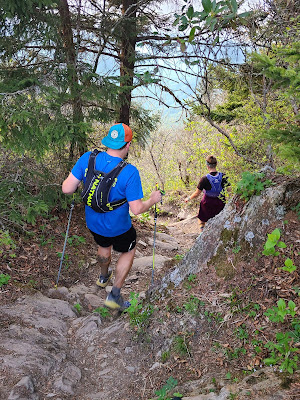
Sammi leading the charge

Our enthusiasm somewhat restored, we began our assault on the southern half of SCAR. Between Sammi the science teacher, David the nurse, and myself the research scientist, our conversation naturally drifted to extremely nerdy topics. Perfect! I can talk anyone's ear off about electrons and photons and the perils of grad school, and will gladly do so when the opportunity presents itself.

Despite the welcome distraction, I became increasingly aware of a sense of discomfort below the equator. The accumulated salt from 14 hours of sweat had resulted in a burning ring of fire, to borrow a phrase from Johnny Cash. I went to grab a lubricating wipe from my pack and realized with horror that I had used them up and hadn't restocked at our last supply point. This was going to be a long 31 miles.

With the boldness that only comes from many hours of running, I loudly informed my two companions that my butt was in the process of sanding itself apart. David confirmed that he was dealing with the same issue. Sammi, who teaches teenagers, was unperturbed by this news.

Quick sidebar: Why the hell are the Jim Walmsleys of the world sponsored by running lubricant companies? You know for a fact that his skinny little thighs have never once touched each other during a run. Want to prove that your lube works? Sponsor a thick legged runner, you cowards!

Thank you for listening to my Ted Talk.

Last little bit of daylight

We crested Siler's Bald just as the last few rays of sun disappeared from the sky. The narrow ridge was dotted with stunted trees and offered a nearly panoramic view. We were about to run through the darkness for the next nine hours. This is what ultrarunning was truly about!

As if on cue, the terrain grew rockier. Our pace slowed and the conversation became less enthusiastic. Sammi was using this run as mental preparation for her first 100 miler, and she was about to get a front row seat to a full fledged death march.

We reached Derrick Knob Shelter, where a very helpful Ridge Runner (Appalachian Trail steward) directed us down a steep side trail to a wonderfully cold flowing spring. Once David and Sammi had filtered their water, I sent them back up while I crafted a makeshift wet wipe from a paper towel and ice cold spring water, and attempted to do some damage control. My apologies to the confused woodland creatures watching this bizarre human bathing ritual. This offered a few minutes of relief, but I would be back in chafe city within a mile. Worth a try.

Filtering water at Derrick Knob Shelter
PC: Sammi Stoklosa

We trotted on through rolling terrain. Our elevation profile insisted that we were gradually descending, but it certainly didn't feel like it.

At some point in the middle of the night we heard a crashing sound just to the right of the trail. We had spooked some kind of large creature. Or at least it sounded large. Then again, a squirrel sounds large when you're running in the dark. The amount of bear scat on the trail was enough evidence that we should proceed with caution though. We yelled and sang loudly to scare off the animal, but as luck would have it, it kept running away in the direction we were traveling. A half dozen times over the course of a mile we heard the same crashing sound just out of sight. These are the times when you really appreciate running with other people.

With cooler temperatures, I was able to stay on top of my hydration and nutrition. My legs felt strong, and the altitude no longer seemed to affect me as much. However, there was nothing I could do about the horrific chafing that I was experiencing. I experimented with different running forms, even attempting a hands-on-buttcheeks approach which worked for a few steps at a time (and presumably looked really cool too). I would periodically fall back from David and Sammi while I attempted all of this and then hobble-run to try to catch up. I once again offered to sell my soul for a little bit of Vaseline.

"You still back there, Ryan?" I would hear from David.

"Yeah, just working through some things," was my honest response.

About 15 miles from the finish, we reached our last spring. We decided to fill all of our water bottles since we anticipated these miles going rather slowly. As David lifted his water bladder out of his pack, a small container tumbled to his feet. Vaseline! David had forgotten it was in there. For the second time in 24 hours, I owed someone a soul. Thankfully I bought a 12-pack of souls the last time I was at Costco.

We slathered our naughty bits with reckless abandon, while Sammi politely turned away and pretended not to be entirely grossed out. Like I said, ultrarunning is disgusting. I make no apologies for that fact.

Miles 60-71: The anticlimactic finish and aftermath

Onward, and upward. Then downward. Then upward again (it was still rolling terrain). I vaguely remember summiting something called Devil's Tater Patch and being annoyed that there was not a single goddamn potato to be found. What kind of clownshow tater patches do you cultivate, North Carolina!?

The sun came up and the 24 hour mark came and went. No matter. We just wanted to get to the finish. Time was a meaningless human construct, and our human forms were just a vibrating mass of particles cooperating for an infinitesimal moment in the grand scale of the universe. Wow, did someone slip LSD into my water bottle or was the sleep deprivation really getting to me that much?

After way too many surprise invisible-on-the-elevation-profile climbs, we reached Shuckstack (or as I had been calling it in my head, Fuck Shit Stack). We climbed up to the fire tower and then just had a few downhill miles to the finish, and -

Wait a minute - where did the trail go?

We were standing at the base of the fire tower and there didn't seem to be any way forward. I pulled up my map and realized that we weren't supposed to climb up to the tower at all. Our only missed turn of the day, and it came four miles from the end. At least we didn't go very far.

Our self pity didn't last much longer, as we ran into Cofer and Lea just below the summit. They perked us up with stories while Cofer blasted classic rock from his phone. David asked Lea to run ahead and grab some drinks for us. A few minutes later she bounded back up the trail with a ginger ale in one hand and a beer in the other. David grabbed the ginger ale, which left me to suffer through an ice cold IPA. We all have to make sacrifices sometimes.

We reached the parking lot after 27 hours and 18 minutes of nearly continuous movement through the mountains. As I left the trail, Cofer informed me that I needed to touch the trail sign. I complied by heaving both trekking poles at it and flipping the double bird to the entire mountain range. Then I regained my composure and we posed for a nice finish line picture.

Done!
PC: David Cofer

We flatly refused to run the extra mile across Fontana Dam, as some people choose to do, so our crew loaded our sweaty corpses into a car and shuttled us over to the bathrooms.

I took one of the most satisfying showers of my life, then spent a few minutes reflecting on the adventure with David. Or, I should say we attempted to reflect on the adventure, but we mostly sat slack jawed with thousand yard stares on our faces. I wondered aloud if it were possible to chafe a butthole completely off and whether I would need some kind of transplant. Ultrarunning is a silly sport.

I slept in the back of my Subaru for a few hours, then woke up at 3pm with an insatiable craving for breakfast food. As I was in the south, there was an easy solution: Waffle House! A short drive later, I was sitting in front of the most beautiful view of the entire weekend.

Three sunny side eggs, triple hashbrowns smothered and covered, side of bacon.
I ate every single bite.

Now with the benefit of four weeks of hindsight, I can say that I got everything I wanted out of this trip. I got to explore some new mountains for the first time since the pandemic shut everything down, I spent time with a good friend, I made a few new friends, and I scratched that long adventure itch that haunts all ultrarunners. Aside from a random Achilles twinge that has lingered around since then, my legs held up well and my nutrition plan (summarized as eating everything in sight) worked to perfection.

A week later, I received a small package from David. Inside was the coolest buckle I've ever gotten from a run, featuring a vintage map of the Smoky Mountains. I don't usually condone belt buckles for sub-100 mile runs, but this was so cool that I immediately made an exception. As I type this report, I am proudly wearing it.

Buckles: For 100 mile races and 71 mile runs that feel like 100 mile races

This concludes my Smoky Mountains adventure. I have now done a handful of long runs in the South, and the mountains down there never disappoint. I can't wait to go back!

Next up: Manutou's Revenge 54 miler.