Friday, March 20, 2020

Frozen Snot 2020: 2 Snot 2 Furious

You ever run a race where there's a totally bullshit rocky steep section that makes you want to quit running forever? The Frozen Snot is what happens when you create a course entirely out of these sections. And then schedule the event for the coldest weekend of the year.

In other words, it's my dream race.

2019 mid-race selfie. Too good not to share again.

There are four major climbs and descents, each with their own distinct "personality," that is to say, their own unique way of kicking my sorry ass. I'll break them down below, but first let's recap my 2019 performance to set the stage...

Ugly climbs. Cute names.

The short story is that I came down with a stomach bug 12 hours before the start of last year's race and spent 4.5 miserable hours on course dry heaving whenever I attempted to run. The long story can be found here.

Needless to say, I went into the 2020 event looking to improve significantly upon my time. This course is, after all, right in my wheelhouse (in the sense that I am absolute garbage at anything involving real running but somehow marginally competitive at rocky bullshit courses).

Okay, here goes.

Three, two, one, go!

Climb 1: Barb's Kiss My Ass

+1,022 feet in 0.47 mi (+40% grade)

A mile and a quarter of road running helps the field spread out a little bit. I spend the first quarter mile weaving through the crowd and then settle in around 50th place in the field of 300 people.

Barb's KMA starts on what appears to be an old logging road but then quickly turns into a rocky leafy section of woods. My pulse is already audibly pounding in my ears as I exhale a frozen cloud into the 5 degree morning air with each breath. Awesome.

After the longest quarter mile ever, we emerge into an open boulder field. The sun is rising and the mountains are turning a pale red in the distance. I can feel frost forming on my eyelashes. I remind myself to take a look around once in a while. This is a special place.

Step. Breathe in. Step. Breathe out. Repeat.

There are volunteers at the top of the climb cheering wildly for us. I think to myself that the only thing crazier than running this race is hanging out on the course to watch people run it. I am eternally grateful for their support.

Descent 1: Unnamed

-751 feet in 0.36 mi (-39% grade)

My thoughts during this can be best summarized as:

"Aaaaaaaaaaaaaaaaaaaaaahhhh!"

Inhale.

"Aaaaaaaaaaaaaaaaaaaaaahhhh!"

And so on.

This section is the first of many to have ropes strung up for runner safety. I find that I can do an awkward sideways run while firmly holding the rope with both hands. I still manage to lose my footing occasionally.

I leave the safety of the rope a few times to pass people. I can feel my life insurance rates go up by the minute. I trip and take a few big downhill strides to catch myself. I'm pretty sure I have briefly become the fastest moving human being on the planet during that stumble.

The end of the descent arrives and I have never been happier to start climbing.

Climb 2: Goat Path Extension

+817 feet in 0.44 mi (+35% grade)

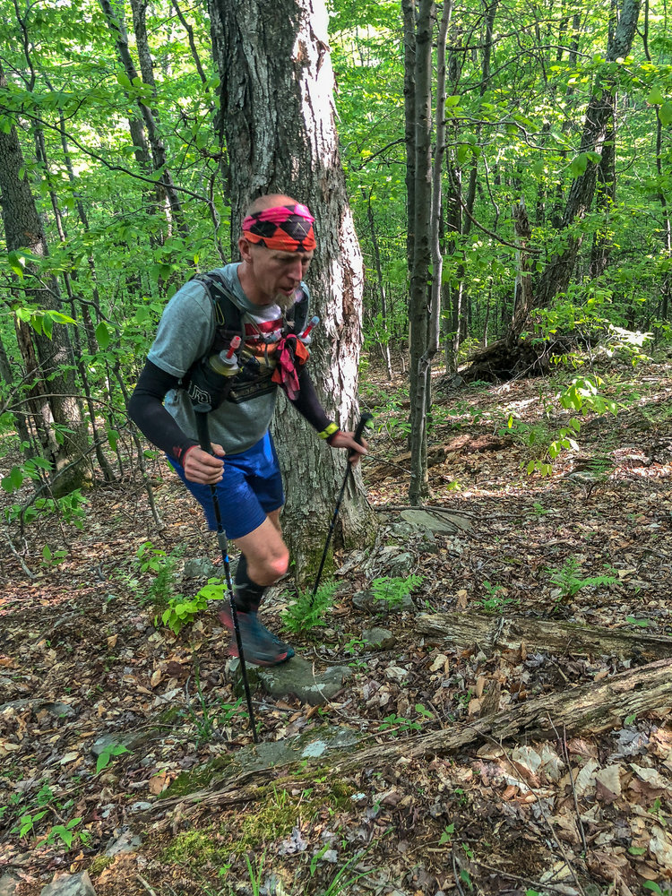
Back to hands-on-knees hiking. The weather is still below freezing but I am already overheating. I remove the Buffs that are over my ears and around my neck. I unzip my shirt. I consider taking off my gloves but know that I need them for protection on the ropes.

Over the sound of my own ragged breathing, I hear a runner speaking calmly to his GoPro. How is he still able to form words? I immediately hate him for having this superhuman ability.

From somewhere above, I hear the deep clang of an enormous cowbell every few seconds. After another minute of climbing, I see that it is hanging from a tree, and a woman is swinging an enormous stick at it like a baseball bat every time a runner passes her. Pennsylvanians truly are a different breed.

She welcomes me to the top of the second climb and I respond with something profound, like "Uhhh." Nailed it.

Descent 2: Lightning Bolt

-1,002 feet in 1.32 mi (-14% grade)

This is one of the few runnable sections in the entire race. That is, unless you are puking your everloving brains out. In 2019 I was only able to eke out a sad little trot in between depositing little puddles of last night's dinner on the course. This year I redeem myself and hammer out a seven minute mile on this fucker.

Runners descending the last part of Lightning Bolt via fixed rope in 2019

I realize that my legs feel really good. It's too early to tell, but this might be one of those magical races where things go well all day. I haven't had one of those in a long time. This thought bolsters my energy, and this energy leads to more positive thoughts. Is this the mythical runner's high that those assholes always talk about?

A bit of rolling single track brings us to the first aid station, where I am greeted by the smell of fresh bacon. I think to myself that life is good, and that if there is a god, I think he wants us to be happy.

I leave the aid station with a mouthful of bacon and a heart full of gratitude. This race is simultaneously the dumbest and coolest thing in the world.

Climb 2.5: The Avenue

+335 feet in 0.13 mi (+48% grade)

In my bacon-induced euphoria, I take a few running strides up this climb before the burning sensation in my lungs reminds me that that's way too goddamn quick. I settle into a pack of racers who are moving well, and we discuss life, the universe, and everything. The whole climb lasts six minutes, but we are all best friends by the top, although we don't know each other's names.

This climb is the shortest on the course but it packs a punch.

Descent 2.5: Debbie's Drop

-342 feet in 0.16 mi (-40% grade)

The mirror opposite of The Avenue.

More fixed ropes. More slipping and sliding. Someone is trying to tell me a "hilarious" story about being an EMT and finding a dead body. I move quickly to pass him. My heart rate spikes. It's worth it.

Climb 3: Backside of the Beast

+1,048 feet in 0.84 mi (+24% grade)

Compared to the rest of the course, this section is pretty tame, though it would easily be the steepest climb in almost any other race. Matt Lipsey probably runs this thing, I think to myself. But he is (1) very fast and (2) a crazy person, in the best sense of the phrase. I'm content to do more hiking, but I make sure to push myself pretty hard. This is, after all, the second to last climb of the race.

The climb tops out at the summit of Mount Logan. At only 2,200 feet, we're still high enough that there is a dusting of snow on the rocky ground. I glance at the microspikes in my chest pocket and decide that it's not worth the trouble to put them on. The next section will make me question this decision.

Descent 3: Mt. Logan Direct

-1,148 feet in 0.82 mi (-27% grade)

The ground is littered with loose snow, loose leaves, loose rocks. Nothing wants to stay in place when I plant my feet. Consequently, my feet don't particularly want to stay in place when I plant them. Should I put on my spikes? Nah, that would take too long.

I end up on my butt twice despite having a white-knuckle grip on a safety rope. The runner in front of me does a half somersault and lands hard on his shoulder with an audible crunch. I stop to help him but he insists he's fine in between a stream of four letter words. We're all in this together, but no one wants to be a charity case.

Why did I sign up for that high deductible insurance plan? I think to myself, because apparently these are the thoughts that go through your head mid-race when you reach your 30's.

I complete the most hair raising 17 minute mile of my life and arrive at the Zindel aid station, where I quickly refill on water and pose for a picture from a volunteer who is impressed by my ice beard. (Incidentally, ma'am, if you could send me that picture I would really appreciate it!)

Climb 4: The Beast

+1,126 feet in 0.66 mi (+32% grade)

Prepare Ye to Meet The Beast warns a sign at the base of the climb. You know when a race organizer breaks out olde English that they're not fucking around.

Pic from 2019 by Mike McNeil

The Beast gets right down to business as I immediately find myself staring up at a thousand foot long nearly-vertical boulder field. There is no defined trail, so it's up to each runner to find the most efficient path through.

I pass a young runner who is cramping badly and offer him a Gu.

"Will it help?" he asks.

I shrug. "It couldn't hurt." What the hell do I know?

I wish him well and continue on my way. We will all need to get ourselves off this mountain one way or another. Food and water are the best medicine at this point in a race.

The boulder field ends but the climb is still only half done. We enter the woods and clamber over downed logs, mossy stones, and piles of wind blown leaves. My legs are feeling increasingly like a bowl of jello, but they only need to last a little longer.

We reach a small aid station near the top of the mountain where a boisterous volunteer informs us that we're done climbing: "They don't put aid stations near the top of mountains! You're there boys!"

We still have another 100 feet of climbing along the rocky ridge line. I'm not pleased about this.

My feet are getting clumsy as my legs tire, and I begin tripping over small rocks, but it's just a little further and I'm still moving well.

Descent 4: The Sluice

-702 feet in 0.53 mi (-25% grade)

One last downhill. Let's go quads! Let 'er rip!

I hammer this descent, high stepping over snowy logs and off-camber stones. There's nothing left to save my legs for, so I just need to survive this next half mile. Easier said than done though. Millions of sharp loose rocks are hidden under a layer of leaves, waiting to grab my feet with every step.

I come up behind another runner and he hits the gas pedal to stay ahead. Now that I have someone to follow, it's much easier to decide on each foot placement. We're running the same pace, but he's doing most of the work.

I pass him briefly on a short climb and he passes me back a minute later as the trail levels out. It looks like it's going to be a sprint to the finish, and I'm game. Unfortunately, he stops at the last aid station, while I fly through knowing that there are only two more flat miles to go. The 30 seconds he spends there prove to be insurmountable as I am able to hammer out the last two miles in 15 minutes (which is pretty quick for me).

I cross the line with a beard full of ice and a big dopey grin on my face.

10th place of 300ish starters, 3:31:43 elapsed for an almost hour improvement over last year's time.

Finisher pic from 2019 when I caught my wife on the final stretch of road

Hell yes.

Global pandemics aside, I'm excited for some good running in 2020.

Strava
Official results

Thursday, February 6, 2020

2019: A Year of Sufferfests

With so many terrible decisions adventures over the past year (plus a job change), it's been tough to keep up with my regular blog posts. So here is a quick run down of some of my crazier runs and hikes from 2019.

Sunrise from the slopes of Long's Peak

Lenape 55K

Date: March 2
Distance: 35 miles
Elevation: 4,000 feet

Lemos, Kolb, and myself on the way to the race

My annual pilgrimage to northeastern NJ. The Lenape Run is a Fat Ass ultra whose entry fee is a $5 train ticket from Millburn to Newark. The course follows the yellow trail blazes through city streets, park bike paths, and eventually single track. While a flat-ish 55K on roads isn't exactly in my wheelhouse, I have come back each year because of the fantastic community around the race.

I started off running 8:00/mi pace through 4" of fresh snow, trying desperately to keep up with speed demons Jay Lemos and Jayson Kolb. Then I wised up and jogged it in for a 4th place finish. The beauty of "shorter" ultras is that there is plenty of time to eat pizza and drink beer afterwards. And that's exactly what I did.


Suffern to Bear Mountain Trail

Date: March 9
Distance: 23 miles
Elevation: 5,000 feet

Sunrise early in the run

Not having suffered enough in the snow, Jay and I linked up with Alex Galasso and Nich Mamrak the following weekend for an attempted double traverse of the Suffern to Bear Mountain Trail. Known for its rocky and hilly terrain, the S-B Trail is difficult under the best of circumstances. As luck would have it, a recent storm had dumped a foot of fresh powder on the trail shortly before our run. Nevertheless, we set out for our attempt at 3:22am on a frigid March morning.

We didn't admit it to each other at first, but it quickly became clear that we would not finish this attempt in any reasonable time frame, as the snow slowed our pace to a crawl. Despite the slow going, it was surprisingly fun to run through fresh powder in the dark. The descents felt like skiing, and each of us took a turn sliding downhill on our backsides. By the time we reached Bear Mountain State Park over 8 hours had elapsed, so we crawled into Jay's Sprinter van and called it a day.


The Catskill Nine

Date: May 11
Distance: 19 miles
Elevation: 6,000 feet

View from Slide Mountain on a perfect day

The "Nine" is a classic Catskills bushwhacking route that summits - you guessed it - nine peaks in just 19 miles. This was my first attempt at bushwhacking solo, and I wanted to see if I could navigate the route efficiently following a track on my phone.

The first five miles followed a marked trail to the summits of Peakamoose and Table. Then I immediately made a navigational error in my first step off the trail, following a northwest heading instead of northeast toward Lone Mountain. After correcting my mistake, I found the summit canister, then thrashed my way through dense pine forest to the summits of Rocky and Balsam Cap. The canister at Friday eluded me for 15 minutes, since I didn't realize that it was 100 yards away from the true summit. After walking in circles, I finally located it, then followed the ridge line to the Wittenberg-Cornell-Slide Trail to summit the last three peaks. A rocky but marked trail took me back to my car, where I was pleased with my 6:41 total time, two hours off the FKT but not bad for a first attempt at navigation in the Catskills.


WTF Solo Loop

Date: May 18
Distance: 28 miles
Elevation: 10,000 feet

A friendly Ent near the summit of Rusk Mountain

Now for some real Catskill navigation. The WTF Loop circumnavigates the Spruceton valley, following a ridge line over 12 summits, including six High Peaks. 75% of the loop is off trail through brush, dense pine forest, and slick leaf covered slopes. I had completed this loop in 2018 with Catskill expert Mike Siudy as my guide, but now it was time to leave the nest and venture out on my own.

The hike up to the ridge line was uneventful. As a general rule, it's always easier to navigate during a climb than a descent (there is only one summit of a mountain, but multiple ways off the summit). The day was sunny and warm, and I easily followed the ridge line using my shadow as a compass (pro tip, at noon your shadow points due north).

My only major error of the day was on the first descent to Spruceton Rd, where I followed the wrong drainage and ended up thrashing around a brier patch before ending up on the shoulder of Rt. 42. A mile jog later, I was back on course, having lost about 20 minutes. The crux of the route is Diamond Notch, which descends 1,000 feet and climbs another 1,000 feet all in less than a mile. I got cliffed out on the descent a few times but otherwise emerged unscathed.

I ended up back at the car in 10:47, which will be more than an hour under the cutoff if/when this loop becomes a race (look for the WTF 100 to start in 2020).

The Devil's Path

Date: May 25
Distance: 23 miles
Elevation: 9,000 feet

A bunch of really fast dudes. And me.

Another weekend in the Catskills, and another weekend chasing Lemos and Kolb. This time, the addition of ultra phenom Steve Lange added an additional pair of fast legs to the mix. The result was a lot of sweating and panting from yours truly. Luckily they were nice enough to stop at summits so we could snack, take pictures, and goof off. All in all a great day in the wilderness with some friends.


Great Range Traverse

Date: June 8
Distance: 25 miles
Elevation: 10,000 feet

View from one of the many summits

The northern cousin of the Devils Path, the Great Range Traverse links up ten of the gnarliest peaks in the Adirondacks. Alex Galasso and I drove up on a Friday night after work, then met Jim Jansen at the Rooster Comb Trail head at 5am on a bluebird day.

We made quick work of the first few peaks but settled into a relaxed pace, talking and taking lots of pictures. The trails were still slick and overgrown after a rainy spring, and I began to understand the meaning of "mud season" in New England when the trail attempted to steal my shoes. The descent off Gothics was aided by the use of cables, which thankfully prevented me from sliding straight off the mountain.

The final miles up Mt. Marcy were completely overgrown, and Jim's broad shoulders plowed a path straight through pine boughs that stretched across the trail. Finally at the highest point in NY at 5,344 feet, we decided to sit and eat lunch before dealing with any more trails. Never one to miss an opportunity to take off his shirt, Jim even got a few minutes of sunbathing in.

Then it was a muddy and overgrown ten miles and 4,000 vertical feet back to the car, where we indulged in some post run beer and a well deserved dinner at the local diner. Adventure accomplished!

Strava

Manitou's Revenge

Date: June 22
Distance: 54 miles
Elevation: 14,700 feet

My happy place

My favorite official race on the planet, Manitou's Revenge seeks out some of the most challenging terrain in the Catskills. Runners must contend with slick boulders, mud, humidity, and a massive amount of elevation change over the 54 mile course.

Much to my chagrin, I was placed in the first starting wave, which meant that I got to watch a dozen people take off ahead of me while I trotted along the first three miles of road at a 10:00/mi pace. Slow and steady, as they say. My the time I reached the first section of trail, two runners from wave 2 had passed me.

Around the first aid station, Alex G. caught up to me, having erased a five minute time delay in the span of ten miles. We would go on to run most of the race together, with him running a bit faster but stopping a bit longer at aid stations. The ascent of Kaaterskill High Peak was a solemn affair, and we didn't speak a word to each other as we slogged through slick muddy trails. Once off the mountain, Alex worked up the nerve to say what we had both been thinking:

"So Ryan, that climb up Kaaterskill--"

"Fucking sucked!" I responded.

"Yeah okay, I thought so too."

Happy to be in agreement, we made quick work of the Devil's Path before he crushed me on the descent of Plateau, passing a few other runners and finishing in a very solid 8th place with the third fastest split on the final section.

As for myself, I trotted in for 10th place with a nine minute PR, thanks in part to the mild weather. I'll be back next year!


Swan Song Loop (Dumbass Variation)

Date: July 4
Distance: 30 miles
Elevation: 16,500 feet

King's Ravine at sunrise

I have written pretty extensively on why I like this route so much. Suffice it to say, it requires rock climbing skills more so than running skills. It feels like a true alpine mountain adventure despite topping out at 6,300 feet.

Alex T. and I drove overnight to get to the White Mountains, parked at the Appalachia Trail Head, and bid farewell as I started my initial climb at 4:30am. I almost immediately made a wrong turn and followed the Valley Way instead of the Airline Trail. This mistake was quickly corrected, but it was a sign of things to come.

The trails were dry, so I made good time up Huntington Ravine to the summit of Adams. The Buttress Trail was, as usual, an overgrown rocky mess, but I made it down to the intersection with the Great Gulf Trail without any major blood loss. Then on the climb toward the Great Gulf Headwall, I inadvertently turned onto the Sphinx Trail. Instead of summitting Washington, I found myself on the northern slopes of Clay. This added another two miles and 500 feet of climbing onto an already very strenuous route, and I texted Alex to let her know that I might be delayed.

I stopped just long enough at Washington to fill up my water bottles before making the completely ill advised descent down Tuckerman Ravine, which was still covered in a thick but tenuous layer of icy snow. It took 30 hair raising minutes to slip and slide my way down the bowl, wondering with each step if the snow would give way and send me falling into the freezing meltwater below. Definitely one of the sketchier things I've done in the mountains.

At last I was back on dry ground, and I climbed up Boott Spur Link and back down to Pinkham Notch without issue. The climb up Huntington Ravine was as thrilling as ever. I don't think I'll ever get tired of scrambling up the headwall, which rises 1,322 feet in just 0.55 miles. After crossing the Auto Road, I bombed down the Wamsutta Trail, high stepping over rocks and routes for 2,000 vertical feet before turning back onto the Great Gulf Trail again.

The final climb of the day was the Madison Gulf Trail to the summit of Madison. Due to wilderness regulations, the fading blazes on this trail cannot be repainted. That's bad news for people who are unfamiliar with the trail or have poor navigational abilities. I meet both of those criteria, so it took an eternity to find my way to the summit of Madison despite using my GPS app extensively.

The sun was starting to get low in the sky, so I plummeted off the summit of Madison after just a quick picture and a celebratory energy gel. The Watson Path doesn't allow for much running, but I did my best, and after 14.5 hours of running, I found myself back in the parking lot where Alex was waiting for me. God damn, do I love that route!


Presidential Traverse

Date: July 5
Distance: 19 miles
Elevation: 9,000 feet

Alex and I celebrating the final summit

Twelve hours later, I found myself back at the Appalachia Trail head, this time carrying a backpack full of food and joined by Alex T., Alex G., Virginia, and Devang. The objective was to summit all of the Presidential peaks over the course of the day (and to destroy my legs in the process, what with Ouray 100 looming on the horizon).

We made pretty quick work of Madison, with the ladies taking the lead and the guys goofing off and periodically getting separated behind them. The scramble off the mountain is particularly rocky, and Alex G. and Virginia decided to call it a day and live to hike another day. The rest of us pushed on and made it to the summit of Adams despite my best attempts at getting us lost. Then it was on to the Gulfside Trail and over the summits of Jefferson and Clay.

On the climb up Washington, Alex starting to lose steam, so we decided to stop for a nice long lunch at the summit house to eat our body weight in pizza and hot dogs. This put a pep in our step for the descent on the Crawford Path, especially knowing that we were mostly done with climbing for the day. Devang ran ahead, leaving Alex and me to finish the rest of the hike together. The climbs up Monroe and Franklin was painless, but Eisenhower packed a punch with its endless switchbacks through a pine forest.

Finally we reach the summit of Pierce, where we snapped a celebratory picture, and started the long descent to Crawford Notch. Several long miles later, we set foot onto Rt. 302 and we had completed a single day Presidential Traverse!

This day was made complete by a porcupine sighting on the drive back to our Airbnb. With a beep of our horn, every quill on the porcupine's body stood on end and it quickly scampered off the road. In our depleted state, Alex and I both agreed that it was the funniest thing we had ever seen.


Long's Peak

Date: July 20
Distance: 14 miles
Elevation: 5,000 feet

Sunrise from Long's Peak

Alex and I flew out to Colorado in late July for a week of hiking and the Ouray 100. After just one day of acclimating in the thin air, I convinced her to climb Long's Peak. What better way to prepare myself for the race the next weekend, right?

We arrived at the trail head at 4am to find a line of cars that stretched a quarter mile down the road. Clearly we were not going to be the only people on the mountain that day. The initial miles were gradual, and we made it easier on ourselves by stopping constantly to take in the scenery as the sun started to peak over the horizon.

Five miles in, we reached the boulder field, which is a fitting if unimaginative name for the rock garden that decorates the northern slopes of the mountain. We scrambled for a while before reaching the infamous Keyhole, a narrow gap in the pass between Long's Peak and Storm peak. Now 13,000 feet up with the most difficult terrain still ahead, Alex made the wise decision to turn back. This is why women live longer than men.

The final mile to the summit followed rocky ledges along the western flank of the mountain before climbing up a chossy chute known as The Trough. With hikers above me periodically dislodging cantaloupe sized rocks, I wished I had worn a helmet or at least had longer hair to protect my skull. Five hundred feet of climbing then brought me back to solid rock for The Home Stretch, a granite slab with a series of cracks that led to the summit.

The views from the top were amazing, but I didn't want to keep Alex waiting so I snapped some pictures and turned around to retrace my steps. The descent down the Trough was even sketchier than the climb, but I made pretty quick work of it thanks to good shoes and a general lack of concern with my personal safety. Once back on groomed trails, I just had to contend with the pounding in my head (altitude sickness is not fun) as I jogged back to the car. Definitely one of my favorite adventures ever!


Mt. Mansfield and Camel's Hump

Date: August 17
Distance: 20 miles
Elevation: 8,500 feet

Sunset from Camel's Hump

A few weeks after Ouray, I drove up to Vermont for a weekend to help support Aliza Lapierre's FKT attempt on the Long Trail. Unfortunately, she would drop out before I had a chance to run much with her, so I decided to spend the weekend exploring some of the most prominent peaks in the Green Mountains.

First up was Mount Mansfield, which I ascended by way of the Hellbrook Trail, which rises over 2,000 feet to the Adam's Apple in less than a mile. From there, I picked up the Long Trail and scampered south to The Chin, The Nose, and The Forehead (in case you couldn't tell, the subpeaks of Mansfield resemble the profile of a face). At the intersection of the Wampahoofus Trail, which is one of the best trail names I've ever heard, I turned around and ran back to The Chin, descending back to my car via the Long Path.


After a quick bite to eat and a beer (and then another beer), I drove to the Camel's Hump trail head, and began a rainy ascent just before sunset. This might not seem like fun, but I'm the sort of person that enjoys doing stupid and not fun things. So it was perfect.

The rain stopped when I was just shy of the summit, and six miles of wet trails and 4,000 vertical feet after leaving my car, I was treated to one of the most dramatic sunsets I have ever witnessed. I texted Alex a few pictures, mostly just to let her know I was alive, and then scrambled off the mountain as quickly as possible so I could find a place to get dinner.


WTF Loop Overnight

Date: September 6
Distance: 29 miles
Elevation: 11,000 feet

Sunrise from Westkill Mountain

Same route as last time, but now starting at 9pm on a Friday night after a long day of work. If I'm ever going to finish the race, I need to work on my night time navigation.

This did not go well.

The first quarter of the loop was uneventful. The climb from the brewery was straightforward, as climbs usually are. Then I just needed to maintain the ridge line westward over several unmarked summits before turning south back into the valley. So far so good.

Now for the southern part of the loop: Balsam was steep but manageable, and I was able to stay on line through the col to Sherrill. But somehow at Sherill's summit canister, I got turned around and started backtracking toward Balsam again, losing a few hundred feet of elevation, but more importantly losing motivation to be out there.

After tagging Sherill for the second time in an hour, I oriented myself in the right direction, but totally botched the descent into the col leading to North Dome, heading too far south and losing a few hundred more feet of elevation than I needed to. This additionally put me on steeper and more wooded terrain than my intended path, which cost me a lot of time and energy.

The descent from North Dome was more of the same, and I somehow couldn't maintain my eastward heading, trending south down the steepest part of the mountain. I additionally started to have issues with stinging nettles in this section, which made me want to pack it up and go home just half way through the loop.

At long last, I reached the Devil's Path at the base of St. Anne's peak and I have never been happier to be on real trails. By the time I reached West Kill, the sun was rising, which was a welcome sight since the hardest descent and climb were yet to come. Diamond Notch is the crux of the route, and despite ending up slightly off line, I impressed myself by not falling off any ledges to my death. Well done, me!

From Southwest Hunter, I was back on easy trails and then to East Rusk and Rusk, which are pretty straightforward. My final issue for the day (night) was on the descent from Rusk, where I once again ran into nettles and blackberry bushes. My shins have still not recovered.

After 14 hours of thrashing around in the woods, I emerged at the West Kill Brewery and treated myself to a well earned beer.

Cat's Tail Marathon

Date: September 28
Distance: 25 miles
Elevation: 7,000 feet

Runners descending a rocky ledge at the 2017 Cat's Tail
Photo by Elizabeth Azze at Mountain Peak Fitness

Back to the Catskills! This time for some actual running on some actual trails.

The Cat's Tail course starts with a meandering ascent of Panther Mountain, makes a gentle descent, and then climbs Slide, Cornell, and Wittenberg in rapid succession on some classic Catskill terrain. The final miles are rolling single track down to the town of Phoenicia.

I again started in wave 1 and again had immediate regrets as every other runner disappeared from sight in the first tenths of a mile. My first step onto the trail resulted in a slip and fall that left my right butt cheek wet for the rest of the race. Dynamite start!

Eventually I caught up to Kelly MacDonald, who had just won Manitou's Revenge a few months earlier. Our climbing pace was similar, and it was nice to have someone to run with. We reached the summit of Panther together and started the descent. Suddenly a thunderous stomping sound reverberated through the woods behind us. A herd of buffalo? No! It was the legendary Catskill Clydesdale himself Ivan Milan, storming through the early miles of the race like a man possessed. We let him pass but continued to hear his footsteps for some time afterward. I don't know how a giant can move that quickly!

The descent was buttery smooth by Catskill standards, and I passed through the first aid station in good spirits, stopping to tell Mike Siudy how much I liked his course. Then I set to work on the Slide Cornell Wittenberg section. The climb up Slide is one of the easiest in the Catskills despite this summit being the high point in the range. However, things quickly got more difficult from there, as the col between Slide and Cornell has numerous rock ledges, ladders, and other treacherous obstacles that require 100% concentration and often the use of all four limbs. It was an absolute joy!

The climb and descent of Cornell were uneventful, but I was greeted at the top of Wittenberg by a pair of men wearing nothing but pink thongs. Or at least, that's what I saw. Maybe some other racers can confirm this so I know I wasn't hallucinating?

Anyway, the vision of naked hairy men at the last summit was all the motivation I needed to finish the race. Unfortunately, there were still ten miles of rocky single track separating me from the finish line. With a long season of racing on my legs, I decided to jog it in, and I crossed the line in 5:49 for 14th overall.


WTF Race!

Date: October 18
Distance: 29 miles
Elevation: 10,700 feet

Mendy, Mike, and me, the only people dumb enough to attempt multiple WTF loops

Having completed two WTF loops solo, it was time for the main event. Of the dozens of people Mike invited to take part in the inaugural event, only Mendy Gallo, Mike, and myself were dumb brave enough to toe the line.

Since the group was so small, we decided to stick together for a loop and then decide how to proceed after that. Unfortunately, the weather did not cooperate with us, and we were treated to rain, fog, and then freezing fog for almost the entire time we were out. We didn't make any major navigational errors, but route finding was too slow for us to finish the loop under the 12 hour cutoff.

We reached our cars just under 14 hours and called it a night. With the next edition of the race scheduled for May 2020, maybe we will see a multi-loop finisher!

Shawangunk Ridge Trail FKT Attempt

Date: November 2
Distance: 42 miles
Elevation: 6,000 feet

One of the many cliffs on the Shawangunk Ridge
Photo from Northeast Explorer

My last adventure of the year was perhaps the most ill advised. On the Friday night before the Sunday that Alex was supposed to run the NYC Marathon, I decided that I would attempt an FKT on the 71 mile Shawangunk Ridge Trail, having never seen most of the route. Why?
  • Because I wanted to squeeze one more adventure into an action packed year
  • Because 71 miles is right in my sweet spot distance-wise
  • Because the annual SRT race is unsupported but still charges $145, and I think that's ridiculous
  • Because I'm overconfident in my ability to navigate after three WTF loops
  • Because I'm a dumbass
Anyway, I think you can see where this is going. After being dropped off at High Point by my very patient and very concerned-with-my-mental-health parents-in-law, I almost immediately screwed up my navigation, making a three mile loop and ending up right back where I started. Thankfully, the beauty of an FKT is that you can start whenever you want. So I called that a warm up loop and started the trail again 45 minutes after starting it the first time.

However, navigation issues would plague the rest of this run. The SRT was cobbled together from a series of singletrack trails, fire roads, and pavement, so the route is not intuitive at all. At times, it drops off the ridge and into random valleys to avoid privately owned land, and the turns are seldom marked. Basically, the route is a nightmare in the dark if you are not intimately familiar with it.

I made the decision to pull the plug while trudging through knee deep water on the flooded D&H Canal Corridor. I knew I wouldn't be able to finish in time to get home for dinner with Alex, and there was a pretty slim chance of getting the FKT in these conditions. But I didn't want to make anyone drive up to meet me early in the morning, so I spent another 15 miles hiking through Wurtsboro Ridge State Forest as the sun came up and the mist burned off in the valley below me.

After almost 50 miles on the day, I ended up in Ellenville, where I inhaled a pizza and waited for my mom to pick me up. The next day, Alex crushed the NYC Marathon, and I was able to walk around the city and cheer her on, which made me glad that I didn't destroy my legs any further. Maybe I'll try this route again this year now that I know where all the wrong turns are.

Wednesday, October 16, 2019

Race Reports: Historical and Hysterical

I'm a sucker for a good race report, in case you couldn't tell.

The list below is a compilation of my favorite race reports from other runners. Some are from important races in ultrarunning history, some are heartbreaking DNFs, and some are just plain funny.

Let me know if there is anything else I should add to this list, and I will keep it updated (In particular, I have had a hard time finding reports from elite women. Please send these my way if you find them.)

Entries marked with a ðŸ”’ require a subscription to Ultrarunning magazine.

Western States


Leadville


Hardrock


Nolan's 14


Barkley Marathons


Other Reports


Other Collections of Race Reports

Tuesday, September 24, 2019

FKT Report: A Bunch of Dix in the Dacks

The Adirondacks are a beautiful mountain range. With a lot of silly names:
  • Dix
  • South Dix
  • East Dix
  • Nippletop

After running the Great Range Traverse with Alex Galasso in June, we exchanged a few ideas about ways to link up the funnier sounding peaks and create an FKT route that would tell the world, once and for all, that we had stopped maturing emotionally some time during middle school.

The result was the Giant-Dix Traverse.

Group photo from the summit of Giant
From left to right, Ryan Thorpe, Devang Patel, and Alex Galasso

The Giant-Dix Traverse

The final route was an aesthetic 25 mile point-to-point through the Giant Mountain Wilderness and the Dix Mountain Wilderness, summitting nine peaks, including six High Peaks: Rocky Peak Ridge, Giant, Dix, Hough, South Dix, and Macomb. We discussed whether to add East Dix (aka Grace Peak), but decided that we didn't want any out-and-back sections (We would then go on to make a massive navigational error that added an out and back. Best laid plans, and all that.).

GDT map, including our wrong turn late in the day

GDT elevation profile. Note the long, unnecessary descent between Dix and Beckhorn

The total elevation gain for the route was about 11,000 feet over a mix of single track and exposed technical ridges, putting this route roughly on par with the Great Range Traverse or the Presidential Traverse, at least on paper.

Goals for the Trip

Alex, Devang Patel, and I decided before this inaugural attempt that we were not going to red-line during this run. Devang was just coming off Eastern States 100 three weeks earlier, I had just run Ouray 100, and Alex didn't want to interrupt his Grindstone 100 training block.

Or, to put this in terms that are consistent with the route name, we were going to dick around a lot. That meant taking lots of pictures, stopping to eat, and just generally enjoying the scenery.

It also meant that we didn't do a whole lot of research on the route, aside from plotting it on Caltopo and saying, "yeah, that looks fun!" We then told our significant others that we would take "about ten hours" and asked them to meet us at the finish around then.

Giant Mountain Wilderness

We started at the East Trail parking area in the little town of New Russia. From there, it would be a 4,000 foot net climb westward to the summit of Giant Peak.

The first two miles were an easy ascent of Blueberry Cobbles, which was below tree line and offered no views. From there, the trail grew increasingly steep and rocky as we climbed Bald Peak and got our first good views of the day.

Having a snack at the summit of Bald Peak

A short scramble then brought us to Rocky Peak Ridge East Peak. If not for the howling wind and chilly morning air, this would have been a perfect spot to stop an enjoy the views.

View of Lake Champlain from the ridge

Some easy running brought us to Marie Louise Pond, whose trees were a welcome shelter from the elements. Alex and Devang sat by the water while I made use of the privy just off the trail. Then it was time to scramble up Rocky Peak Ridge proper and tag our first High Peak of the day.


And another short scramble later, we were standing on Giant Mountain with 3:30 elapsed. We waited five minutes for a cloud to pass over, took a whole bunch of pictures (see, for example, the top picture in this post), and then started the 3,000 foot descent to Route 73.

Descending off the summit of Giant Mountain

The Ridge Trail was steep, but the footing was pretty good in the dry late summer weather. In the spring, this would have been a miserable slog with mud and overgrown trees. If nothing else, we had chosen the right weekend to run this route.

We got separated shortly below the summit as Devang and Alex stopped to take some pictures and I took a detour out to "The Bump," a side trail with some nice views. But eventually, we all met up again at Route 73.

Thus concludes the scenic but relatively uneventful first half of our adventure. Now let's get to the good stuff.

Dix Mountain Wilderness

We hopped onto the Dix Trail with 4:38 elapsed and about 11.6 miles into our 25 mile day. We were feeling good about finishing in under 10 hours and I briefly considered texting our loved ones that we would be done early. Thankfully, I never sent this text.

We stopped shortly after the trail head to filter water at Round Pond, then made quick work of the climb up to the intersection of the Old Dix Trail (ha!) as well as the three miles of rolling single track beyond that.

Mile 16 marked the beginning of the hardest climb all day, a 2,000 foot scramble up a rock slide and a boulder strewn gully.

Looking up the slide on Dix Mountain

We stopped at a creek part way up to have a snack. As we were getting up to go, Alex lost his footing and ended up sitting in the knee deep water. Unfortunately, I had started up the trail too early to see this in person and Devang wasn't able to capture the moment on camera. So it will just have to live on in our imaginations.

Alex looking more than a little sullen after his creek incident

After a seemingly endless climb, we finally reached the summit of Dix Mountain, the high point of our route at 4,840 feet. From here, it would just be a few miles of ridge running and then a steep descent to the finish.

Or so we thought.

Looking west toward the Great Range from the summit of Dix

Dicking around on Dix

After the requisite amount of dicking around, we made the quick traverse over to Beckhorn, took a few more pictures...

Foot selfie

...and then promptly fucked up our navigation beyond all hope.

You see, unbeknownst to us the Dix Range Trail, which continued over the remaining summits, is a separate entity from the Dix Trail. And, in fact, it is not an official trail at all but instead an unblazed herd path. None of this is clear from the cursory view of Caltopo which comprised our research into this route.

Consequently when I continued following yellow blazes after the summit, as I had been doing for  the previous three hours, I inadvertently led us a mile and 1,700' vertical feet down the wrong trail.

Shit.

Silver linings: the Beckhorn Trail (our detour) was a beautiful and very pleasant trail to run on. But this didn't make up for the fact that we had budgeted our mental energy for another 2-3 hours, rather than the 4+ that it would now take us to complete the route. The slog back to the summit of Beckhorn was slow and very quiet. When we got back to the top, we just sat without looking at each other for 30 minutes.

This sums up our feelings

We debated calling it a day, but decided that it would be stupid to drop out this close to the end. So with heavy hearts and heavier legs, we set to work on the Dix Range Trail.

Now on unmaintained trails, our path was choked with overgrown tree limbs, and we found ourselves working for every step forward.

View of Beckhorn from Hough

Devang put his head down and charged ahead, only to run smack into a fallen tree. We made sure he was okay and resumed our run, only to stop two steps later when I smacked my head on the same stupid tree.

Spatial awareness and short term memory are not my strong suit.

View from somewhere along the ridge

The Dix Range had now exacted a toll on all of our egos and added a few scrapes and bruises for good measure.

But at least the scenery was nice

We tagged Hough, South Dix, and Macomb without further incident, stopping to commemorate each summit with some food and pictures.

Devang "celebrating" at the final summit

We then started the long steep descent down the Slide Brook Trail, which is more slide than trail. As a matter of fact, it was just about the worst terrain we were on all day, strewn with loose dusty talus which threatened to dislodge and chase us down the mountain with each step.

Slide Brook "Trail"
See video below for a better perspective.


After picking our way through the 1,000' half mile descent, we were finally back on a real trail. Devang celebrated by breaking into a run and immediately slamming into another tree so hard that I thought he knocked himself out cold.

The Dix Range Wilderness would not permit us to have the last laugh.

With renewed purpose (and ignoring my nagging questions like "do you know what day it is?") Devang sprang back to life and took off sprinting. Not wanting our concussion addled friend to wander off trail into the wilderness, Alex and I gave chase. Devang would go on to lead us to a string of 9 minute miles to end the day.

After 12 hours, 20 minutes, and 33 seconds, we collectively smacked the hood of Virginia's truck in the Elk Lake parking lot, signifying the end of our run. We had taken 2.5 hours longer than anticipated, and probably lost a few brain cells along the way.

But in the end, we achieved our goal of establishing an Only Known Time on a ridiculous and tough route.

Giant-Dix accomplished!


[Edit: I have since learned that this route was previously done by a hiker in 13:50 on 8/28/2014 with the addition of Grace Peak (East Dix). This should be considered the original FKT, with ours being a slightly faster but slightly shorter variant.]

Thanks!

...to Alex (Thorpe) and Virginia for waiting patiently for us at the finish, not knowing whether we were lost, dead, or had just decided to tack on another summit. These ladies even had a cooler full of beer waiting for us when we finished, which was vital to helping us forget the abuse we had just survived.

Thoughts on This Route

After some navigational issues and a lot of down time at summits, our final time was not at all competitive. A fast and motivated runner could easily cut this time in half. Best of luck to anyone who attempts it. We look forward to passing on the crown to the new Giant-Dix King or Queen.