Thursday, August 2, 2018

Manitou's Revenge: A year older and a bit dumber

"The trail is viewed by many as an exaggeration of the term. It is extremely rocky and a runner must expect to navigate over boulders, downed trees, gullies and hidden roots the entire distance. Contestants must be prepared to deal with any of the forest's natural barriers, such as bees, slippery rocks, porcupines, black bears (not probable, but possible) and anything else that can be found in the forests of the Catskills. There are numerous places where runners must climb hand over fist to scale a rise, conversely, extremely steep downhill sections add not only challenge to the course, but also a high degree of unwelcome danger. There are sections of the course that travel along cliffs. If you're not careful, you could fall to your death. Very few runners go the distance without taking at least one painful spill. Most runners take many. Believe me, you're going to take a flop or two, or more." — Dick Vincent, RD of the Escarpment Trail Run
This is the official course description of the Escarpment Trail Run, an 18 mile race considered one of the toughest endurance events in the Northeast.

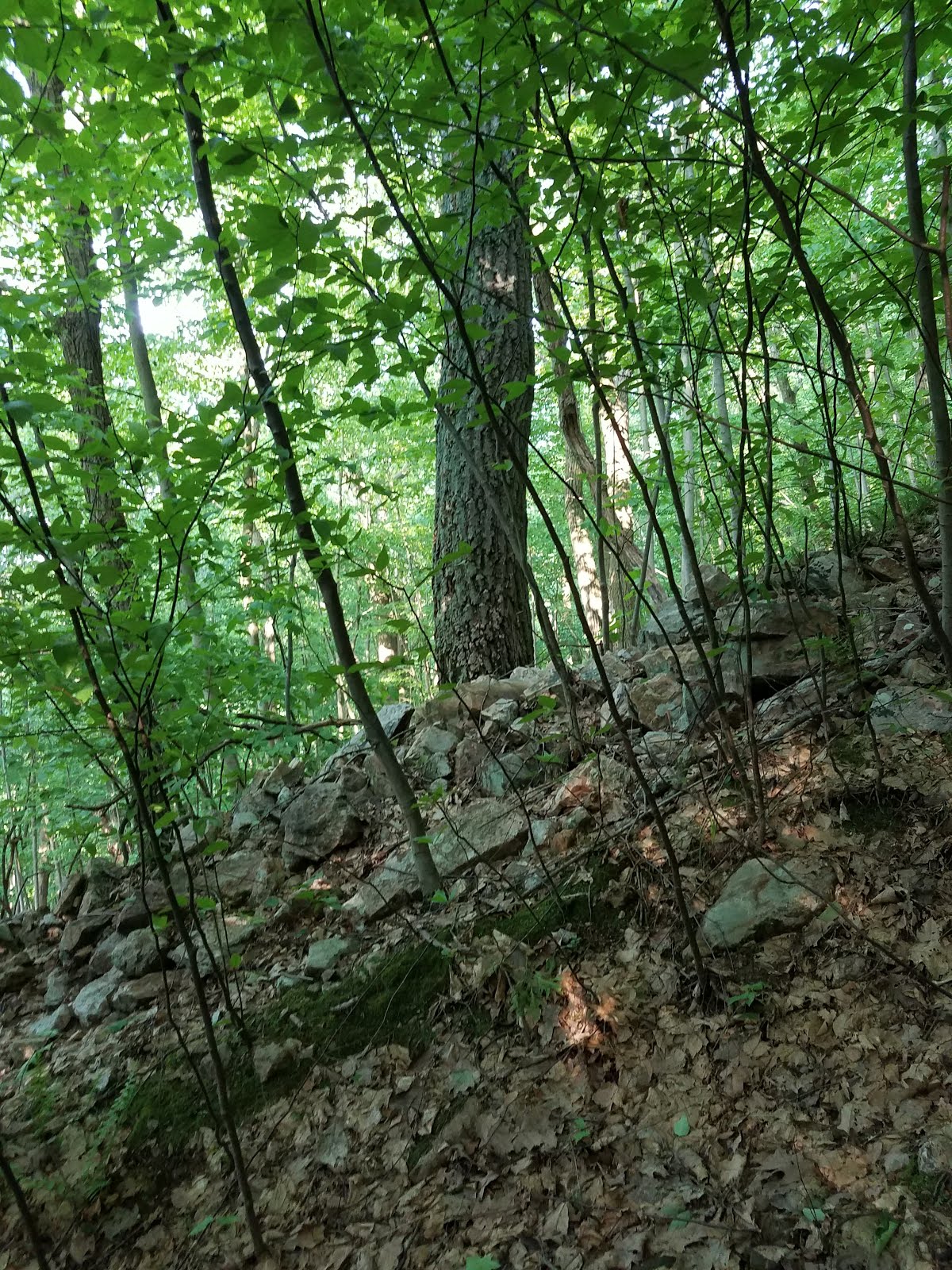
The Escarpment Trail forms the first third of Manitou's Revenge 54 miler. It is widely regarded as the fastest and easiest section of the race. The hardest sections look like this.

Climbing Indian Head Mountain during the 2017 race
Photo by Joe Azze of Mountain Peak Fitness

I often talk about trails as being "runnable" or "not runnable." But there are huge sections of Manitou's Revenge that are not even remotely "walkable." There is a seven mile section of the race that takes the leaders over two hours to cover (17:20/mi pace). Perhaps a better term for these trails would be "climbable" or "hurl-your-body-downhill-and-pray-to-whatever-god-you-believe-in... -able."

Manitou's Revenge is 54 miles of pure WTF.

Manitou's Revenge also happens to be the coolest race on the planet.

Race Day

At 3:00am, my alarm mercifully freed me from one of the most restless nights of sleep in recent memory. Apparently taking a few months off from "A Race" ultras had rekindled my pre-race nerves. Which is a good thing I suppose. No sense in running races if they don't get you excited.

After a quick bagel and coffee, Alex and I set out on the 30 minute drive from the finish line in Phoenicia to the start at C. D. Lane Park in Maplecrest. The weather was cool and the forecasts called for thunderstorms during the day. I had been hoping for sunny weather, but I also seem to perform well in apocalyptic conditions so I wasn't too concerned.

At packet pickup, I learned that I was seeded in Wave 2, which was a nice little ego boost after starting in Wave 5 in 2017. The downside was that I wouldn't be able to pass many people this year.

At 5:10am, we were off. What lay ahead of us was 54.3 miles and 15,000 feet of climbing. But as I mentioned earlier, the numbers don't tell the whole story of how difficult this race is.

Manitou's Revenge Course Map

Manitou's Revenge Elevation Profile

Start to Dutcher's Notch (Miles 0.0 - 10.3)

The first three miles followed a paved road, which allowed the runners to separate a little bit before entering the trail. I started out conservatively and was the 14th of 15 runners in my wave to enter the woods. Right on track!

The trail quickly began to get steeper and I settled into my familiar power hiking rhythm, which I had honed with hundreds of hill repeats over the previous months. Within a few miles, I had passed a handful of people from my wave while maintaining a nice easy effort.

The climb to Acra Point on the first section of the Escarpment Trail was pleasant and easy in the cool early morning weather. A mile of rocky but relatively fast single track then brought us to the base of Blackhead, the first major climb of the day. Rising 1,071 feet in just 0.81 miles, Blackhead offered an early glimpse of the terrain that we would will face on the Devil's Path later in the race.

RD Charlie Gadol climbing Blackhead in 2017

At the base of the climb, I mentioned to the other runners that this was one of my favorite sections of the race. They smiled and nodded politely in response, while silently considering whether I should have my head examined at the next aid station.

We crested the 3940' summit - which despite being the fifth highest peak in the Catskills does not have any views - and began the steep rocky descent to Dutcher's Notch. The rocks were dry and the soles of my shoes stuck nicely as I hopped from boulder to boulder. The dry conditions and unseasonably cool weather made this an ideal day to run fast in these mountains.

I cruised into the first aid station with 2:10 elapsed, feeling strong and eager to get back onto the trail. After a quick bottle swap with Alex I was on my way.

2:10 elapsed, 27th place, 6 min ahead of 2017 pace


Dutcher's Notch to Palenville (Miles 10.3 - 21.5)

Back on the trail, I met up with Joel Noal, who had just run Massanutten 100 the month prior. He explained that his legs had not fully recovered yet, and that he had intermittent issues with vertigo, which affected his balance. I wouldn't recommend Manitou's Revenge to anyone with balance issues, but ultra runners are not known for their excellent decision making.

From the aid station, three short climbs brought us to Stoppel Point at 3,422', the site of John T. Grace's fatal 1983 plane crash. I always feel like I'm walking past a grave stone when I pass the wreckage, so I paused our conversation until the plane was out of sight.

The wreckage of John T. Grace's Piper PA-28 on Stoppel Point
Shortly below the summit was North Mountain Ledge, which offered a sweeping view of North-South Lake and Kaaterskill High Peak, which were our next destinations. It took a little bit of route finding to sniff out the trail blazes that were painted on the bare rock ledge, but eventually we were on our way down off the mountain.

I was running just behind Joel and making idle conversation when, without warning, a rock reached up and grabbed his toe. He took a full Superman dive on the rocky trail, landing awkwardly on one shoulder. I helped him up and tried to assess his condition. He seemed coherent and was not bleeding badly. We were still 2.5 tough miles from the next aid station, so help would not come quickly. Our best bet was to keep moving. I spotted him as he descended the next pitch and noted that he was still moving well, though more cautiously than before. After confirming that he was not concussed and could still run, I went on ahead to notify the aid station that he was coming.

Despite the slow down, I still pulled into North-South Lake well ahead of my 2017 pace (perhaps too far ahead, Alex reminded me).

3:34 elapsed, 21st place, 19 min ahead of 2017 pace

View of the Hudson Valley from the Escarpment Trail on a clear day

After a whirlwind of questions from the volunteers about who the injured runner was (for the life of me, I couldn't remember his name) I was back on the trail for the long descent to Platte Clove. I would later find out that Joel rallied and finished in just over 15 hours. He's a seriously tough dude!

An abrupt left turn shortly after the aid station marked the end of the Escarpment Trail and the "easy" part of the course. From here, things would only get much, much harder.

The 1,700' descent to Platte Clove on the Long Path/Harding Road was covered in loose babyhead rocks, which made the footing treacherous. I maintained a 9:00/mi pace, which was probably too aggressive, but it felt nice to open up my stride for a few minutes.

An eternity of descending later, I found myself in the gravel parking lot that was Palenville aid station, the lowest point on the course at 700' above sea level. Alex reminded me that I was a full minute per mile ahead of my pace from last year, but the pace was feeling effortless so I brushed off her concerns.

4:17 elapsed, 15th place, 22 min ahead of 2017 pace

Palenville to Platte Clove (Miles 21.5 - 31.5)

The course profile calls Kaaterskill High Peak "the worst climb all day," which seems like hyperbole until you actually attempt it. The first 1,780' of climbing are on a relentlessly steep rutted out fire road over just two miles. Last year, I was able to share these miles with the always cheery Mendy Gallo, but this year I was on my own, chasing a group of three runners who were just far enough away that I could hear that they were talking but couldn't participate in their conversation.

View of Kaaterskill High Peak from Sugarloaf Mountain
Photo by Daniel Case

I slowly reeled them in over the course of the climb, feeling very satisfied with myself for catching people on an uphill (typically my weak point in any race). Just as I was patting myself on the back, a blur of legs and spandex whizzed past me like I was standing still.

"Are you a relay runner?" I shouted ahead.

"Wave 6, comin' at ya!" was the response.

Well holy crap! This guy had made up 20 minutes on me in the span of just 23 miles. Clearly this was someone who did not belong in wave 6. This would turn out to be Tristan Baxendale, a speedy NY runner who would go on to finish 7th overall in a phenomenal 12:22.

Anyway, back to the grind. After a short muddy flat section, I found myself at the base of a 900' climb on a rocky trail. This was the final pitch of Kaaterskill. I set to work plodding uphill, now totally isolated from the rest of the field. I reached the summit almost two hours after leaving Palenville and then had a "short" 1,000 foot descent to Platte Clove. Two mile later, I was back at an aid station.

6:35 elapsed, 12th place, 27 min ahead of 2017 pace

Platte Clove to Mink Hollow (Miles 31.5 - 37.5)

Here's a fun fact to give you some insight into how tough the miles are at Manitou's Revenge: Runners are required to carry a headlamp after Platte Clove, even though the first runners pass through at 10:30am and it is only six miles to the next aid station. The field is so spread out by this point that the last runners pass through around 3:00pm, and the trail is so difficult that they don't make it to the next aid station until 8:00pm. Craziness!

Alex climbing up Twin Mountain on the Devil's Path last year

With my headlamp packed and an extra water bottle shoved into my pack, I was off to start the Devil's Path. Known widely as one of the hardest day hikes in the country, the Devil's Path is a 24 mile trail that climbs and descends six Catskill High Peaks in the most direct way possible. The eastern half of the path is considered the hardest part. This is the section that Manitou's Revenge follows for 8 miles.

As luck would have it, the skies opened up just as I left Platte Clove. The rain had a nice cooling effect, but it also meant that I would be running on wet slippery rocks for the entire length of the Devil's Path. And as Mike Siudy would say, "Nothing like running on wet sedimentary stone!"

Just before the first steep climb, I ran into Amy Hanlon, who was sitting under an EZ-Up, making sure runners didn't miss a crucial turn. This is our conversation, word for word:

Amy: It just started raining.

Me: I noticed.

Amy: I'm going to take a picture of you. Try to look cool.

Me: [thumbs up]

Amy: Nope. That's not it.

Portrait of the author not looking cool
Photo by Amy Hanlon

So off I went, not looking cool, but giggling like an idiot. A good way to start a brutal section of trail.

The first climb up Indian Head Mountain includes my favorite section of the entire race, a ten foot scramble up a vertical wall of boulders and roots, pictured at the top of this post. The descent/ascent to Twin Mountain was short and steep, dropping 500' and gaining it all back again in the span of less than a mile. An all-too-short runnable section at the summit of Twin then gave way to a treacherous 800' descent over 0.6 miles.

The descent from Twin was hair raising for a couple of reasons. First, the rocks were getting progressively wetter, which made them more and more slick with each passing moment. I had to choose each step carefully to avoid having my feet slide out from under me. Second, a crucial root was missing on a steep rock slab. This root had served as a vital handhold for many years before finally succumbing to the elements. Its absence meant having to carefully slide my toes into an inch deep pocket in the flat rock face, hoping that my soles would stick to the wet stone, and then carefully downclimbing to the ground.

Descending Sugarloaf in the rain
Photo by Steve Aaron

By the time I reached the bottom of this descent, I couldn't wait to go uphill again! The trail would answer my wishes with a 1,000' scramble up Sugarloaf Mountain in a mile. Of course, this was followed immediately by a 1,150' descent in just 0.8 miles. Are you getting the pattern here?

This final long descent would be the last of this seven mile section, which had taken me 2 hours and 37 minutes to cover, a blazing fast pace of 22:26/mi! Amazingly, this was seven minutes faster than it took me to cover this section the year before, and I was still almost a minute per mile faster than in 2017.

9:12 elapsed, 11th place, 34 min ahead of 2017 pace

Mink Hollow to Silver Hollow (Miles 37.5 - 43.5)

I was close to the end of the Devil's Path, but the Devil would have one last laugh before he was through with me. The final climb was a whopping 1,250' in just 0.9 miles to the summit of Plateau. My pace dropped to 36:03/mi as I staggered my way up the mountain. You would think that a pace this slow meant that I stopped a lot, but this was a continuous hard effort the entire way up. Gotta love the Catskills.

Experienced Catskill hikers will tell you that the Catskills are not a true mountain range, but are actually the remnants of a giant plateau which was dissected by glaciers and the elements over millions of years. Nowhere is this more evident than the flat summit of Plateau Mountain. After a steep climb, the Devil's Path runs almost perfectly flat for two miles along the top of the mountain.

The flat summit of Plateau Mountain

Of course, it would be too nice to allow the runners to follow this flat section of trail for very long, so naturally the Manitou's Revenge course makes a hard left and plummets off the side of the mountain on the Long Path after less than a half mile. The descent is not as steep or rocky as the Devil's Path, but it is overgrown and not well worn, making the footing equally tricky.

Coming in to Silver Hollow. #quaddamn
Photo by Alex

A rolling 1,500' descent brought me to the final crew-accessible aid station, where Alex wished me luck and the aid station volunteers gave me a much needed Dixie cup of beer to boost my spirits.

10:35 elapsed, 11th place, 35 min ahead of 2017 pace

Silver Hollow to Finish (Miles 43.5 - 54.3)

I set off on the 500' climb up Edgewood Mountain, and immediately I could feel that I was working harder than earlier in the race. But the race was almost over, so I ignored my ragged breathing and pushed hard, knowing I only had a few climbs left. The trail was still rocky and overgrown, and my legs were getting clumsy from fatigue. I stumbled over loose rocks repeatedly, each one sending a jolt of pain through my already battered feet.

The 1,500' descent from Edgewood was barely faster than the climb, but I kept my feet moving and plodded onward. I reached Warner Creek, the largest water crossing of the day, and attempted to tip-toe over the slick rocks to reach the opposite bank 50 feet away. My feet slipped and slid with each step, and I finally gave in and stepped fully into the calf deep water, taking some time to splash off my face and wipe the grime off my legs.

Once back on dry land, I found myself staring up at the last climb of the day, a meandering 1,200' ascent of Tremper Mountain. With less than 10 miles left in the race, I pushed hard, feeling my heart beating out of my chest.

I was stopped in my tracks after the first switchback when a pair of black bear cubs went scampering across the trail less than 100 feet in front of me. I scanned the forest looking for mama bear, imagining myself getting mauled to death only a few miles from the finish. Although compared to the agony my legs were in, death didn't seem so bad. After a minute of standing in place waiting for my death, I realized that mama bear wasn't coming for me, so I plodded onward. I didn't know it at the time, but Jim Walmsley had a similar experience in his record-setting Western States run on the same day. We're basically the same person, Jim and I.

Pictured: my imagination

A few slow mile later, I reached the Willow aid station, nearly at the top of the final climb.

12:19 elapsed, 11th place, 35 min ahead of 2017 pace

I quickly refilled a water bottle and grabbed a couple of pickles for the road. In 2017, I had reached  Willow just under 13 hours and raced to the finish in just under 14 hours. This year, I would certainly finish under 14 hours again, but I had no time goals other than to finish. The runner ahead of me was Mike Siudy, who despite his 140 mile FKT the month prior was not likely to blow his 15 minute lead in just six miles. So I decided to jog it in and enjoy the last few miles.

Amazingly, I would lose a full 14 minutes on my 2017 splits in just these last six miles, making Alex think that I was lost in the woods or mauled by a bear (little did she know!). I trotted across the finish line in 13:33:33, which is kind of a nice looking number. So there's a minor victory.

13:33:33 elapsed, 11th place, 21 min ahead of 2017 pace

Last few steps! (My wave started with 5 min elapsed)
Photo by Alex

Thoughts and Future Races

My first words to Alex at the finish line were, "You know, maybe I did go out a little fast."

I went into this race feeling more fit for mountain running than ever before. A four week training block with over 64,000' of climbing, much of which was in the rugged Catskills, gave my legs the strength and resilience to cover the early miles of Manitou's much faster than in 2017. I'm not sure whether my late race struggles were due to nutrition or pacing, but I'm still tweaking both of those.

My main takeaways from this race are
  1. Hill training really, really works for me.
  2. The Catskills are an amazing place where I need to spend more of my time.
Next up for me is the Fat Dog 120, which is now technically the Fat Dog 103 due to a course change caused by wildfires near the start of the race.

But first, look out for an adventure report from the Swan Song Loop, a 28 mile self-supported run that I did in the White Mountains a month after Manitou's Revenge.

Happy running!

Wednesday, June 20, 2018

Best Climbs and Rock Scrambles near NJ

Living in the so-called flat lands of the East Coast, it can be difficult to prepare for rugged mountain races. But if you look hard enough, you'll find plenty of steep and technical climbs within driving distance of the NY, NJ, PA area. Here are a few of my favorites, in no particular order, all within a 3 hour radius of northern/central NJ.


Rock Scrambles

These are not necessarily the steepest trails, but they'll show you the meaning of the word "technical."

Giant Stairs


Location
: Palisades, NJ
Description: Boulder field at the base of the Palisades Cliffs on the Hudson River. Starts on a paved section of the Long Path, then descends down the Shore Trail. Once at the bottom of the cliffs, scramble over car sized boulders on a relatively flat trail. Then climbs a steep but well maintained trail to the parking lot.
Biggest climb: 504 ft. over 0.38 mi (25%)

Lehigh Gap


Location: Lehigh, PA
Description: Rocky section of the Appalachian Trail from the Lehigh River to the Kitatinny Ridge. Portions of the trail require the use of all four limbs. For extra fun, stick to the ridge line above the AT where the views are better, then follow a social trail to get back to the AT when the ridge levels off.
Biggest climb: 927 ft. over 0.97 mi (18%)

Bonticou Crag


Location: Mohonk Preserve, NY
Description: Short and sweet! Follow the well maintained Crag Trail to Bonticou Rd. The crag is a white cliff face which rises abruptly from the road. Scramble over a massive pile of giant rocks to reach the summit where you have spectacular views of the Catskills to the west. For more fun, follow the trail north to Table Rocks, to find giant crevices in the bedrock.
Biggest climb: 157 ft. over 0.09 mi (33%)

Lemon Squeeze


Location: Mohonk Preserve, NY
Description: Not for those with claustrophobia! From the Labyrinth Trail near Mohonk Lake, follow blazes through a boulder field climbing under several house sized boulders as you ascend the face of the rock. The trail is so narrow that you might be required to take off your pack and hold it in front of you.
Biggest climb: 219 ft. over 0.26 mi (16%)

Pyngyp Mountain


Location: Bear Mountain State Park, NY
Description: A short steep scramble up a series of rock faces from Palisades Interstate Parkway to the summit of Pyngyp Mountain. Unfortunately, there is no parking on the parkway, so you'll need to hike about 3 miles to get there.
Biggest climb: 623 ft. over 0.66 mi (18%)

Onoko Falls


Location: Jim Thorpe, PA
Description: A 1.3 mile loop following a waterfall up a steep rocky trail. In the winter, the waterfall can freeze and the trail will be covered in ice, so traction devices are a must. This trail is crowded in all seasons.
Biggest climb: 676 ft. over 0.62 mi (21%)

Breakneck Ridge


Location: Cold Spring, NY
Description: A series of rock slabs which climb from the Hudson River to the summit of Breakneck Ridge. The trail is always crowded on nice days, so expect to get stuck behind other hikers. Also note that the trail is scheduled to close for maintenance some time in 2019.
Biggest climb: 1,172 ft. over 1.05 mi (21%)
Trailhead parkinghttps://goo.gl/maps/Bu9tZEEo6Ek

Anthony's Nose


Location: Garrison, NY
Description: Basically a smaller, steeper version of Breakneck Ridge. The trail makes a staggeringly steep climb up a rock face overlooking the Hudson River before joining the Appalachian Trail. This is just across the river from Bear Mountain, so it's easy to link up with other climbs.
Biggest climb: 703 ft. over 0.30 mi (44%)
Trailhead parkinghttps://goo.gl/maps/Bu9tZEEo6Ek

The Beast


Location: Lock Haven, PA
Description: This is just over 3 hours from most parts of NJ, but it's worth the trip. The Beast is one of the largest and steepest boulder fields in the region, climbing well over 1,000 feet to the summit of Mt. Logan. Navigation is a little tricky, so it's best to follow a GPS track if possible.
Biggest climb: 1,126 ft. over 0.66 mi (32%)


Big and Steep Climbs

For those days when you want to get a ton of vertical change without moving horizontally too much.

Mount Tammany Red Dot Trail


Location: Columbia, NJ
Description: The Mecca for NJ area trail and ultra runners. The Red Dot trail is a steep, technical ascent of Mount Tammany from the Delaware River. Runners often opt to descend the Blue Trail which is slightly more runnable. On hot days, a quick dip in Dunnfield Creek is a nice way to cool off after a tough run.
Biggest climb: 1,039 ft. over 1.00 mi (20%)
Trailhead parkinghttps://goo.gl/maps/j7Vboofsgkp

Mount Tammany West Headwall


Location: Columbia, NJ
Description: A breathtakingly steep and faintly blazed social trail used by rock climbers to access the cliffs on the south face of Tammany. From the Dunnfield Creek parking area, follow a drainage ditch along Rt. 80. Look for faded green blazes on the trees leading up the steep embankment on your right. If you reach the boulder field on the south side of the mountain, you went too far.
Biggest climb: 1,115 ft. over 0.49 mi (43%)
Trailhead parkinghttps://goo.gl/maps/j7Vboofsgkp

Hunter Mountain via Becker Hollow Trail


Location: Elka Park, NY
Description: Really, I could have picked any climb in the Catskills, but this is one of the biggest. From the Becker Hollow parking lot, this trail climbs the east face of Hunter Mountain, eschewing switchbacks in favor of a more direct route. The trail is constantly wet and very rocky, making footing difficult. On the bright side, the view from the fire tower is amazing on sunny days. For extra fun, link up with the Devil's Path after summitting.
Biggest climb: 2,119 ft. over 2.03 mi (20%)
Trailhead parkinghttps://goo.gl/maps/2h2dgsRxENw

The Leg Destroyer


Location: Hamburg, PA
Description: They called it that for a reason! This is a gas pipeline cut that branches off from the Appalachian Trail at the Schuylkill Gap. The steepest section rises 339 ft. over 0.16 mi. (40%) and is covered in loose rock, which can make it difficult to stop if you descent this trail with a full head of steam. For more vertical, check out the AT on either side of the Schuylkill River. This area has a crazy amount of elevation gain per mile.
Biggest climb: 847 ft. over 0.61 mi (26%)
Trailhead parkinghttps://goo.gl/maps/yemEvZ5HYfr

Mount Beacon Trail


Location: Beacon, NY
Description: A rocky but runnable trail that climbs from the town of Beacon to the fire tower at the top of Mt. Beacon. To maximize elevation gain per mile during hill repeats, turn around at the overlook, where you'll have a 180 degree view of the Hudson Valley.
Biggest climb: 1,011 ft. over 0.98 mi (20%)
Trailhead parkinghttps://goo.gl/maps/PyYpMch87xm

Bear Mountain via Major Welch


Location: Tomkins Cove, NY
Description: Ascend Bear Mountain from the Hudson River by way of single track trail and steep rock slabs, then descend via the AT. Good views from the top, but these trails and the surrounding area are very crowded on nice days, making it difficult to descend quickly.
Biggest climb: 940 ft. over 0.90 mi (20%)

Camelback Mountain via Cliffhanger


Location: Tannersville, PA
Description: Climb Camelback Mountain on a double black diamond ski slope, then descend via the blue square Nile Mile, which is a gravel road in the summer months. Beautiful views from the top, but the slope is not maintained during the summer, so prepare to bushwhack a little, and check for ticks afterwards.
Biggest climb: 748 ft. over 0.55 mi (26%)

The Frozen Snot Course


Location: Lock Haven, PA
Description: Home of The Beast, this course was designed to pack the most elevation gain into the shortest distance possible. In the 11.4 miles of trail on this 14 mile course, runners climb and descend 5,650 feet, with multiple climbs and descents of 1,000+ feet. The steepest of these is Barb's Kiss My Ass, which rises 1,022 ft. over 0.47 mi (42%)!
Biggest climb: 1,126 ft. over 0.66 mi (32%)

Spring Road Races (are finally over!)

Spring is road racing season for me since the trails tend to be a muddy snowy mess, plus I think some fast flat running is a good way to gauge my fitness each year (#anysurfaceanydistance or whatever). The downside to this tradition is that - as I have come to learn - I don't really enjoy running on roads. No sir, I'm definitely a trail runner through and through. So here are some quick updates on how my road races went, and then we'll get back to the good stuff in a few weeks.

Lenape 50K: New Year, Same Navigation Issues

So here's the good news: I spent less than 10 seconds off course at the Lenape 50K this year, shattering my record low of 14 minutes set last year. The bad news is that my missed turn was literally the very first turn on the entire course, less than a tenth of a mile into the race. Early enough that the entire field of runners watched me make this mistake and then yelled at me to get back on course...

Thankfully this wasn't a sign of things to come

The point is that despite running this race four times now, I still apparently have no idea where I'm going. I've been informed that my previous race reports are terrifying for first time runners because they think the course is impossible to navigate, and they imagine themselves getting horribly lost and dying of exposure in downtown Newark. Well rest easy, fellow runners, because it turns out that I'm just a fucking idiot.

Anyway, here goes my account of 2018...

Lenape Course

The Lenape 50K is a point-to-point fatass, which follows a faint series of trail blazes through roads, greenways, and forests across northeastern NJ. The course gets progressively more difficult as the race progresses, with much of the final 10 miles on rocky single track.

Course map. The race runs from east to west.
Elevation profile

The Race

Having just run Mt. Mitchell the week before, I again promised myself that this would be a long run effort, rather than a full race effort. No last minute dashes for the finish, no seeing stars on the final uphill, none of that funny business. Just a nice moderate effort for 5-6 hours to work on my endurance before the NJ Marathon.

Runners in Newark train station before the start
Photo courtesy of Anthony Longano

After my initial navigation error (yes, I know I'm dumb), I was immediately passed by the dynamic duo of Jay Lemos and Jayson Kolb, who would run together and easily go on to tie for the win in 5:17. The first 13 miles were all on pavement or sidewalks, and I chugged along at a steady 8:30/mi effort, chatting with Chris McGovern and Joe Limone. The weather was a brisk 40 degrees and windy, but these early miles passed quickly as we discussed our racing plans for the summer. The days leading up to the race had seen snow and rain, and the patches of snow lining the road hinted at the wet trail conditions that we would face later in the day.

Early paved miles in Branch Brook Park
Photo courtesy of Anthony Longano

At mile 14, we made a steep snowy 200 foot climb up to Mills Reservation and I pushed ahead on the sloppy trail, now running alone. The next few miles were slow and wet, but otherwise uneventful. As the course went through Cedar Grove and Montclair, the course was a mix of bike paths, snowy trails, and roads, so it was tough to stay in a rhythm.

Another 200 foot climb at mile 22 brought us to Eagle Rock Reservation, where I made one of my many wrong turns last year. As I passed the trail that I mistakenly took that year, I flipped it off for good measure. That'll teach that trail to uh... let me run on it, I guess.

The trail spit us out onto Rt. 611 in West Orange, where a few tricky turns had us crossing under I-280 and then climbing a power line cut which gained 200 feet in a quarter mile of slushy, slippery, overgrown trail. This is the kind of masochism that keeps running interesting, and I made quick work of this section with a big dopey grin on my face.

A runner coming up the power line
Photo courtesy of Anthony Longano

From here, it was a short jaunt through a neighborhood (big thanks to a local woman who paused from shoveling her driveway to point me in the right direction), and then we were back on trails for the remainder of the race. Miles 27 and 28 passed through marshy areas, and I carefully crossed the icy wooden boards that were placed in particularly wet parts of the trail. A few near-falls into frigid water convinced me to slow my pace until the trail got better.

Entering South Mountain Reservation around mile 29 was a relief because I knew I was on the home stretch, but the last few miles would be the most difficult of the race. A series of hills on washed out rocky trails meant that these miles were my slowest of the day. Keeping my promise to myself, I trotted along at the same effort level that I had maintained for the previous 5 hours.

After a final rocky descent, I reached the parking lot and smacked the back of Jay's van, which acted as the finish line. My final time was 5:36:11, about five minutes slower than my previous best, but in worse conditions and a lower effort level. Not bad. As a bonus, my time was good enough for 3rd place, which meant that I got one of the coveted wooden trophies that Jay made.

Jay, Jayson, and myself showing off our hardware.
Note that they had enough time to change their clothes before I got there!
Picture courtesy of Jay Lemos

The part where I find out how much Jay likes my race reports

It's well known in the local running community that I write very lengthy - some would say tedious - reports for just about every event I participate in. Jay has noticed this over the years and tends to give me a hard time about it. But secretly, I know that he loves spending hours poring over my epic tales of heroism (and whatever the opposite of heroism is).

When I requested the above picture, Jay asked, "Is this conversation going to end up in your race report?"

A sparkle in his eye (or maybe it was the sun shining through his hair) told me that he was really asking "Can you make me the star of your report?"

Of course not, I replied with a wink, as I mentally filed away the conversation for later use.

"Good," he responded, "because that would be pointless."

Indeed, Jay.


New Jersey Marathon: New Year, Same Speed

I went into this year's NJ Marathon feeling like I did (almost) everything right. I didn't race too much in the spring and gave myself a full 8 weeks to recover from Lenape, train, and then taper. By comparison, last year I ran the brutally tough Breakneck Marathon two weeks before NJ and then Bear Mountain 50 miler two weeks after it. I also managed to avoid aggravating my right calf/Achilles tendon this year, which I have done both of the past two springs. So, pretty successful all around.

The Race

The weather on April 29 was absolutely perfect. Scattered showers in the early morning darkness gave way to a fifty degree day with partly cloudy skies and a slight breeze. Not exactly beach weather, but if you're a stocky runner who tends to overheat in the sun, this is an ideal scenario.

Getting dropped off and looking like a homeless person
Photo by my mom

I tucked in behind the 3:10 pace group, hoping to take a few minutes off my previous best of 3:15, which I set at last year's race. A 3:10 finish would mean 7:10-7:15 per mile, depending on how well I ran the tangents of the course.

Miles 1-6: 7:10, 7:04, 7:11, 7:07, 7:08, 7:12

I did my best to stay patient in the initial chaos of the start. I often find myself scrambling to pass slower runners in the first few miles in order to stay with the pace group, but this kind of early adrenaline rush can have disastrous consequences later in the race.

Around mile 6, I found myself getting a little ahead of the pacers. In retrospect, I should have backed off the pace and let them take the full force of the wind, but I was feeling good so I forged ahead.

Miles 7-13: 7:13, 7:10, 7:07, 7:06, 7:05, 7:06, 7:12

I was still going strong through here and I stayed about 10-20 seconds ahead of the pacers. It was nice to not be in a pack of runners, getting jostled and bumped or worrying about people abruptly stopping in front of me at water stations.

I passed Alex, my mom, and Julie at mile 9, and they were enthusiastic as usual. A little while later I hit the half marathon timing mat with 1:34:40 elapsed, setting a new personal record at that distance. That reminds me, I should really try racing a half marathon again. As Alex says, "It's such a lovely distance."

Feeling good for now
Photo by Alex

Miles 14-20: 7:12, 7:17, 7:18, 7:06, 7:19, 7:19, 7:22

Somewhere in here, the wind started to pick up, and the pace group caught back up to me. I was still feeling strong, but it became more of an effort to hold my pace. Finally around mile 19 or 20, they passed me for good, and I was on my own in the quietest part of the course.

Miles 21-26: 7:22, 7:40, 7:35, 7:41, 7:32, 7:25

Of all the "walls" that I have hit during a marathon, this was the mildest. I couldn't stick to my pace, but my drop off was much less significant than in previous years. I slowly lost sight of the pace group, but I found other runners to chase down. I saw Jun Bermudez, a fellow ultrarunner with whom I shared some miles at Grindstone in 2016, and I made it my goal to keep him in sight.

My hamstrings complained and threatened to quit, so I shortened up my stride and tried to keep my cadence as high as possible. I focused on my form, reminding myself to keep my elbows back, push forward with my hips, etc... With a mile to go, I caught up to Jun. I tried to say nice job, but instead I wheezed something incoherent as I passed by.

Two tenths to go and still not dead yet
Photo by Alex

At mile 26.0, I saw my little cheering squad again, now flanked by Harry and Eileen "The Half Marathon Queen" Uberti. I managed a smile and a feeble kick as I passed by, entering the boardwalk for the home stretch.

Harry with the greatest marathon sign ever
Photo by Alex

I crossed the finish line in 3:12:56, a two minute improvement over last years time.

Thoughts

I'm pleased to be a little closer to a Boston Marathon qualifying time, but it sucks that I only improved by two minutes after a year of training and more rest leading up to the race. I guess the takeaway from this is that I shouldn't bother avoiding fun races in the spring to save myself for my annual marathon attempt.

Next year I'm running whatever the hell I want to, and if that means I'm a few minutes slower in the marathon, I can live with that.


Next Up

Now that this road nonsense is out of the way, we can get down to serious business.

Manitou's Revenge 54 miler is on June 23, and then the big mama race of 2018 - Fat Dog 120 - is in August. Along the way, I'll probably have some other adventures in the mountains.

Stay tuned.

Tuesday, April 10, 2018

Mount Mitchell Challenge

Things that I like in races:
  • Climbing mountains
  • Beautiful views
  • Technical terrain
  • Beer
Yeah, this event checked a lot of boxes.

Oooh! Aaah!
...Okay, this part wasn't so beautiful

Course and Goals

The Mount Mitchell Challenge is a 37 mile race in the Black Mountain range of eastern North Carolina. The concept is very simple: start in the town of Black Mountain (elevation 2,360'), climb the tallest peak in the eastern US (Mount Mitchell, elevation 6,684'), and then return. The accompanying Black Mountain Marathon follows the same route, but turns around at 5,200'.

Course Map

With the exception of the final two miles leading to the summit, the course mostly consists of double wide trail and pavement. Combined with the relatively moderate grade of the trails, this makes Mount Mitchell a real runner's course (note: I do not consider myself a "real runner").

Elevation Profile
Just one climb!

The difficulty of this race lies in two factors: the relentless nature of the climb and descent and the unpredictability of the weather. The initial climb - and essentially the only climb of the race - lasts anywhere from 2.5 hours to 6 hours depending on the runner. That's a long time spent using the same muscles. The descent then lasts another 2-4 hours, during which every runner's quads are turned into ground beef. The weather has also been a huge variable over the years, ranging from frigid with several feet of snow at the summit in 2016 to mid-70's and humid this year.

Picture from the course in a high snow year. Note the Stop sign on the left.
Photo from blackmountainmarathon.com

Following a pretty rough end of 2017, I decided to run my first few races of 2018 as long training runs and avoid burning out too early in the year. I decided not to taper before Mount Mitchell nor to take any time off afterwards. My race goals were:
  1. Maintain a "long run" effort level
  2. Don't get hurt
  3. Have fun
  4. Finish as fast as possible while following rules 1-3
So with that in mind, Alex and I made the ten hour drive from NJ to Black Mountain on Friday, grabbed our bibs and race swag, and met up with David White and Cindy Huang for some pre-race BBQ. Alex was nervous about running the marathon, since she hadn't trained much over the past few months, so I wasn't sure whether talking about the course would ease her mind or push her over the edge. I tried to convince her that she could walk the course and finish well under the ten hour cutoff but she wasn't convinced. Regardless, the southern BBQ did not disappoint, and I traded some NJ beer with David for some delicious Michigan microbrews, so the weekend was already a smashing success!

Of Nerves and Run Bums

Since our hotel was less than a mile from the start, we were able to "sleep in" until 5:30. Which sounds awful until you realize that we regularly wake up at 2:00-3:00am for races (and, on one occasion, at 11:45pm). We showed up to the starting line just a few minutes before the starting gun, which was perfect since Alex was a bundle of nerves by this point and she didn't want to mill around anxiously.

Alex looks cute, but she's trying really hard not to puke

The weather was a comfortable 50-something degrees as we started off through the paved streets of Black Mountain. A couple hundred yards into the race, I spotted a skinny ginger dude wearing a bedazzled trucker cap and recognized him as Sean "The Run Bum" Blanton, the infamous race director and loquacious host of the East Coast Trail and Ultra Podcast. We fist bumped and parted ways. He would go on to have a solo adventure, exploring miles of trails off course before finishing DFL and getting blackout drunk at the finish line. Legend.

So anyway, the first few miles of pavement were pretty easy going, and I settled into a 8:30/mi effort level while focusing on my breathing. Inhale for 3 steps, exhale for 3 steps. That was the plan for the next 6+ hours. Mile 3 was the start of the real climbing, and I allowed my pace to slow while maintaining a steady running cadence.

The course was blanketed in fog, so the early miles were uninspiring. However, I inquired about a  massive group of runners wearing matching yellow shirts and was told that they were members of the South Carolina Runners of Trail UltraMarathons (SCROTUM). I also learned that they award an annual "SCROTUM of the Year" to their highest performing member. Something to shoot for if I ever find myself living in South Carolina!

As the course grew steeper and rockier, my pace slowed further, but I reminded myself to hold back and save any heroic efforts for later in the year. The trail was wet from several inches of rain that had fallen over the past few weeks, and I plodded up the slippery rock strewn path, trying to maintain my footing. Occasionally, the clouds would part for a few seconds and reveal the surrounding landscape, but mostly the views consisted of rocks and moss.

A mossy section of trail
Photo by Alex

Mile 14 marked the marathon turnaround at the Blue Ridge Parkway around 5,280' elevation. The field thinned out as we began the paved douche grade climb of 1,000' over the next three miles. Having honed this climbing gear with hours of hill repeats over the past few weeks, I managed to run almost the entire climb. I was feeling pretty good about myself until I saw race leader Morgan Elliott careening downhill towards me at a 5:30 pace! He would go on to shatter the course record with a time of 4:20:48 (7:09/mi), faster than all but the top 28 marathon finishers. Whew!

Anyway, this is where the fun started.

The Fun Part

We departed the road at mile 17 and began our assault on the Old Mitchell Trail. New to the course in 2018, this section of trail felt like being transported 800 miles north to the Catskills. A narrow track over massive boulders led us through a dense primevil spruce-fir forest. Each step had to be carefully negotiated, as the camber of the trail constantly changed. After miles of pavement and fire roads, the slick boulder strewn path was a startling change of pace (literally).

Old Mitchell Trail, mile 18
Photo by David White

Between the altitude (hey, 6,000' is pretty high up when your home is at 200') and the technicality of the terrain, my heart was beating out of my chest as my pace slowed to 15:00/mi, then well over 20:00/mi. The verdant forest was a welcome distraction from the effort of the climb, but I could not afford to take my eyes off the trail for more than a split second. A brief downhill section even had a rope for runners to hold on to. The final pitch to the summit gained 600' in just 0.6 miles. Now this was ultrarunning!

Just shy of mile 19, we popped out of the woods again and onto the paved Mt. Mitchell Trail, which took us the remaining 100 feet up to the observation tower at 6,684'. I dug my phone out to snap a picture of the awe inspiring view, only to find that I couldn't see a damn thing in any direction! The summit was completely blanketed in a dense fog. Well, such is life. Instead I took a picture of the surveyor's mark and sweet talked volunteer Jordan Chang into taking my picture in front of the summit sign (see above).

I guess this will suffice as a summit picture

After a quick stop to refill on food and water, I hit the summit road and went into a free fall descent for the next few paved miles. It felt great to open up my stride again, and I hit splits of 7:43, 8:34, 7:51, and 7:47 as the course plummeted 1,400 feet back down the mountain. On the saddle between Mitchell and Hallback, the clouds parted and we were treated to a spectacular 360 degree panorama of the Black Mountains.

The Black Mountain Range through the mist
Photo by David White

Why is it so hot in February?!

Five miles and 40 minutes after leaving the summit, we were back on fire roads. It was now close to noon, and the weather was starting to heat up as we descended into increasingly thicker, more humid air. Weather records show that the high for the day was 74 degrees, but I'm reasonably sure it was more like 95. Having trained exclusively in frigid conditions for the past few months, my body was unable to shed the excess heat that I was generating as I barreled down the mountain. I thought about gritting my teeth and powering through final 10 miles, but then I remembered rules 1-3 and resigned myself to a more reasonably paced finish.

More beautiful scenery during the descent
Photo by Alex

I eased off the pace and drank in the scenery whenever possible. I also drank in some beer at the mile 31 aid station (Dale's Pale Ale if I remember correctly). After a final jarring descent of almost 900 feet in a mile, we reached the picturesque Flat Creek Greenway for the final few flat(ish) miles.

For the past few miles, I had expected to see Alex ahead of me at some point since she was anticipating a 7-8 hour finish, and we were just over 6 hours elapsed at this point. As the finish line got closer, I began to worry that she had gotten hurt or otherwise DNF'ed. Then, as I rounded the final turn, I saw her standing at the entrance to Lake Tomahawk Park, looking justifiably proud of her 6:25 finish! She crushed the race and had just enough time to see me make the final loop around the lake and under the finishing arch.

Done!
Photo by Mount Mitchell Challenge

I crossed the line in 6:35:25, good for 34th place of 158 finishers. Not bad for a "long run effort" race!

Official results (shout out to Morgan Elliot for destroying my Ultrasignup score!)
Strava

Epilogue

With the running portion of the day finished, we were able to enjoy the unseasonably warm weather, as we enjoyed the post race buffet and Michigan's finest beer while watching the rest of the finishers come in.

70 and sunny in mid-February. Thanks, global warming!

All in all a great trip and a fun little event to start the year! I would definitely recommend this race to anyone who is looking for an early season race that has a mix of every conceivable terrain.

Next up: Lenape 50K on 3/3 (report incoming) and NJ Marathon on 4/29.